The Great Arkansas State Park Shirt Genericization

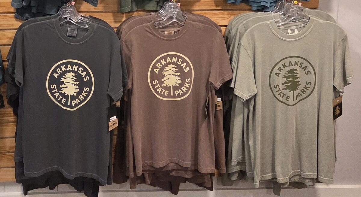
If you have been in an Arkansas state park store lately, you might have noticed something different. Rather than shirts promoting that specific park, you will notice that almost all the new merchandise just features the generic official ASP logo, with the specific park name relegated to small letters—if it is mentioned at all. Continue Reading »

Natural Dam Falls Flood Pics (Ozark Forest)

There is nothing like the drama and beauty of a waterfall at flood stage! Back on April 4, 2026, following a period of heavy rain, I headed up to northwest Crawford County, Arkansas, to check out Natural Dam Falls. This stunning 187-foot-wide natural rock wall spans the entirety of Mountain Fork Creek. Continue Reading »

Hobbs: Hidden Diversity – War Eagle Valley Loop – 6 mi

The 6-mile War Eagle Valley Loop of the Hidden Diversity Trail is a cool and scenic hike at Hobbs State Park-Conservation Area (Benton County, near Rogers). The overlooks near War Eagle Creek are a real treat. Continue Reading »

Hobbs: Hidden Diversity – Bashore Ridge Loop – 4 mi

Bashore Ridge Loop hike is an enjoyable and mildly challenging 4.1-mile hike at Hobbs State Park-Conservation Area (near Rogers, Benton County, AR). The highlight is the beautiful Beaver Lake overlook. The Hidden Diversity Multi-Use Trail is a complex of loops and spurs in the west part of Hobbs. This hike does one of those loops. Continue Reading »

Brushy Creek Trail Loop (Ouachita Forest) – 7 mi

This is a scenic 6.5-mile loop which begins at the Big Brushy Recreation Area (Montgomery County), about 30 miles east of Mena, Arkansas. The trail begins at the back of the recreation area and makes a counterclockwise loop. The last 3.1 miles of the loop are on Section 4 of the Ouachita Trail. Continue Reading »

Ouachita Trail: 13.4-19.9 Wildhorse Creek to Holson Valley Vista to Horsethief Springs (Section 1)

This stretch of the Ouachita Trail Section 1 on Winding Stair Mountain (LeFlore County, OK) goes from Horsethief Springs (19.9) to a stream that becomes Wildhorse Creek (13.4), about 5.5 miles to the west. As an 11-mile out-and-back day hike, it is challenging but doable (for many). Beautiful area with lots of rock formations! Continue Reading »