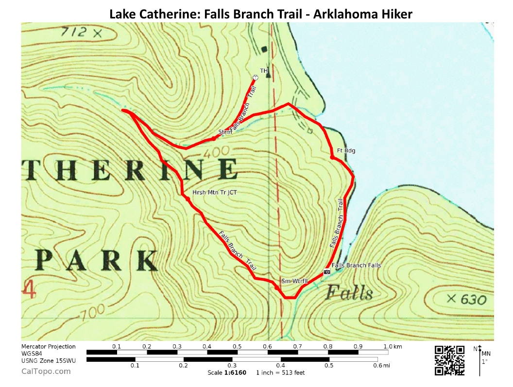
If you’re a sucker for streams and hills like I am, you should check out the Falls Branch Trail at Lake Catherine State Park (Hot Spring County, near Hot Springs). I think this 1.6-mile semi-loop is the most scenic trail in the park.
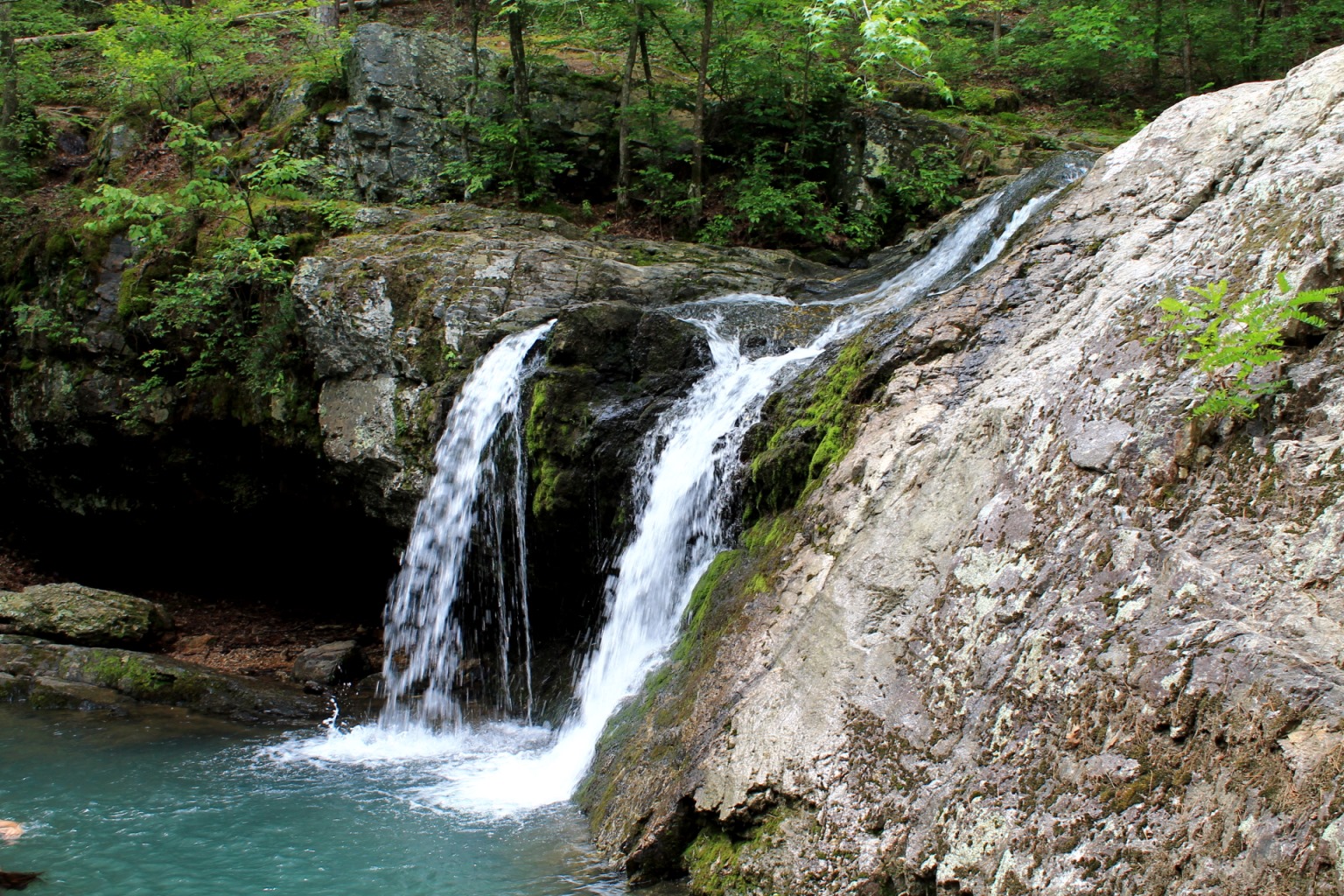
The highlight of the trail is the 10-foot waterfall, Falls Creek Falls.
The trail starts at the park’s main trailhead at the south end of the Camp Area C bathhouse loop, near the amphitheater. This is the same trailhead for Horseshoe Mountain Trail and Dam Mountain Trail.
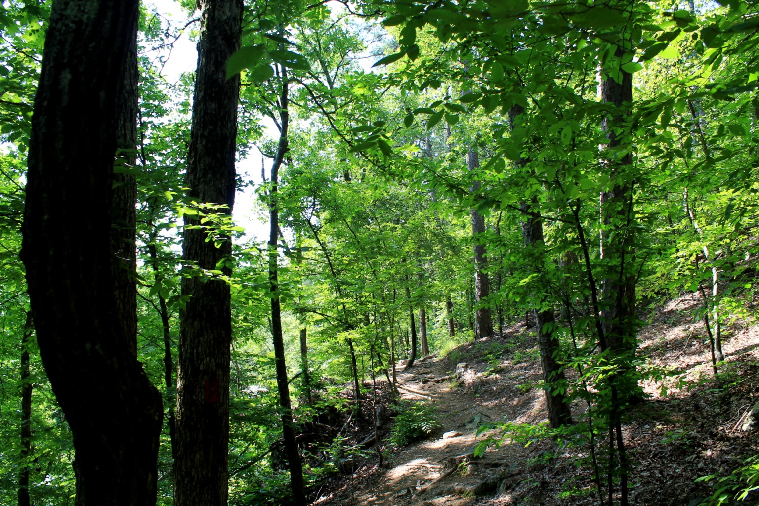
From there, follow the signs (heading counterclockwise) and the red blazes.
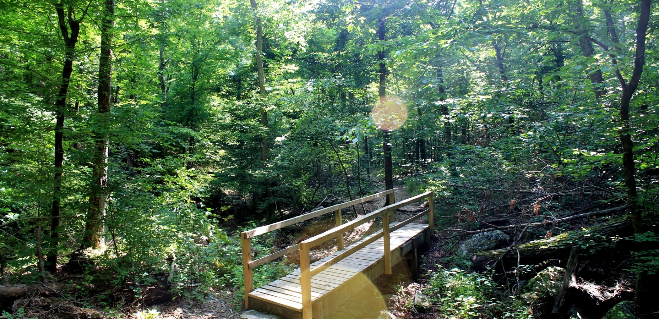
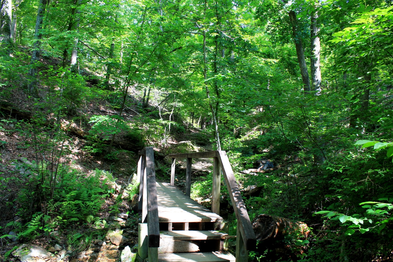
The first .3 miles goes uphill along a pretty stream with a number of small footbridge crossings.
The trail then makes a sharp left turn and heads up part of Horseshoe Mountain. Just a little ways up is a nice overlook.
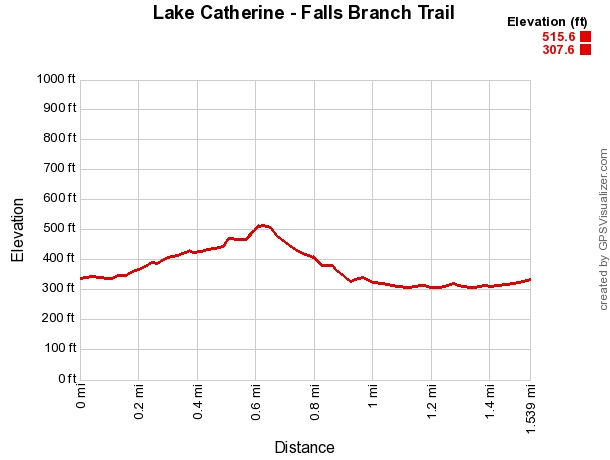
The trail reaches its highest elevation point at about .6 miles when it crosses the Horseshoe Mountain Trail.
The trail then heads downhill and toward the waterfall. (The net elevation change on the hike is about 180 feet.)
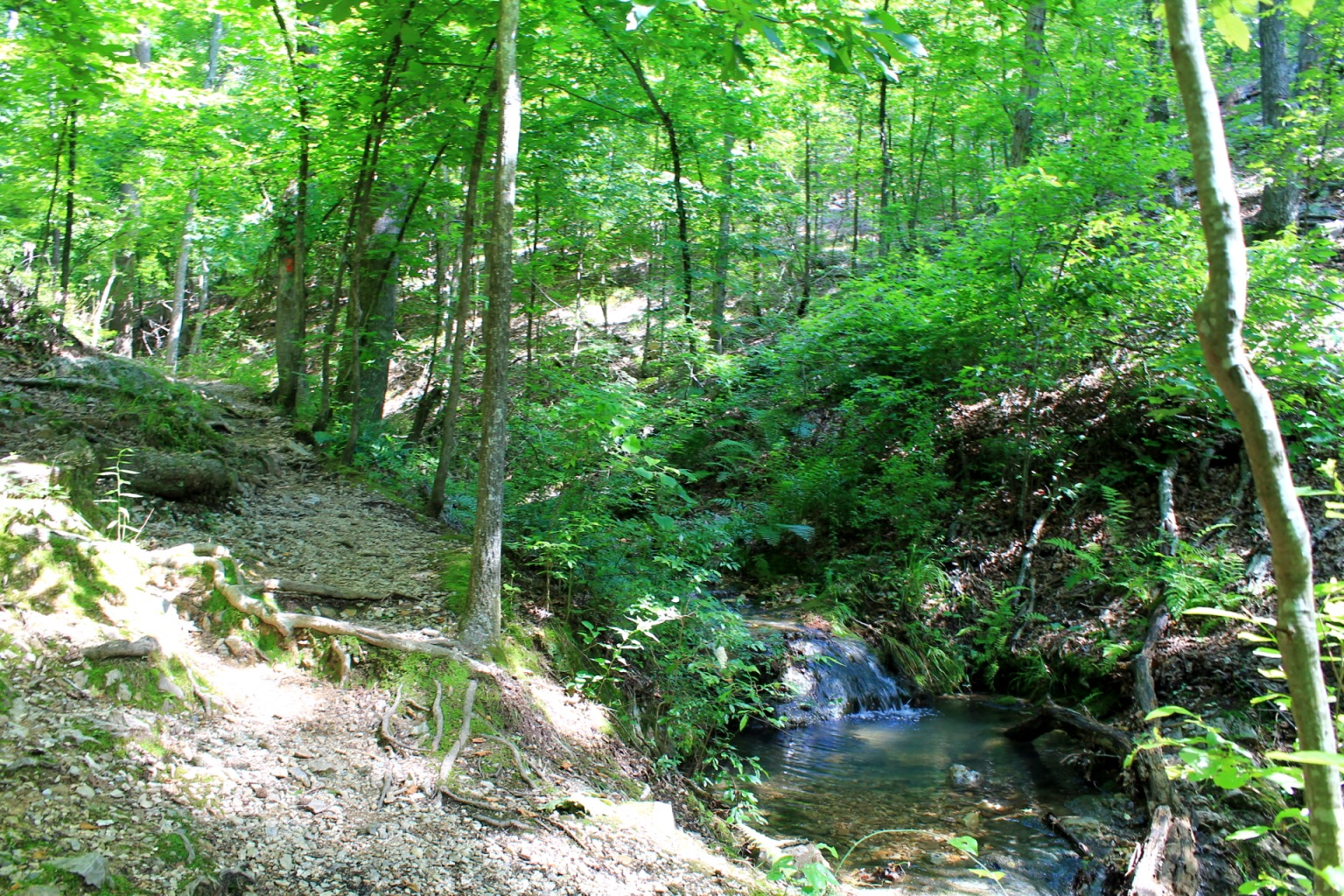
Pretty soon, the trail starts following another stream. At about .8, there is a several-foot-tall mini-waterfall in this stream.
Eventually, the trail comes upon Falls Creek and then the waterfall. The pool beneath the falls is also gorgeous and is sometimes used as a swimming hole.
The rest of the trail, finishing the loop back to the trailhead, has some great views of Lake Catherine.
These are some photos and my gps-based map from my hike back on June 14.
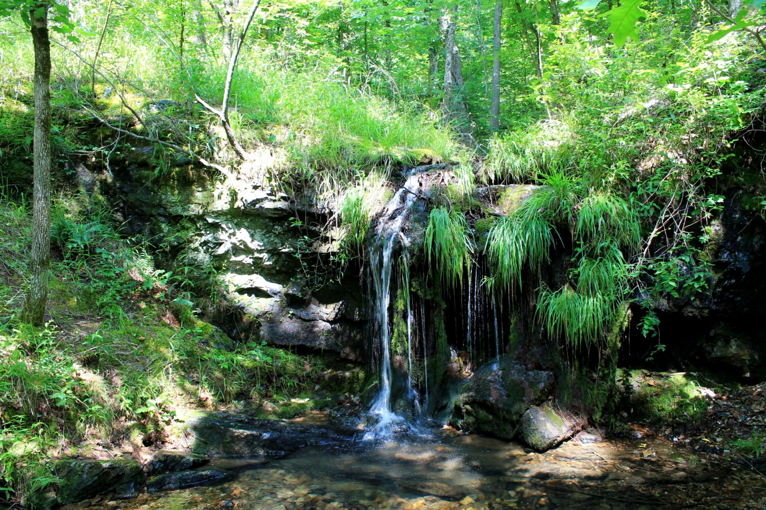
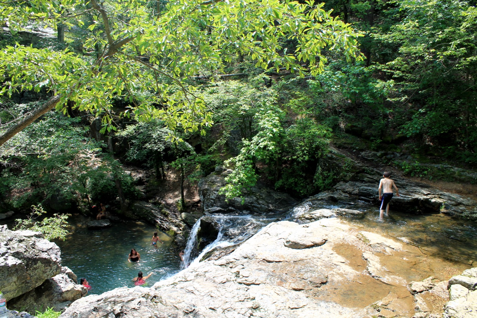
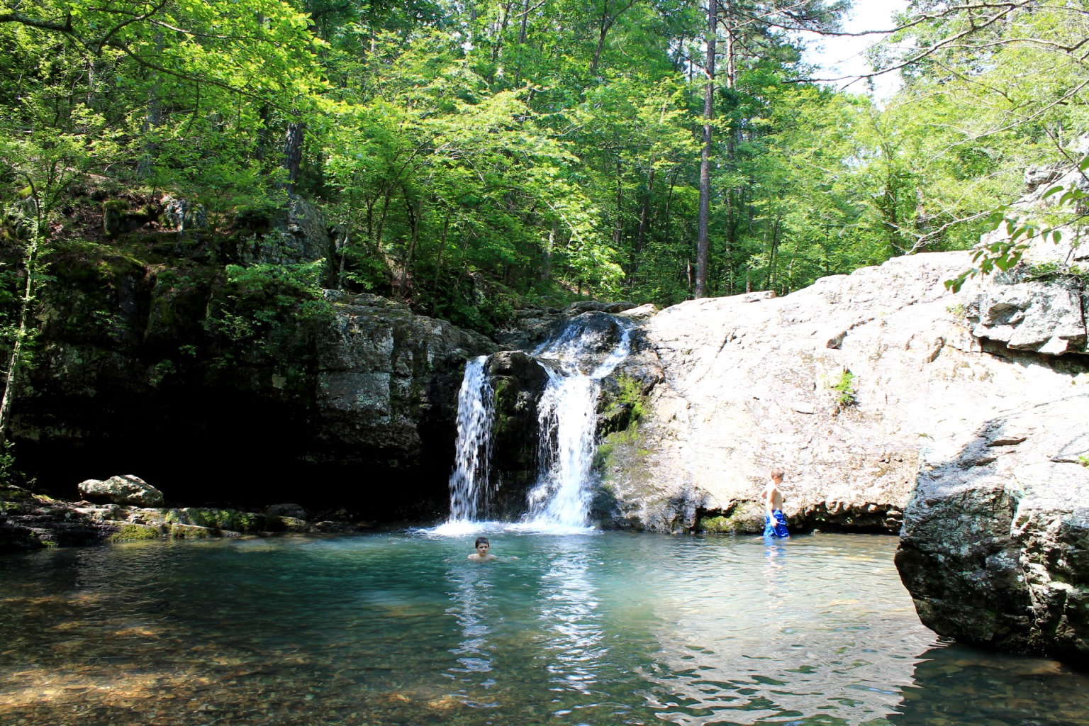
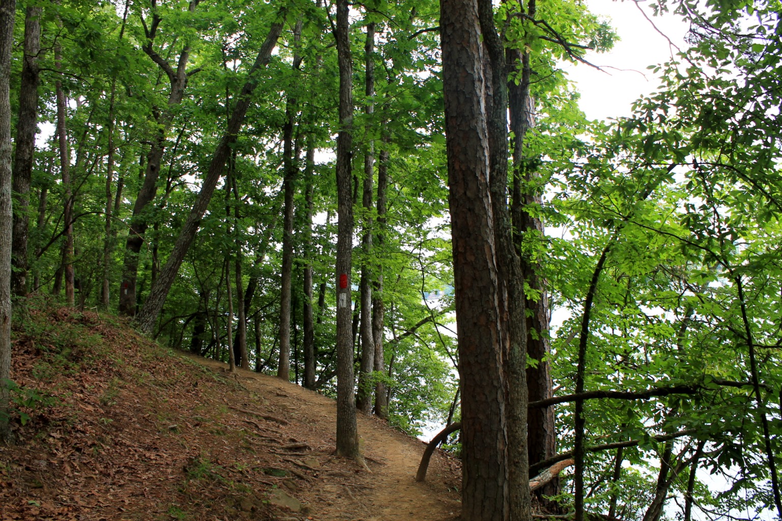
Photo Gallery
Click below for full-screen photo gallery.


Map
Lake Catherine State Park: Falls Branch Trail |
|
|---|---|
| Location | Hot Spring County, Arkansas |
| Length/Type | 1.6 mi./Semi-Loop. Red blazes. |
| Difficulty | Mildly challenging (2 of 5) |
| Other permitted usage? | Pets on leash. |
| Gpx file (by Mike) | Link |
| Date Hiked | June 14, 2014 |
| Directions | Google Maps Directions to Lake Catherine Trailhead |
| Official Info - Phone/Links | 501-844-4176 Website Official Lake Catherine Trail Brochure (pdf) |
[Last revised: 5-27-2021.]
2 replies on “Lake Catherine: Falls Branch Trail + Falls Creek Falls – 2 mi”
This looks so great! Can I please ask a question of clarification? What is the whole loop from start to finish 1.6 miles? And where they’re shallow part of the swimming hole near the falls? I am bringing my little kids and think they would enjoy it. Thanks a ton!! Love your site!
Hi. The loop is 1.6 miles by my measurement. (I can’t address the swimming question since I just use it for hiking.) Have a good visit!