PDF LINK
Sequoyah State Park in northeast Oklahoma (Cherokee County, near Wagoner and Tahlequah) is a really cool park. It has over a half dozen trails which are all accessible to hikers and walkers with many also being open to bikes as well.

PDF LINK
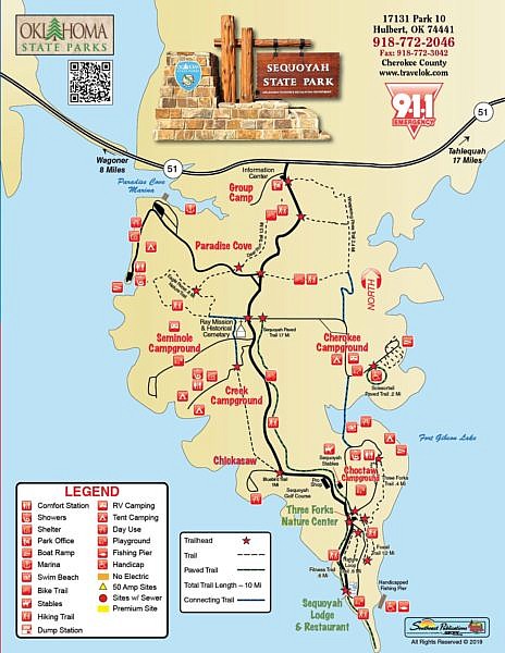
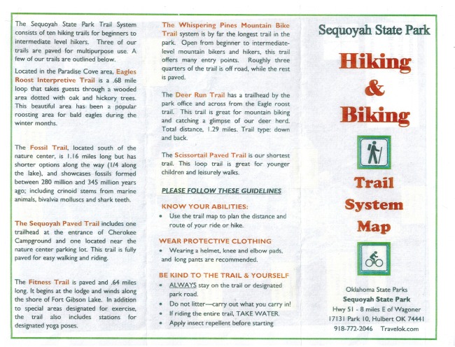
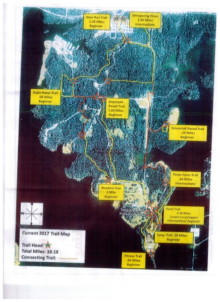
I hope to get some detailed info about some of the trails posted soon. In the meantime, here is the park map with trails and also the Hiking and Biking Trail System Map flyer. They are also available at the park lodge (Sequoyah Lodge).

PDF LINK
Trail info can also be obtained at the park office near the front entrance and at the nature center.
Like most Oklahoma state parks, you will probably need to pay a day use fee of $8 to $10.
Sequoyah State Park Map with Trails (from park guide brochure) (pdf)
Sequoyah State Park Hiking and Biking Trail System Map Flyer – p. 1 (pdf)
Sequoyah State Park Hiking and Biking Trail System Map Flyer – p 2 (pdf)
Revised: 7-14-2020.
