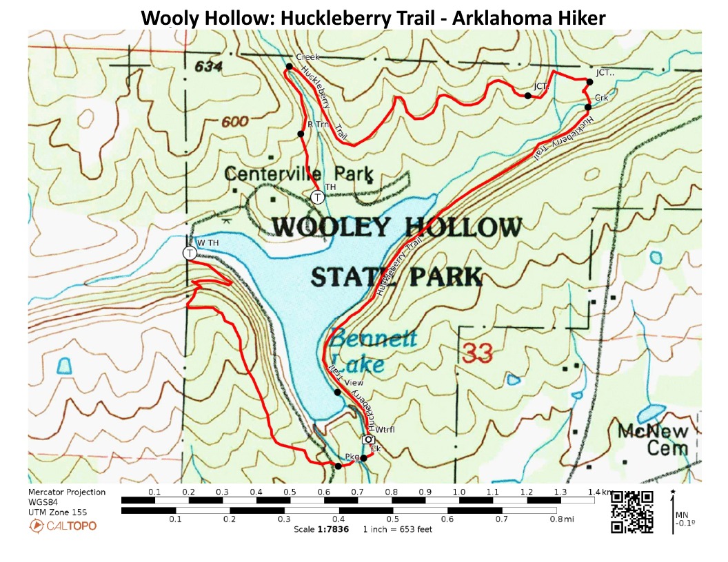
Hiking the Huckleberry Trail at Woolly Hollow State Park (Faulkner County, north of Conway in the foothills of the Ozarks) is a great way to see and explore the entire park. This mildly challenging 3-mile loop showcases the hardwoods and landscape of the area as it circles Lake Bennett, a 40-acre lake built in the 1930s.
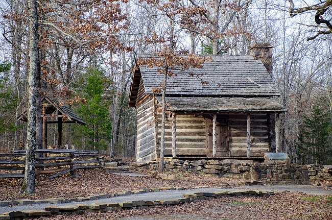
The Huckleberry Trail isn’t a complete loop. The trail begins and ends near the same point, but it can easily be connected by walking the road for about a quarter-mile. This not only gives you more views of the lake, but it also takes you by the Woolly Cabin, a one-room family homestead built in 1882.
Getting to the Huckleberry Trailhead at Woolly Hollow
To get to Woolly Hollow, take US Highway 65 north from Conway. After about 10 miles (and after going through Greenbrier), turn right (east) onto state highway 285 and take it for 6 miles. The state park will then be on your left.
To find the main trailhead for the Huckleberry Trail from the visitor center, drive toward the campground and past the pavilion. After roughly 0.2 miles, the trailhead is on your left with a small parking area.
There are also two other trailheads for alternate starting points
The Hike – Trailhead to Springfield Road
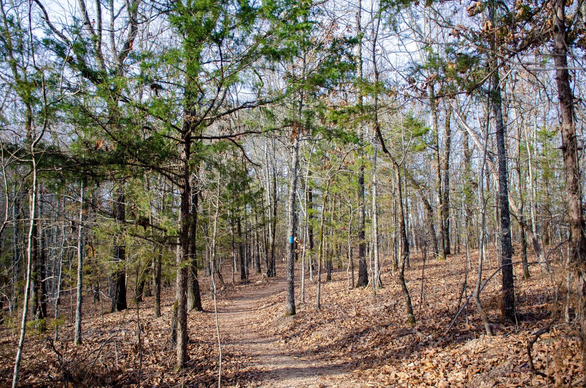
From here, you will take the loop clockwise.
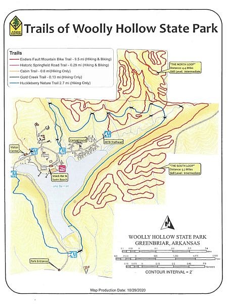
As you begin your hike, you pass several trail intersections. The Gold Creek Trail is a short 0.13 spur that exits and returns back into the Huckleberry Trail.
The Cabin Trail also leaves from the Huckleberry Trail and ends at the historic Woolly Cabin. It is 0.6 miles in total.
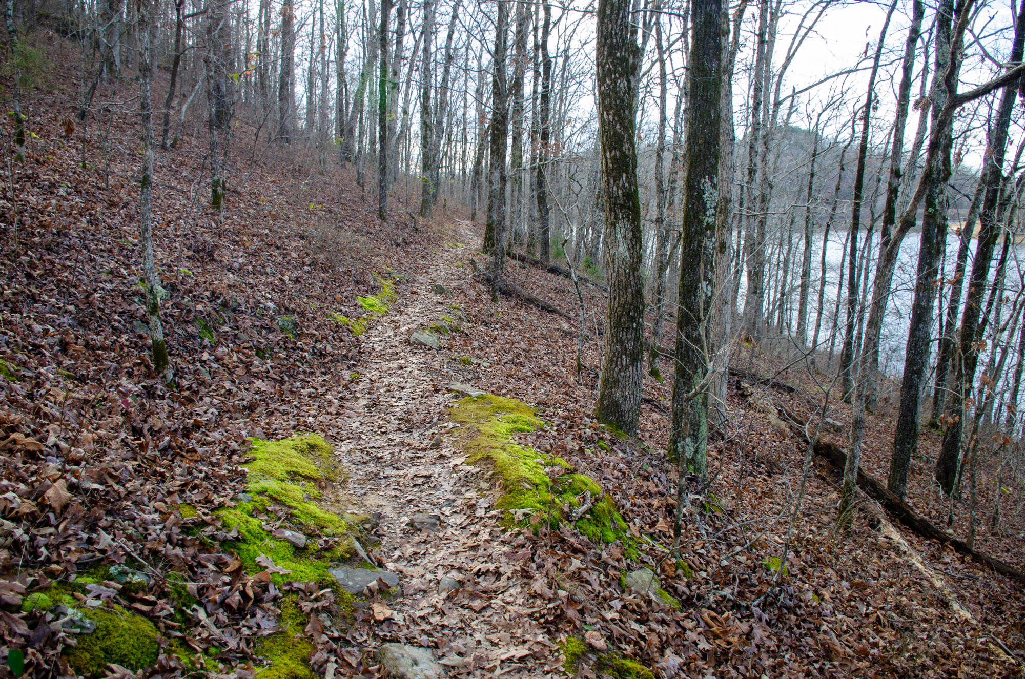
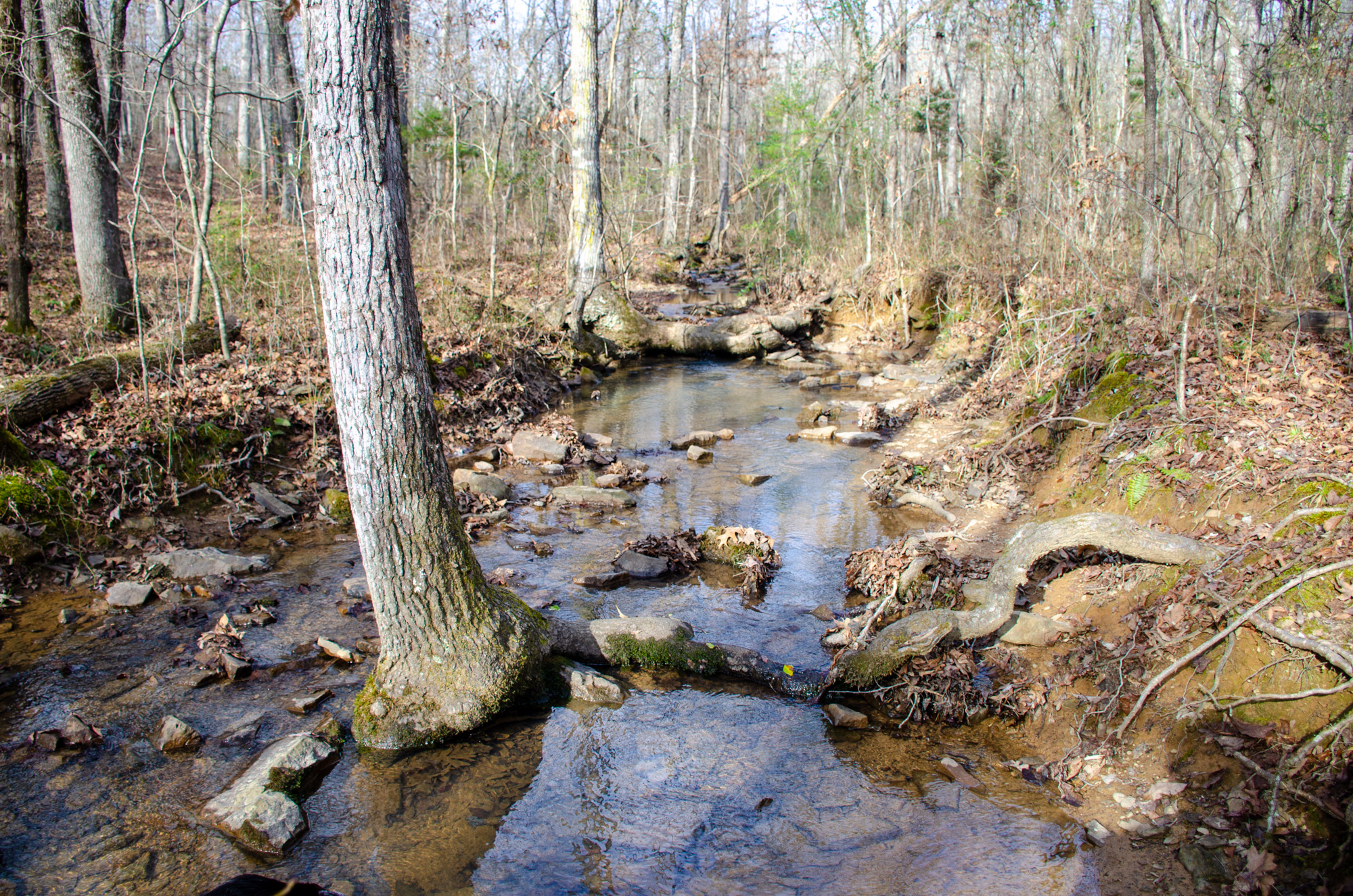
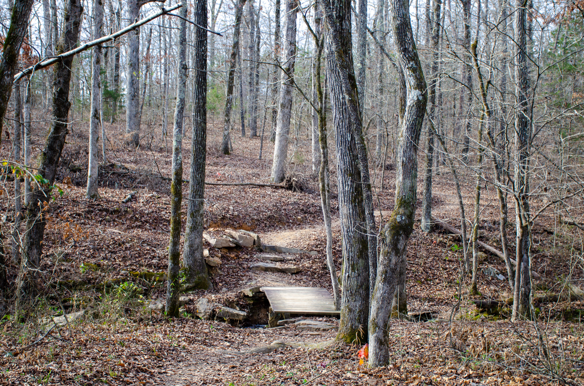
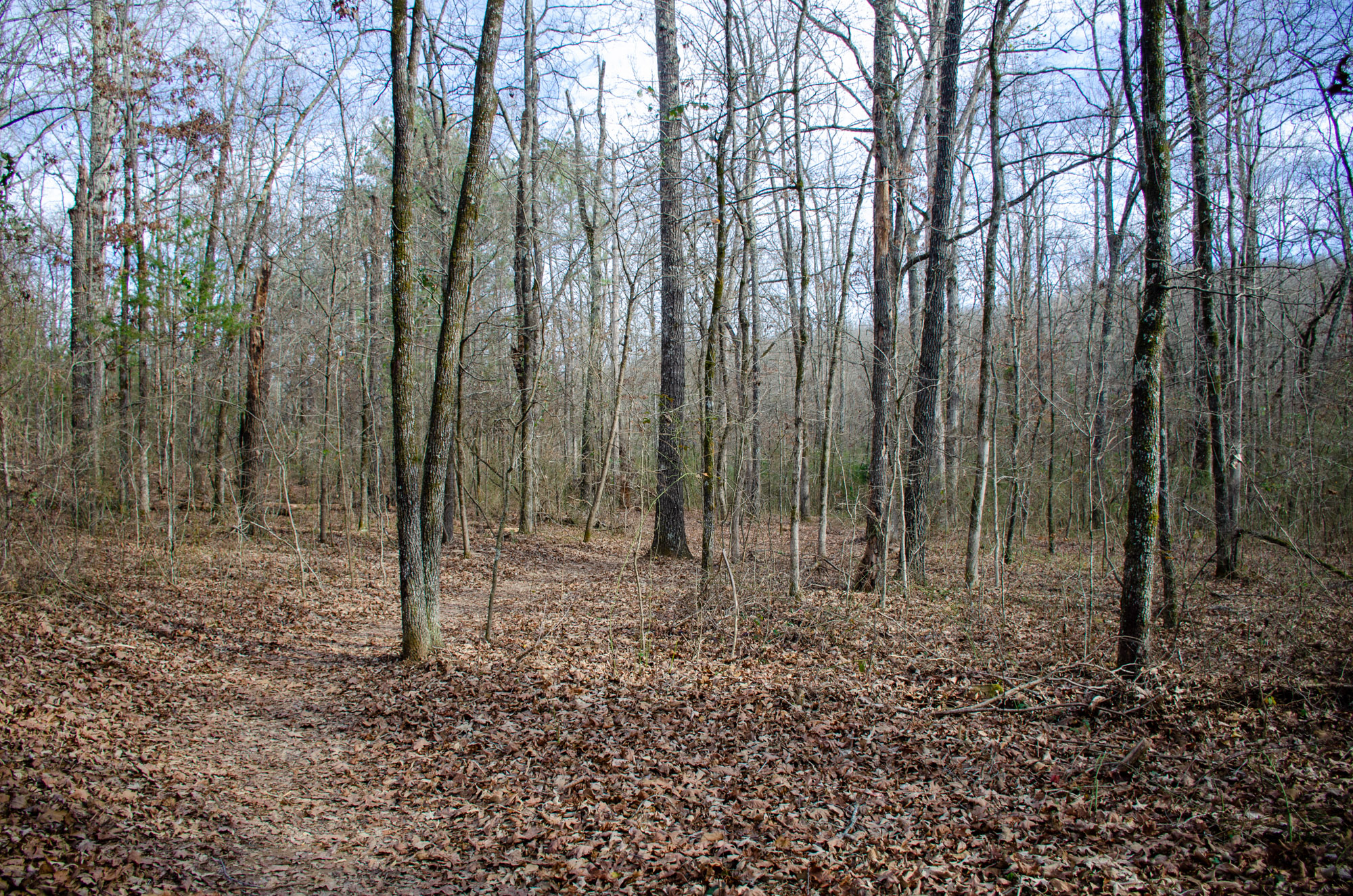
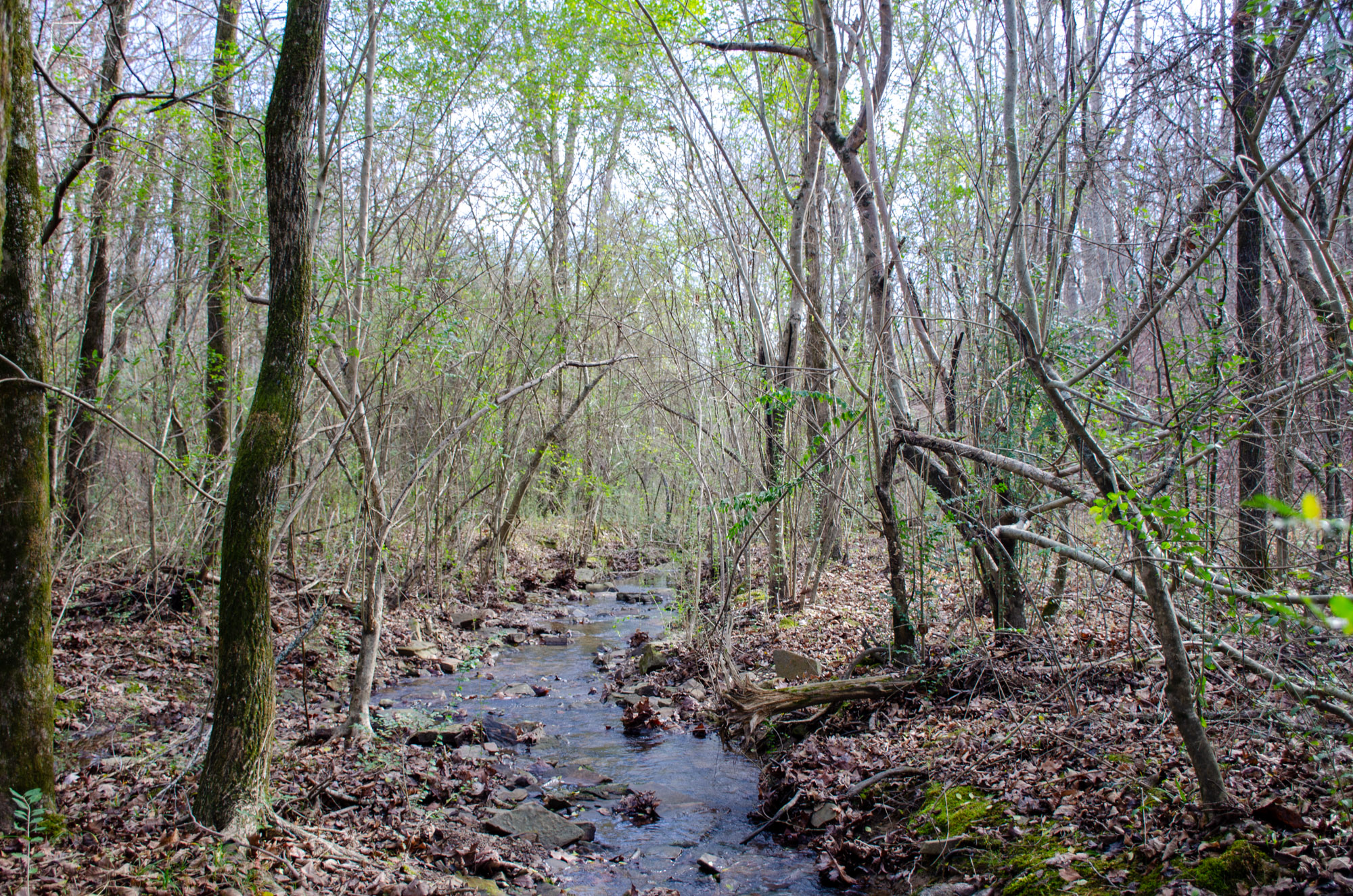
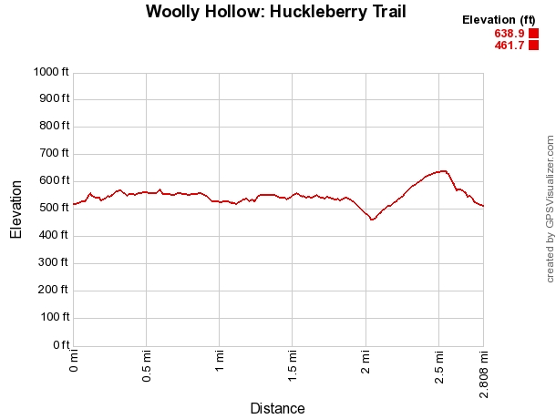
The Huckleberry Trail begins with a gradual climb. After you pass the trail intersections, it drops down a little into the valley and crosses the creek.
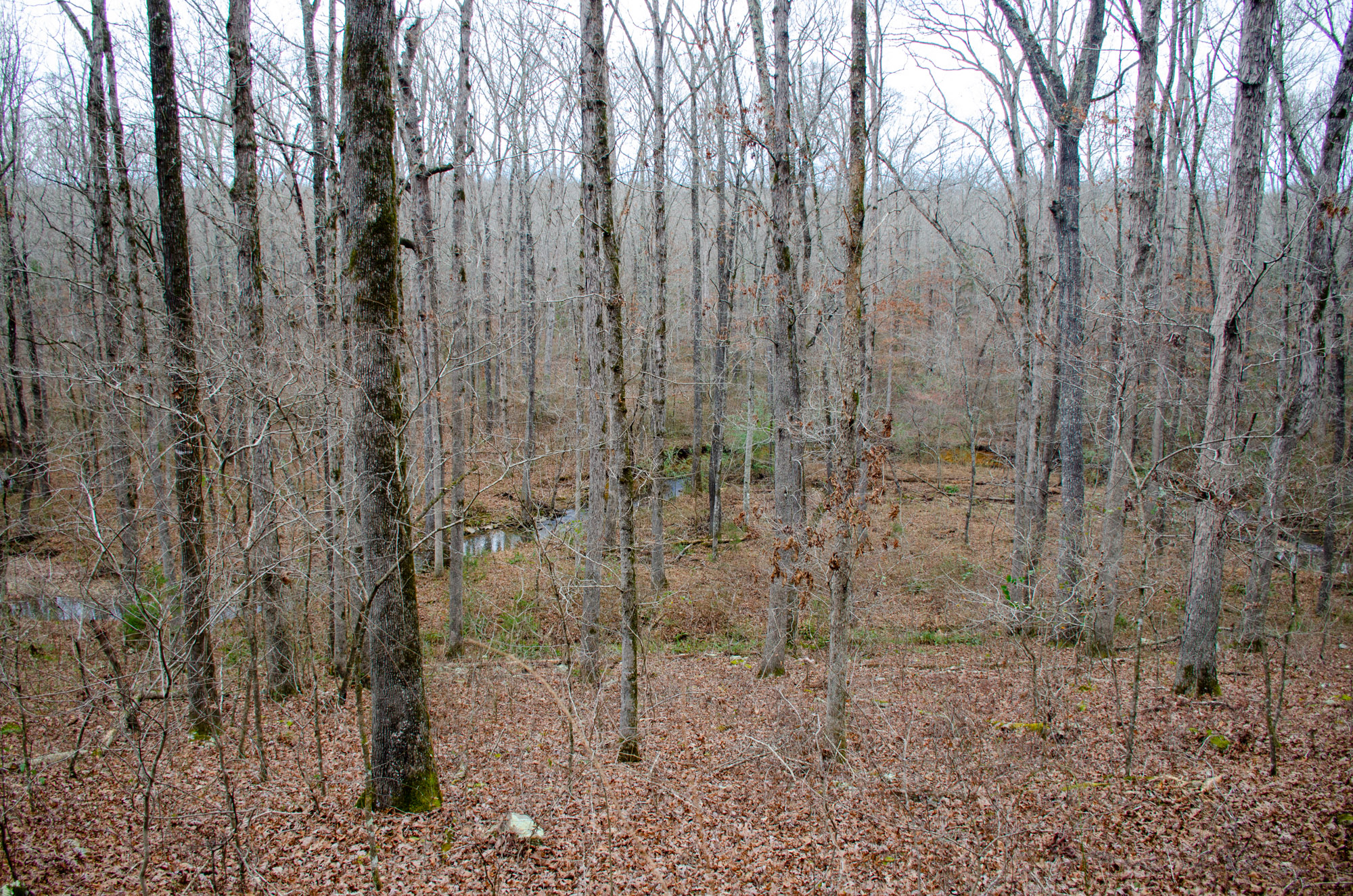
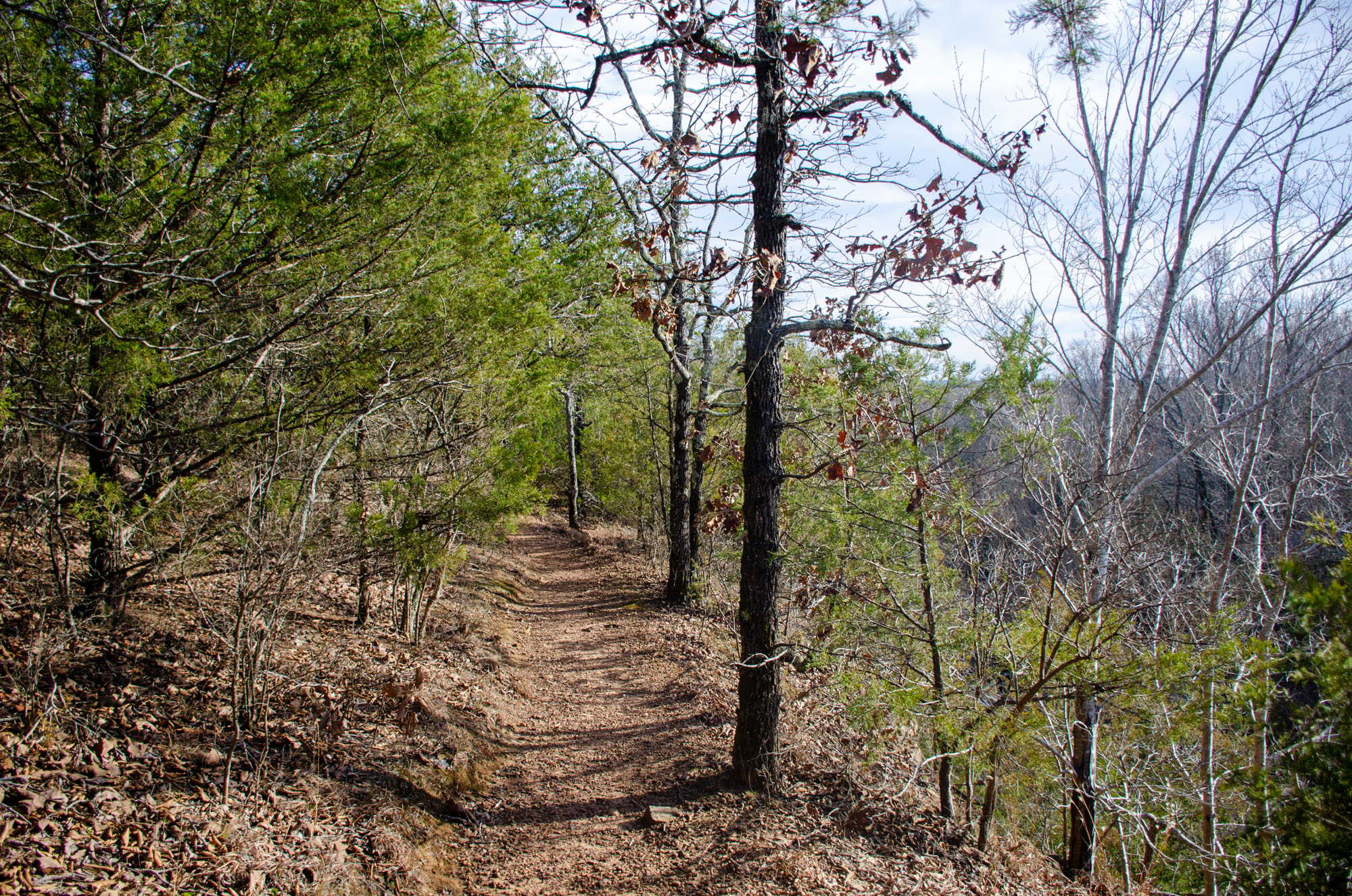
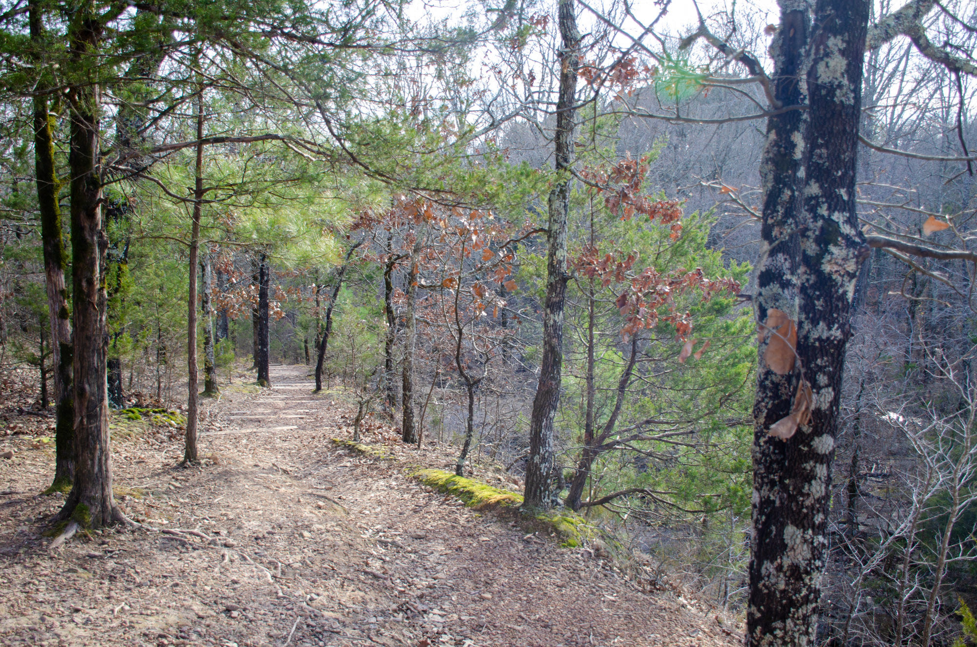
The trail then slowly climbs out of the valley, and (especially during leaf-off) you begin to get glimpses of the campground and lake below. It then hugs the contours of the hillside and heads west into the wilderness.
At mile 1.15, the trail crosses Historic Springfield Road Trail. There are two fences you walk through to separate the hiking trail from the mountain biking trail.

Springfield Road to Woolly Hollow Road Crossing
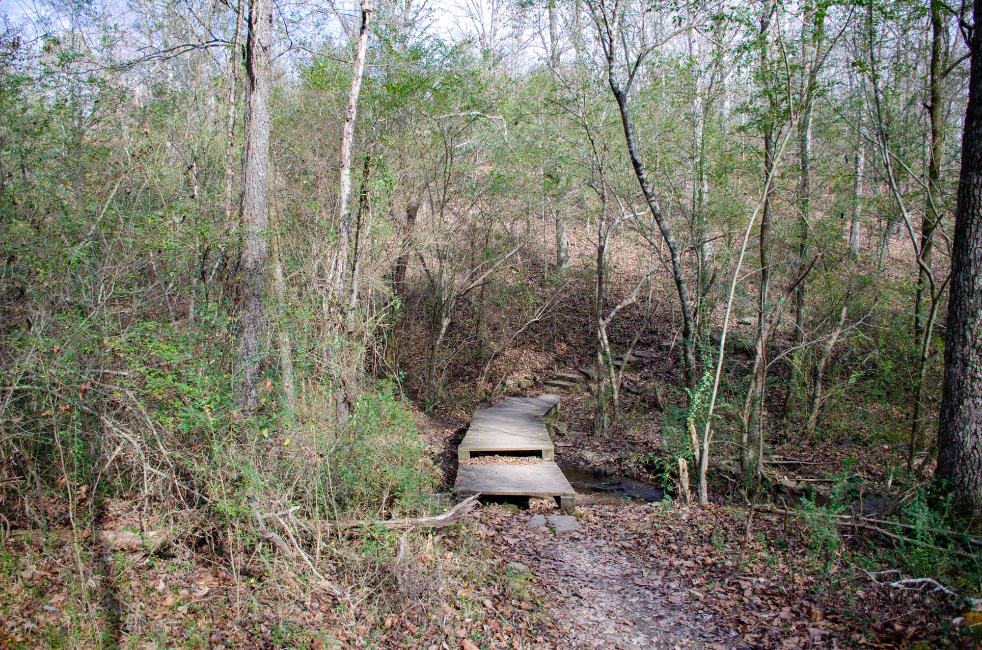
After you cross the Historic Springfield Road, the trail takes you across a beautiful creek. Then it climbs a little along the hill.
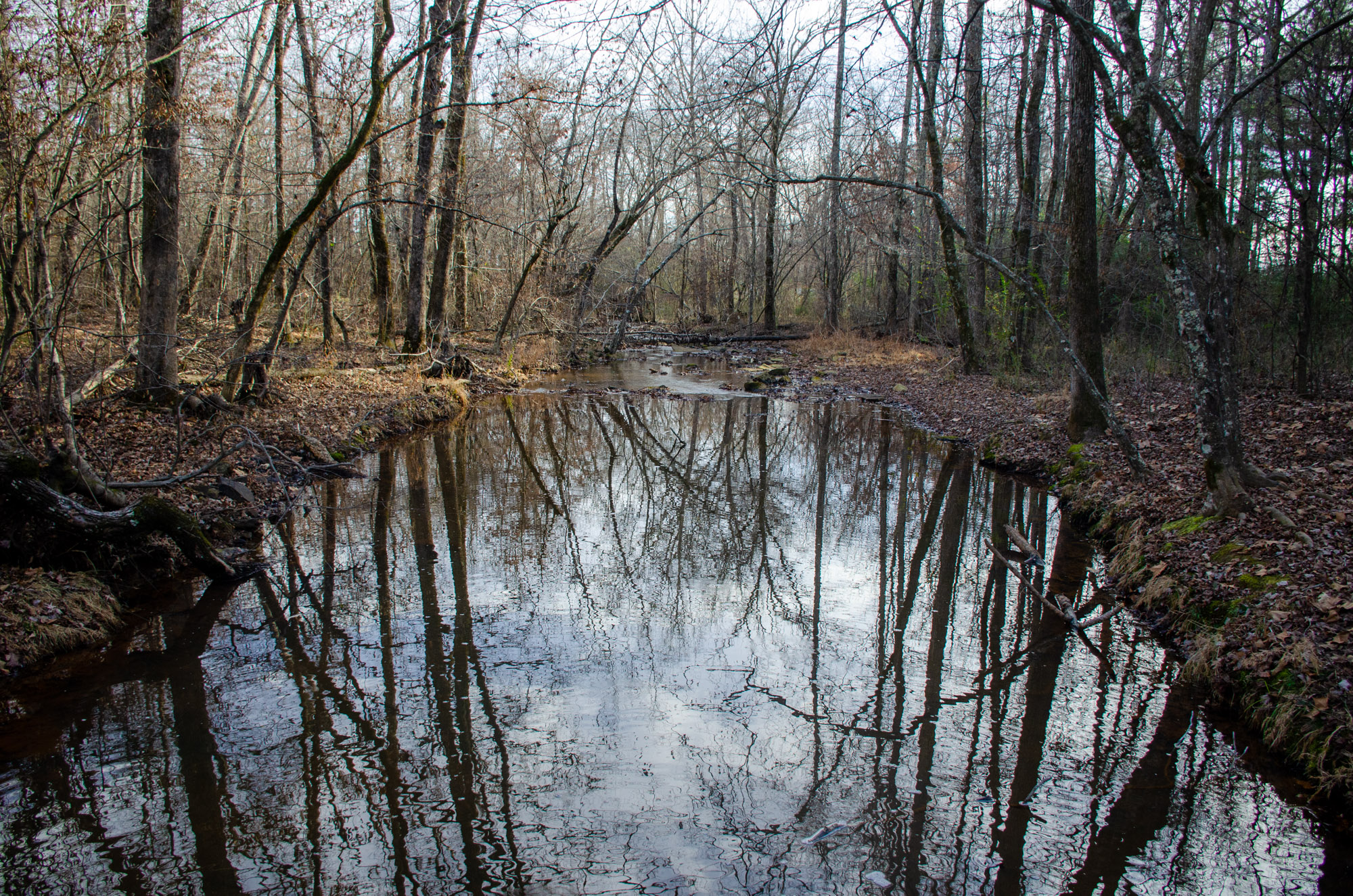
This portion of the trail gives you gorgeous views of the creek below. You can see it get larger, as you approach where it flows into Lake Bennett.
The trail can be a bit confusing in this area because the blazes switch colors from blue to red. Apparently, this loop used to be two different trails.
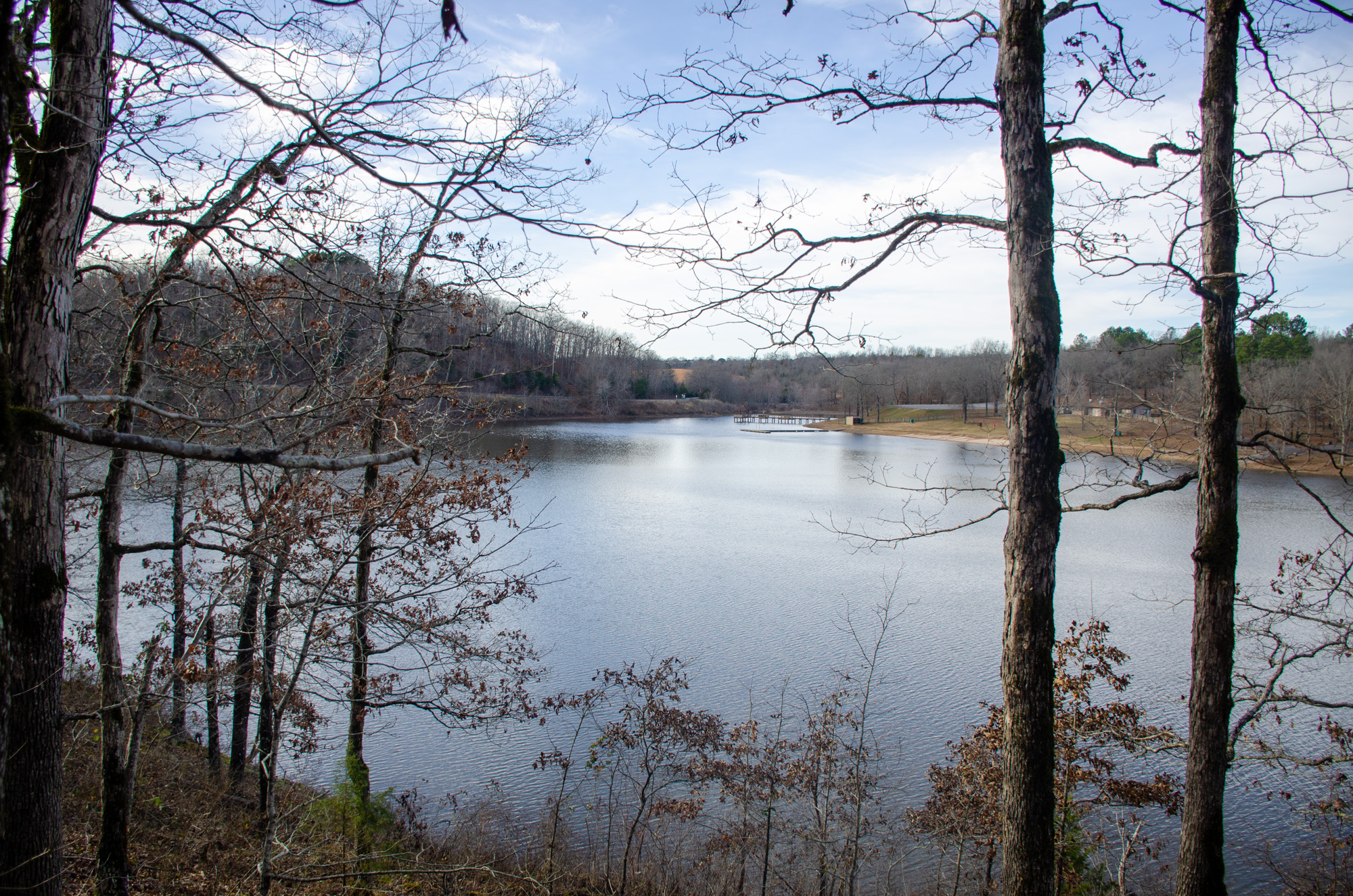
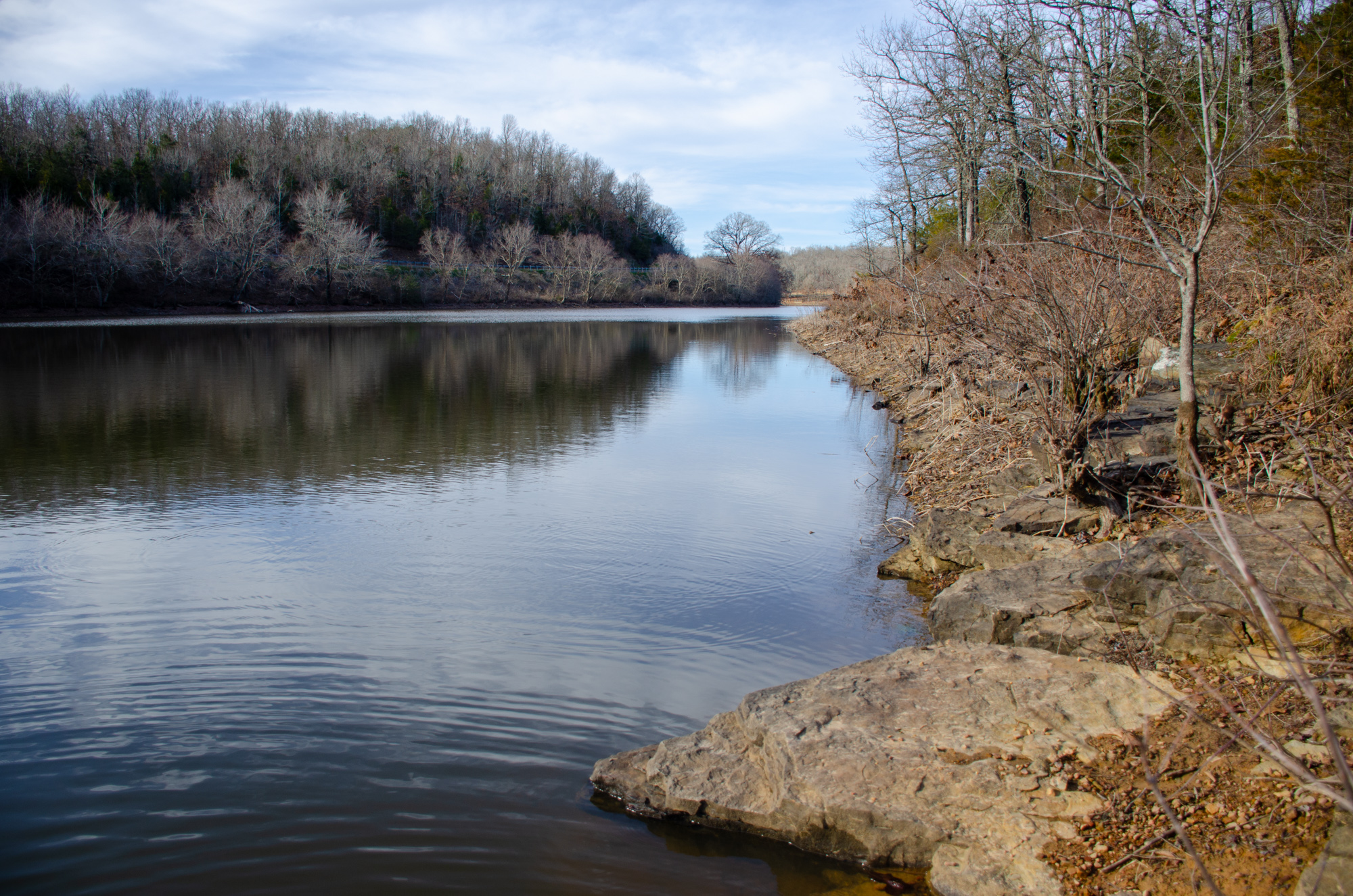
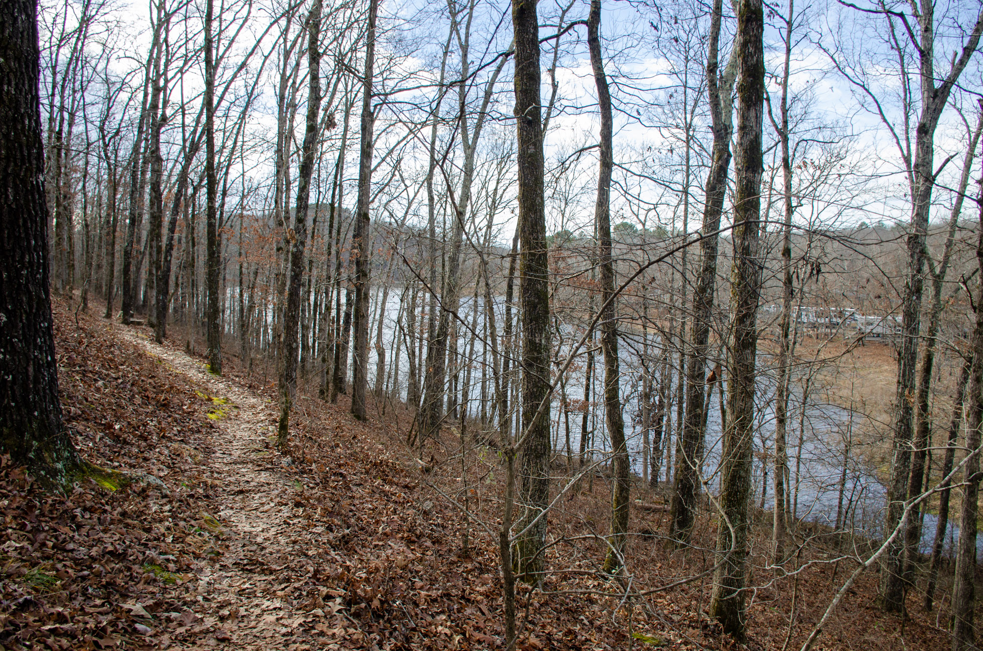
Around mile 1.5, the creek turns into Lake Bennett, and you begin to get beautiful views of the lake. For the next 0.4 miles, the trail follows the lake high above the shore.
At mile 1.8, there is a lovely bench for you to take a rest and enjoy the wonderful views of the lake and park.
Just a little farther at mile 1.9, there is a short spur trail to another bench and the lakeshore below. This is a great place to take a break.
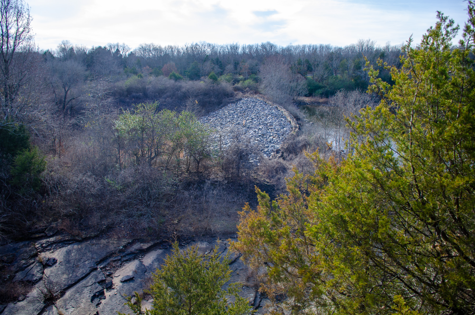
From there, the trail follows along the ridge for just a short way. Here you get views of the earthen dam of Lake Bennett.
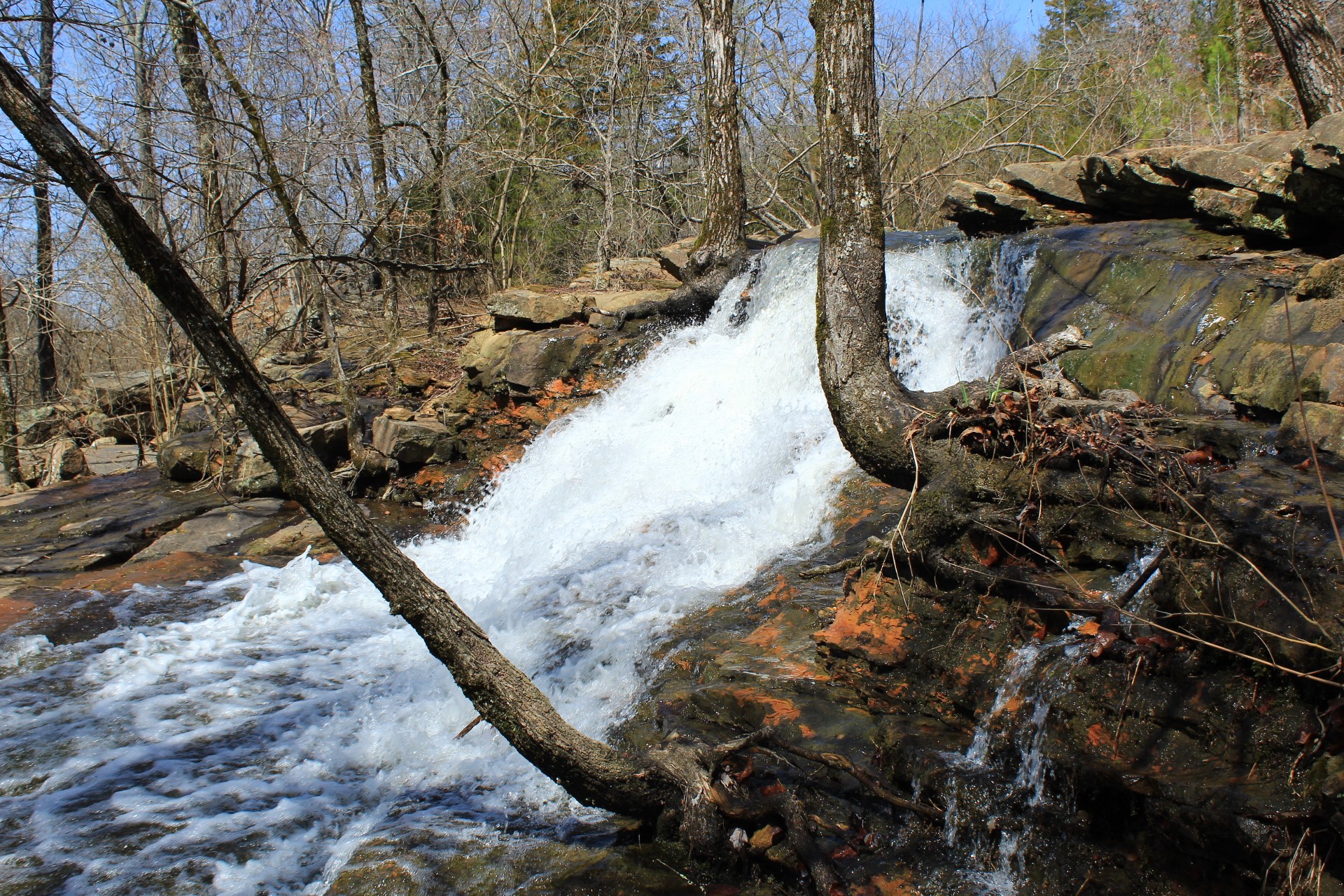
The trail then drops down into the valley below the dam. As it does, it passes a seasonal spillway (making a waterfall) for the lake which is very scenic during wet times.
The trail continues to a different trailhead near the entrance of the park at mile 2.2.
Road Crossing to End
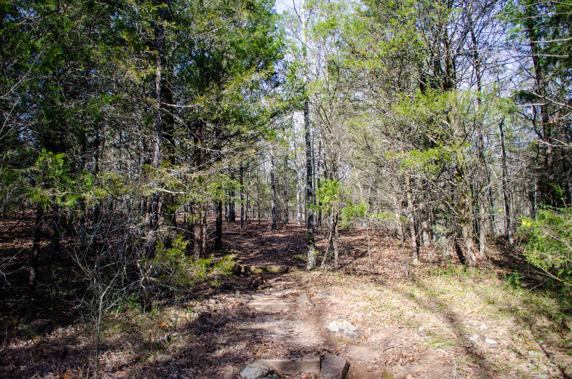
The Huckleberry Trail crosses Woolly Hollow Road and climbs to the top of a ridge.
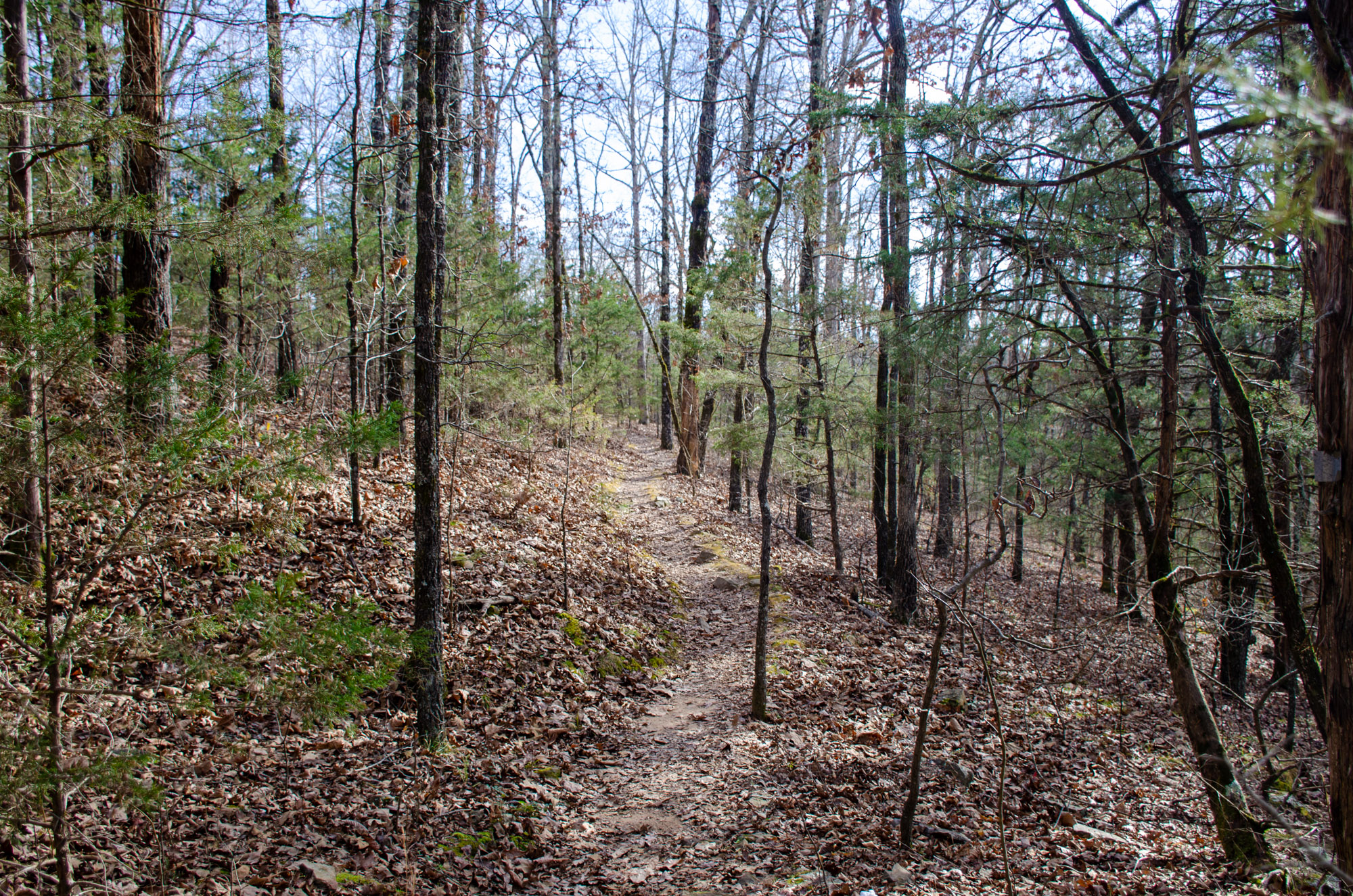
In this part, the trail continues through the hardwood forest. The trail gets close to the park boundary, and you get views through the trees of meadows from private land which is really pretty.
The woods are nice and open, and toward the top of the ridge, you get more glimpses of the lake.
Around mile 2.6, the trail begins to drop back down into the valley and to the road below.
Walking the Road Back
The Huckleberry Trail officially ends at mile 2.8, where it intersects with the road. From here you walk along the road toward the visitor center.
At mile 3.05 you can see the history of Woolly Cabin. Take the short spur trail for an up close and personal look at it. It’s really neat to be able to see how people lived 150 years ago.
After you’ve explored the cabin, continue along the road – past the pavilion – and back to the trailhead.
Final Notes
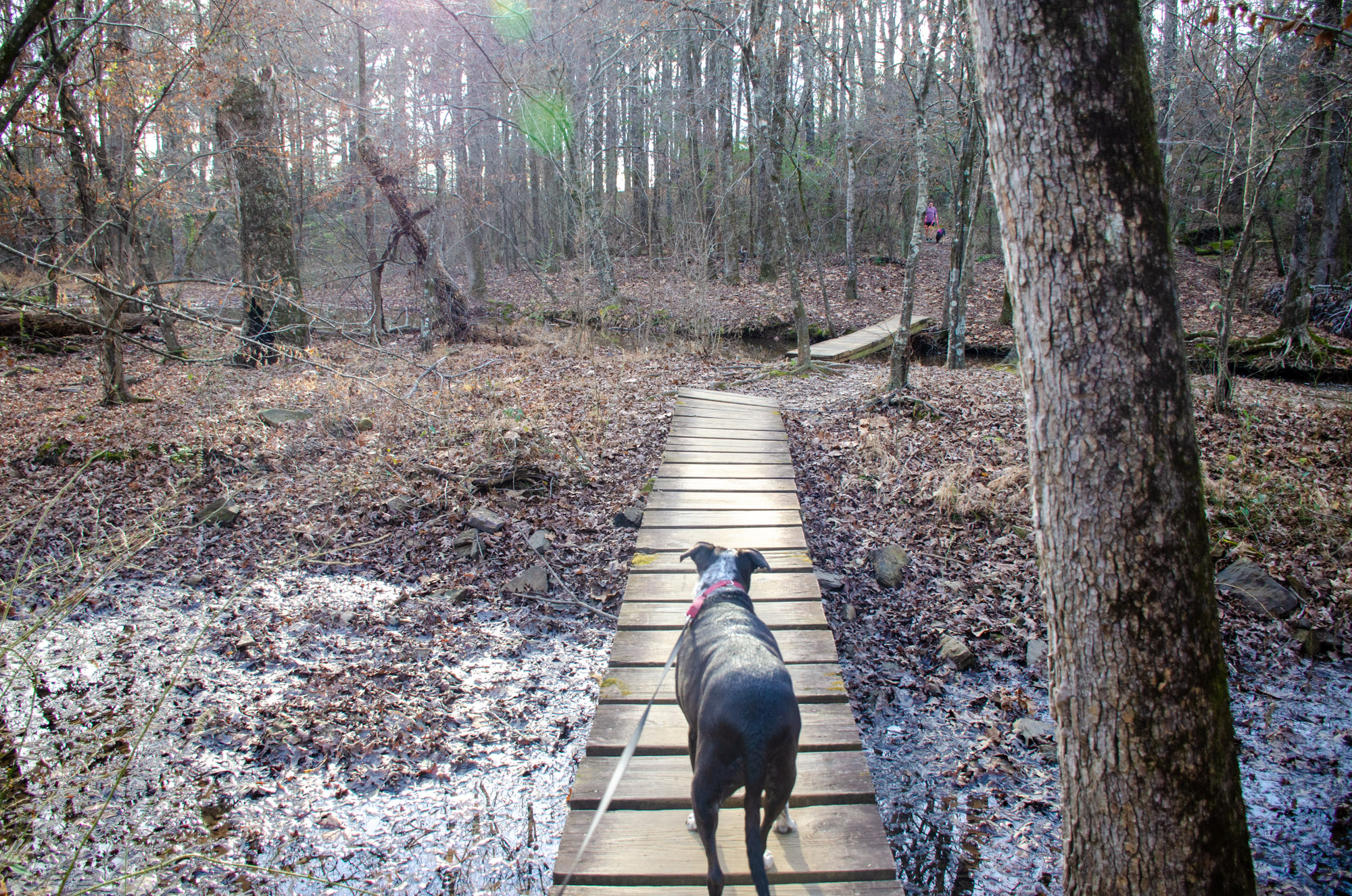
Generally, the trail was easy to follow and in good condition.
Most of these photos are from my December 25, 2021 hike.
Woolly Hollow State Park offers many other fun outdoor activities, including fishing, kayaking, and mountain biking.
Photo Gallery
Click below for full-screen photo gallery.

Map
Woolly Hollow - Huckleberry Trail |
|
|---|---|
| Location | Wooly Hollow State Park, Faulkner County, Arkansas |
| Length/Type | 2.8-mile loop (3.1 miles if completing the loop via road walking). Blue and red blazes. |
| Other Permitted Usage | Dogs allowed on leash. Backcountry camping not allowed. |
| Difficulty | Mildly Challenging (2 of 5). |
| Gpx file by Mike | Link |
| Date Hiked | Dec 25, 2021 |
| Directions | Google Maps Directions to Huckleberry Trailhead |
| Official Info (Links) | (501) 679-2098 Website Park Trail Map (pdf) |
[A version of this post was originally published on January 13, 2022 in the blog “Right Kind of Lost.”]