Devil’s Den: Twin Falls Winter Video

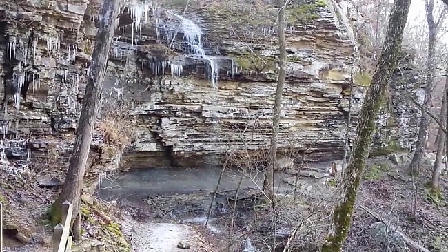
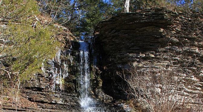
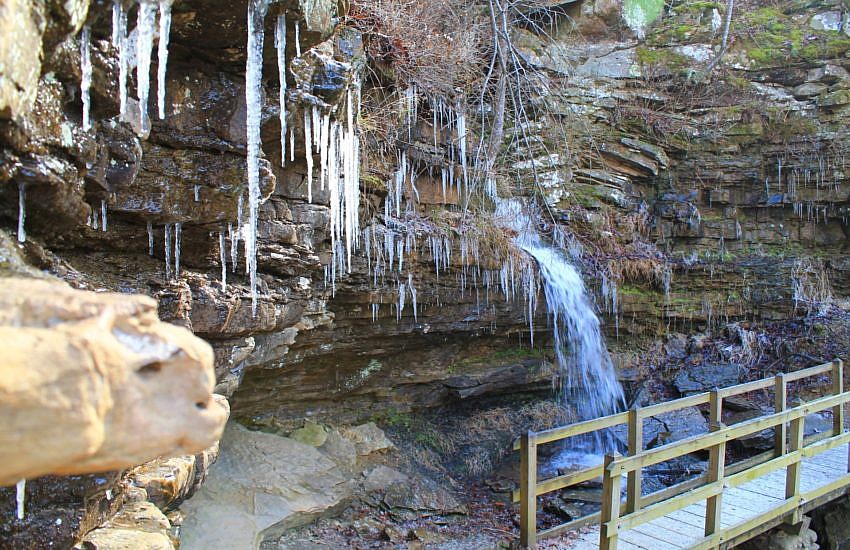
In early January I had a cool (and cold) visit to Twin Falls on the Devil’s Den Trail (the cave trail) at Devil’s Den State Park (Washington County). It was great to see both branches flowing well, and I got a kick out of the icicles as well. Alternate video link. According to Tim Ernst’s […] Continue Reading »

Pinnacle Mountain: West Summit Trail Pics 2014

About a month ago during the holidays, my brother and I did a hike up the West Summit Trail at Pinnacle Mountain State Park (Pulaski County, near Little Rock). This is an awesome trail. There are two trails that will get you to the top of Pinnacle Mountain: the East Summit Trail and the West […] Continue Reading »

Intersection Falls Near Falling Water Creek (Ozark Forest)

Intersection Falls (southeast Searcy County, Ozark National Forest) is a great, tropics-like waterfall that is just a short bushwhack from Six Finger Falls. It’s a bit of a challenge to get to, but it has first-class scenery all along the way to make for a very enjoyable bushwhack. Getting to the Intersection Falls Bushwhack (These […] Continue Reading »

Devil’s Den: Twin Falls Winter Pics

One of the highlights of the Devil’s Den Self-Guided Trail (also referred to as the “cave trail”) at Devil’s Den State Park is Twin Falls, a scenic double waterfall. Like many Arkansas waterfalls, you can’t always expect to see a good flow on a particular day. So it was a real treat for me a few weeks […] Continue Reading »

Mount Magazine: Benefield East Loop Trail – 1 mi

The Benefield East Loop Trail at Mount Magazine State Park is one of my favorite short trails. This one-mile loop has some of the best views in the park. (Other trails with great views are the North Rim Trail and the Bear Hollow Trail.) Mount Magazine State Park sits on the highest mountain in Arkansas. […] Continue Reading »

Queen Wilhelmina: Reservoir Trail – 1 mi (o&b)

The Reservoir Trail at Queen Wilhelmina State Park is a short but vigorous hillside walk that starts right behind the lodge. It makes a .4-mile (each way) downhill zigzag on the south side of Rich Mountain leading to a historic reservoir. Continue Reading »