-hobbs")
The Sinking Stream Trail is a new trail at Hobbs State Park-Conservation Area, in Benton County, Arkansas. It does not yet have any signage, but it is a nice little nature walk.
-hobbs")
.

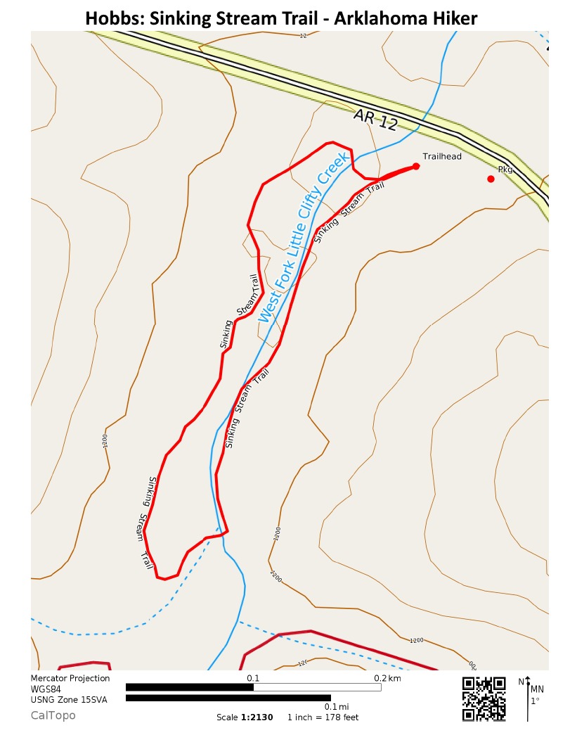
The .6-mile loop trail follows a short section of West Fork Little Clifty Creek.
There are several footbridges on the trail. At least one of them obviously predates the new trail.
-hobbs")
The trail begins near the Historic Van Winkle Trail trailhead. Parking is nearby.
Click here for gpx file download.
(1=Easy; 5=Most Difficult)
VITAL INFO
Trail Name and Location Sinking Stream Trail - Hobbs State Park-Conservation Area
County/State Benton/Arkansas
Date Hiked 09-06-2010 (midday)
Weather/Conditions 80's
Directions It starts at the Van Winkle trailhead area. Parking is nearby. No signage had yet been installed when I was there. I walked it clockwise.
Length 0.6 miles
Loop? Yes
Difficulty 1
ATT Cell Coverage? Yes
Official Info - Phone/Links (479) 789-5000
Official website. Friends of Hobbs website.
Last revised: 9-29-2019.