[Note: as of 10-28-2020, parts of this trail is still closed due to recent storm damage. Check park for updates.]
Withrow Springs State Park, in Madison County in Northwest Arkansas, is a pleasant little park with plenty of things for people to do and see.
The park is pretty easy to get to. It is on Highway 23, about 20 miles south of Eureka Springs and 5 minutes north of Huntsville. (So take the opportunity to eat at Granny’s Cafe).
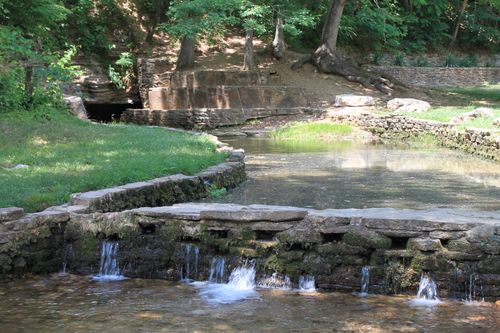
The park is named after Withrow Spring (above). It comes out of a hillside and forms a small creek that flows along the main entrance of the park. There are a lot of little picnic spots along this stretch of creek that are great for a family outing.
The 786-acre park has a swimming pool, baseball fields, tennis courts, a lot of picnic sites, and some really great campsites. There are also three short hiking trails that make up about 4.5 miles of trails. When you go out and back, they can fill a full day of hiking.
War Eagle Trail
The most popular hiking trail is the War Eagle Trail. Officially, the trail is only about 1 mile long, but you need to go out and back, so it’s a two-mile round trip.
If you add a little spur from the visitor center to the trailhead, it is about a three-mile round trip.
The official trailhead is right off of Highway 23, and is well marked, very near the park entrance. (It has parking available.)
We started across the road from the visitor center inside the park. Park in either of the two parking spots by the visitor center and then cross the road to the two picnic areas, and there is a sign that points the way to War Eagle Trail. Enter the woods at the sign.
The trail heads up into the woods on some stone steps and then levels out a bit. You eventually meet up with a fence line that will follow you along your right for a bit until the trail dips back down the hill into a little mowed field and follows a service road for a few hundred yards until you hit a gravel road.
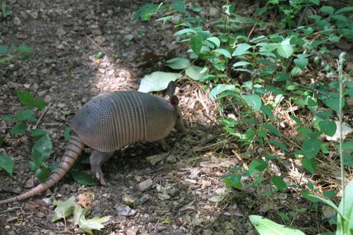
This part of the hike isn’t officially part of the War Eagle Trail, but we saw a lot of wildlife along the trail including several species of lizards, a snake, deer, and a pack of armadillos.
When you get to the gravel road (I’m guessing it is at about .4 miles), turn left, and walk along the road for a bit until you get to the highway and another gravel road to your right. Take the gravel road. This is the official War Eagle Trail trailhead.
From here, the trail heads off to the left under the bridge. It’s an easy-to-follow trail, but it’s also strangely easy to miss because there is another trail of sorts that heads down to War Eagle Creek on the right. (That one isn’t the real trail. It just goes down to the creek.)
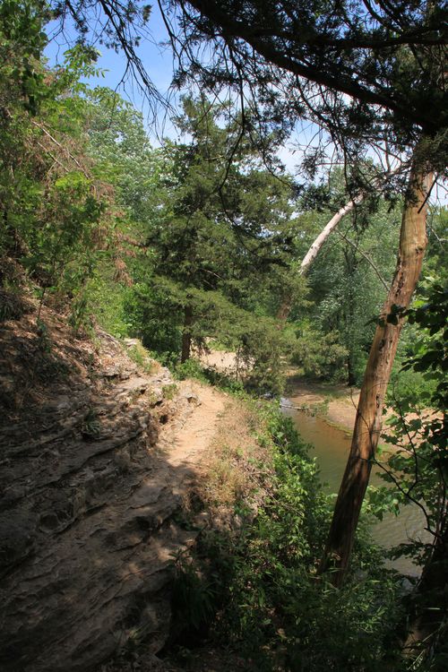
The trail first goes back under the highway bridge. Then some steps climb up to the ridge where the trail overlooks War Eagle Creek. The trail pretty much follows this ridge along the creek most of the way.
The trail stays mostly level, crosses some rocky bluffs, and then goes back to dirt path again.
Eventually, you come to a small cave. A few hundred yards later, there is an even bigger cave. This is War Eagle Cave. You can hear a stream running through it.
This cave, like most wild caves in Arkansas, is closed due to the white-nose syndrome threat to the bat population.
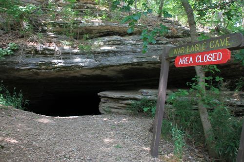
At War Eagle Cave, the trail goes up the hill, then over the top of the cave, and back down on the bench.
This next stretch of trail is the best part. It follows along a natural rock bench. There is a wire cable safety rail in this area, but you should still exercise caution in this area. Falling would mean quite a tumble into the creek.
This is a really nice little stretch of the trail.
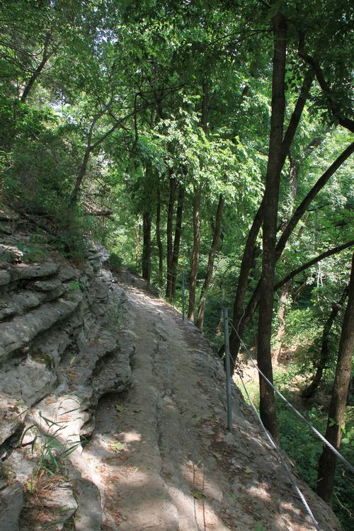
Shortly past this stretch, the trail heads back off into the woods, and then curves off to the left where it eventually arrives at Crossbow Pavilion. Here, you can either head back, or cross the highway and hit a trail that heads off toward the campsites and the Dogwood Trail. For us, we headed back the way we came.
Note that at the very end of this trail is a very large, steep climb to an impressive overlook. Because it was a very hot day and we were still worn out from the day before, we opted not to make the climb.
Distance: 2 miles round trip, about 3 miles if you include the stretch from the visitors center to the trailhead.
Difficulty: Easy-to-moderate
Footwear: Trail runners or tennis shoes
Map/Guidebook: Trail maps are available at the Park Visitor’s Center, or probably through the state park service.
Date Hiked: May 26, 2012
[This post was originally published on October 8, 2012 in the blog “Exploring Northwest Arkansas.”]
