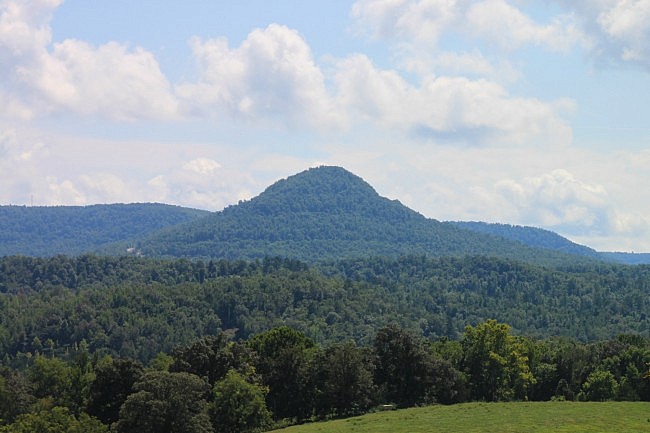
About two miles south of Jasper on Highway 7 is the prominent and aptly named Round Top Mountain. There is a great hiking trail here with beautiful scenery, wildflowers, and a bit of unusual history.
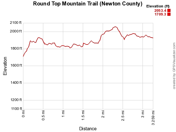
Round Top Mountain Trail is not a difficult hike. It is about a 3.6 mile hike with a net elevation change of about 300 feet.
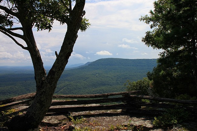
Part of the Round Top Mountain Trail was washed away three years ago in some serious April rains. It just reopened about a year ago after a lot of work by the folks at the Newton County Resource Council which has managed the area since 1997. They do a great job of managing the trail.
Even though we hiked it in late August when many trails are overgrown, this trail was well maintained and easy hiking. Most of it is well signed.
Getting to Round Top Mountain Trail
To get there from Jasper, take Highway 7 south for about 2 miles. After you pass the Newton County Fairgrounds, the road heads up the side of the mountain.
About halfway up the hill, there is a small sign with a hiking symbol on it and a sign saying “Round Top Mountain” pointing to the right. Turn right here and drive up the short (but steep) hill to the parking area.
There is an unmarked entrance a few hundred yards further up the hill that allows for a less steep entry if desired.
There is parking next to the small visitor center building. (I’m not sure it’s open yet.) There also is a bathroom here and trail maps.
Round Top Mountain Trail
The trailhead is next to the visitor center.
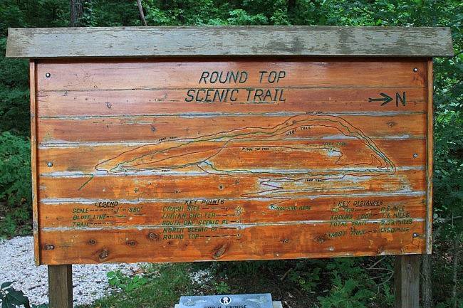
As you may gather from the pictured trailhead sign, the Round Top Mountain Trail is actually made up of a couple of smaller trails and connecting spurs.
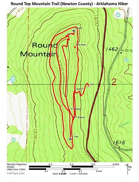
There is a lower loop about halfway up the mountain (the Loop Trail), and a semi-loop at the top that is made up to two separate, connecting trails: the Ridge Top Trail and West Trail.
And there are connecting spurs: one from the trailhead to the Loop Trail, one from the Loop Trail to the Ridge Top Trail, and one on the Ridge Top Trail for the North Bluff Overlook.
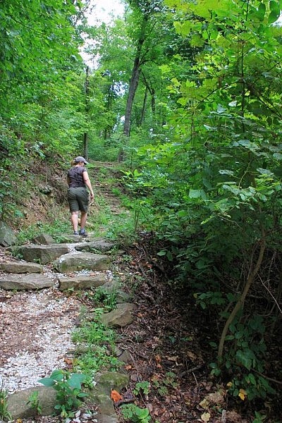
The first part of the hike is a short uphill spur with several switchbacks that gets you up to the Bench Trail.
This part is pretty gradual. So while there is a bit of an incline, it isn’t as bad as you might think hiking up the mountain would be.
Loop Trail (Lower Loop)
At about about .3 miles, there is a fork where you connect to the Loop Trail (the lower loop). If you are planning on hiking both loops, turn right here (i.e., take the loop counterclockwise).
The Loop Trail follows a nice bench through a thickly wooded area.
To your left will be a lot of nice rock formations, and to your right, a lot of trees with an occasional view of the valley below. It’s a really nice stretch of trail.
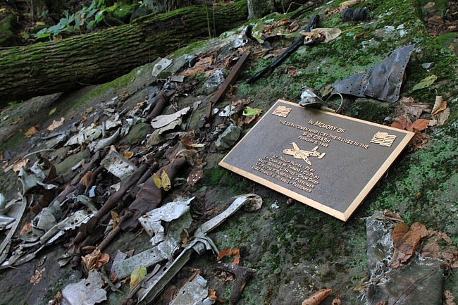
At about .8, there is a unique historical marker on your left (pictured). On Feb. 6, 1948, a foggy cold night, a B-25 bomber crashed into the mountain at this site killing all five military passengers.
There are also quite a few fragments of the plane that sit on a couple of rocks at the site, and many others that you may see scattered around the area. Please respect these remnants of the crash and leave them for others to see and experience.
After exploring a bit here, continue along the trail, enjoying the bluff lines.
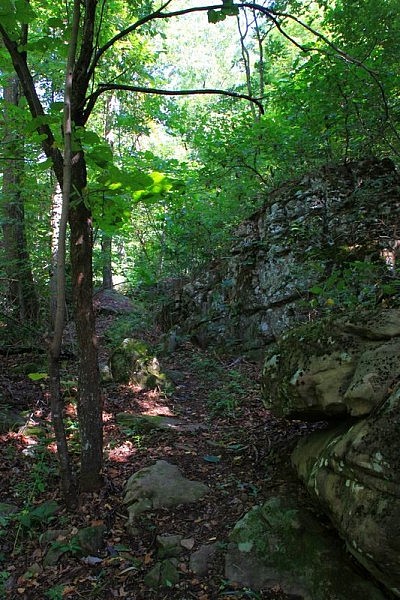
After about 2.2 miles, you will have looped to the south side of the mountain (called the “South Gap”). The trail goes up through the crack in the rock bluff that the trail has been following.
The trail goes up through the ledge, then back down through some more rocks. (There is even a hand rail here.)
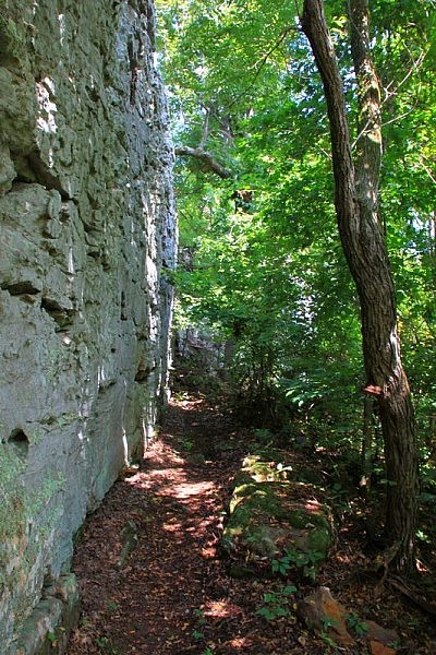
On the other side of the South Gap, the trail follows directly beside the bluff line for a really great stretch of trail.
Then there is another set of steps that leads down through some large rocks that also has a nice handrail.
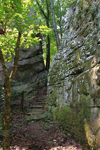
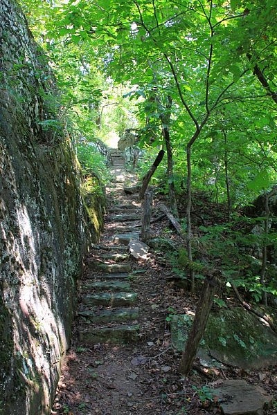
At about 2.8, there is a fork. Turn left here to go up the spur that connects to the Ridge Top Trail. This begins to climb up through another gap in the rocks on a nice little stone staircase up to the Ridge Top Trail.
Ridge Top Trail and West Trail (Upper Semi-Loop)
At the upper level, you will come to a 4-way junction. To your left is the south part of the Ridge Top Trail, heading to the South Gap. The other two trail sections, the north Ridge Top Trail to the right and the West Trail straight ahead, form a loop.
Turn right here (on the Ridge Top Trail) to head toward the North Bluff Overlook.
Follow this trail gradually up and then it will turn right and switchback down a bit, and then continues back north.
At 3.2 there is another fork. To your right is the short spur to the North Bluff Overlook.
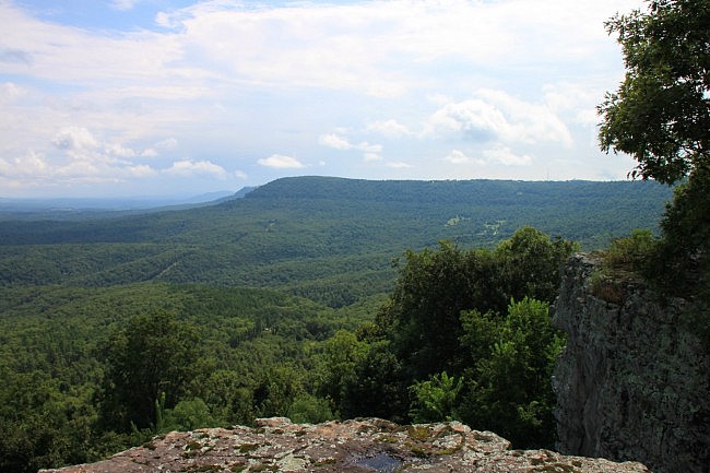
The North Bluff Overlook has an expansive view of the Little Buffalo River Valley and the community of Jasper below.
There are also some really determined trees that are growing on this rocky spot that appear to have weathered a lot over the years.
When done enjoying this spot, go back up the spur to return to the main trail. Turn right to continue the loop. The rest of the loop is considered the West Trail. (I don’t know why they don’t just call it a loop rather than naming this as a different trail.)
The West Trail was in the best condition and had the best views and wildflowers on the whole mountain. The yellow wildflowers when we were there were simply magnificent.
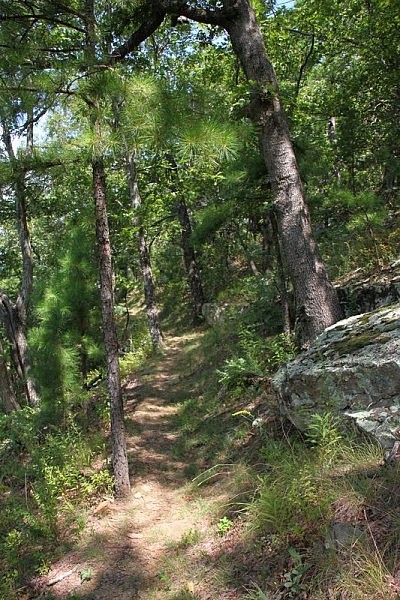
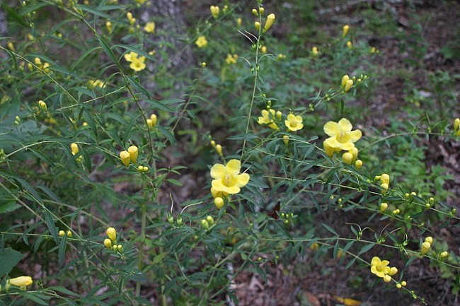
At about 3.4, you will finish the loop and be back at the 4-way junction. Now, turn right to take the south part of the Ridge Top Trail.
This takes you out to an overlook area on the south part of the mountain that sits above South Gap. There are some great views here and some really good rock formations (just like you would have imagined when you hiked through them down below!).
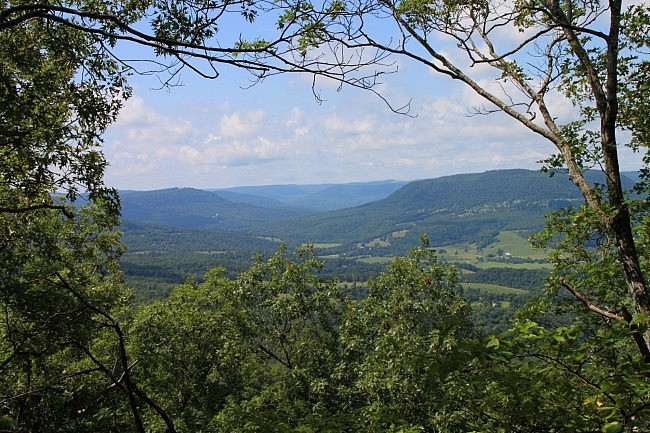
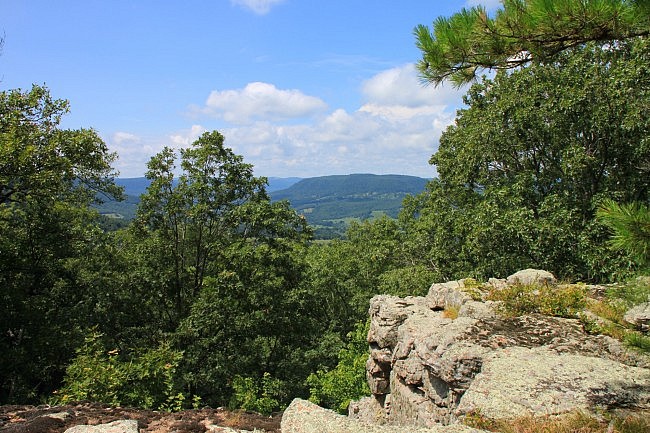
Enjoy some time here, and then head back. At the 4-way junction, turn right and head back down the stairs.
At the base of the stairs, you will be back at the Loop Trail. Turn left here to head back toward the spur that goes to the trailhead.
Once you reach that spur, turn right to descend back to the parking lot.
Final Notes
The maps and elevation profile below are based on Mike’s gps data from his August 23 hike on the trail. He followed the same path I did except he took a left (going clockwise) on the Loop Trail (lower loop).
The mileage measurements I have used here are based on those listed on the trail map at the visitor’s center.
I’ve seen a lot of mileage differences on this trail. The trail map at the visitor center says it is a 4-mile trail. Tim Ernst logs it as a 3.6 mile trail. So plan to go 3.5 to 4 miles and you’ll enjoy your trip!
Photo Gallery
Click below for full-screen photo gallery.
Map
Round Top Mountain Trail |
|
|---|---|
| Location | Round Top Mountain, south of Jasper, Newton County, Arkansas. |
| Length/Type | Approximately 3.6 miles to top and back going through both loops. |
| Difficulty | Mildly challenging (2 of 5). |
| Other permitted usage? | Unknown. |
| Gpx file (by Mike) | Link |
| Date Hiked | August 30, 2014 |
| Directions | Google Maps Directions to Round Top Mountain Trailhead |
| Official Info - Phone/Links | (870) 446-2090(Newton County Resource Council) |
[Last revised: 8-11-2020]


