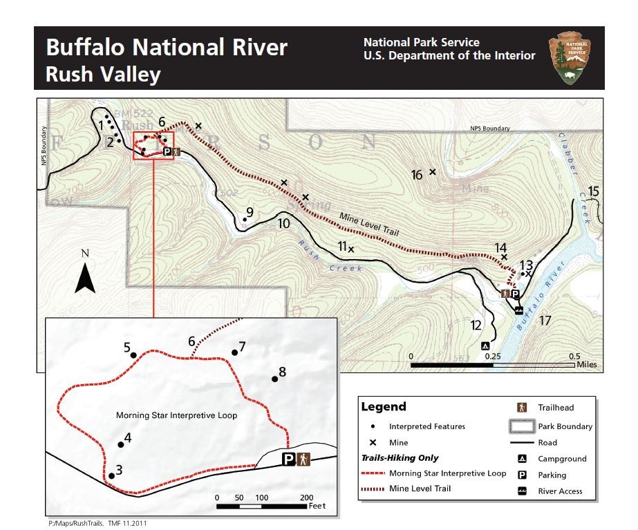
The Morning Star Interpretive Loop is an easy .2-mile loop in the Rush Historic District of the Buffalo National River Lower District (Marion County, Arkansas).
It has numerous remnants of the area’s mining town history.
Getting to the Rush Morning Star Trailhead
To get to the Rush Historic District, take Highway 14 south from Yellville. After about 10 miles, there will be a sign that clearly marks the left-hand turn to Rush. Turn here, and follow the paved road all the way down the hill to the river area.
The Morning Star Interpretive Loop trailhead will be on your left, just after a row of abandoned old buildings.
Morning Star Interpretive Loop
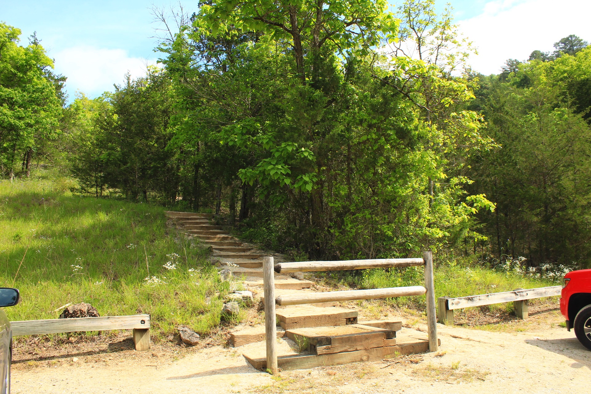
Park at the Morning Star Trailhead. It is the first parking area on the road. It is on the left, just past the row of old buildings on the right.
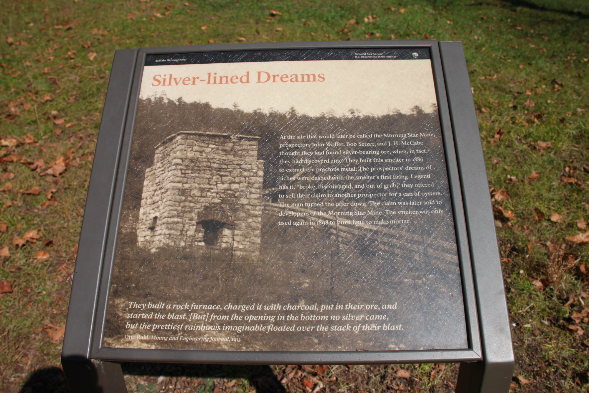
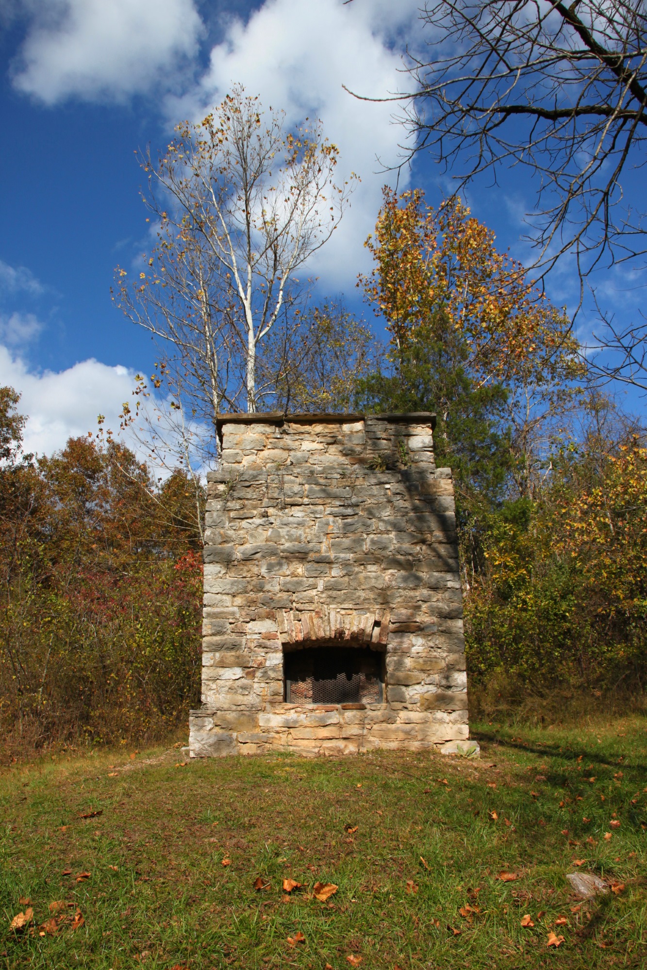
The Morning Star Interpretive Loop starts to the left. It first passes an old smelter that dates back to 1886. It is the oldest structure in Rush.
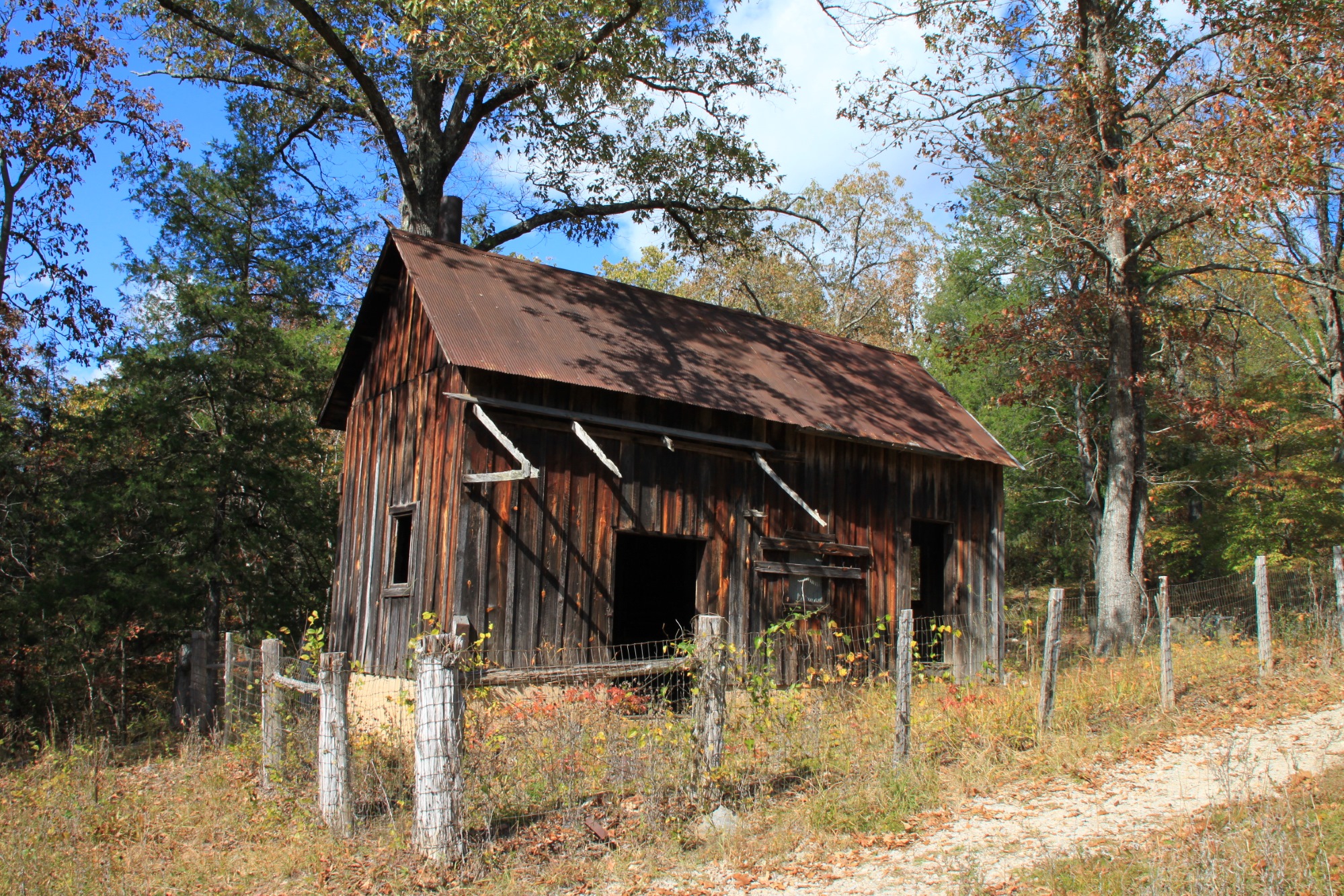
Next up the trail are the remains of an old livery barn that was built in the 1890’s. The trail then passes an old blacksmith shop and the remains of the Morning Star processing mill, and several other old ruins.
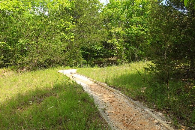
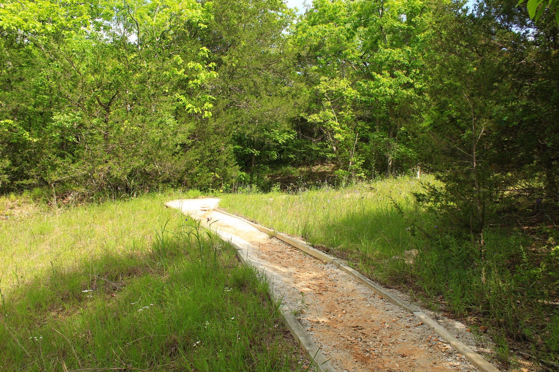
After about 400 feet in, when you are in the higher part of the loop, you will notice a trail that takes off to the right going uphill. Keep straight to complete the loop. Going to your right would take you to the Mine Level Trail.
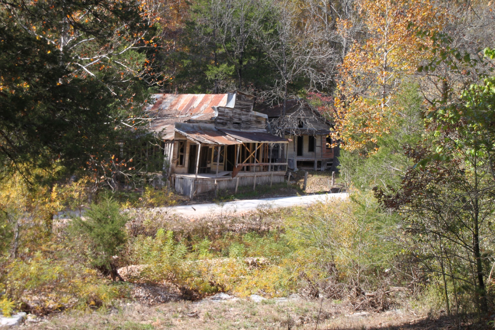
Further on the loop, there is a great view through the trees of the old ghost-town houses and general store that are on the other side of the road.
Final Notes
This little loop has a lot of history and reading. It is worth taking the time to read the plaques to learn about the history of the area.
The elevation change on this short path is only about 40 feet.
The posted photos are from our hike on October 23, 2011. (The photos by Mike Newman were taken on May 30, 2021.)
Photo Gallery
Click below for full-screen photo gallery.
Map
Rush Morning Star Interpretive Loop (Buffalo River) |
|
|---|---|
| Location | Rush Historic District, Marion County, Arkansas |
| Hike Length/Type | .25 mile loop |
| Difficulty | Easy (1 of 5) |
| Other Permitted Usage | None. (No pets.) |
| Gpx file | N/A |
| Date Hiked | 10-23-2011 |
| Directions | Google Maps Directions to Rush Morningstar Trailhead |
| Official Info | (870) 449-4311 (Buffalo Point Ranger Station Information) Website |
[A version of post was originally published on December 21, 2011 on the blog “Exploring Northwest Arkansas.”]