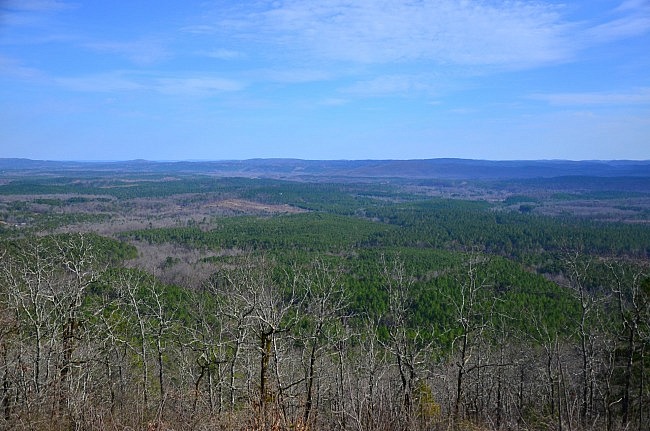
One of my favorite day hikes around Hot Springs is the Hunt’s Loop Trail in the Ouachita National Forest (north Garland County/south Perry County).
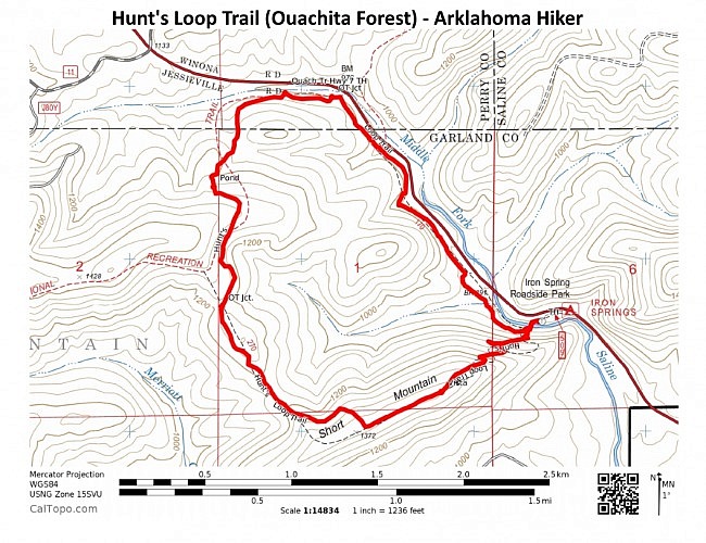
The 4.3-mile-hike takes you straight up Short Mountain to a gorgeous vista and then through some of the most beautiful woods along the ridge of the mountain before returning to the narrow valley of the Middle Fork of the Saline River.
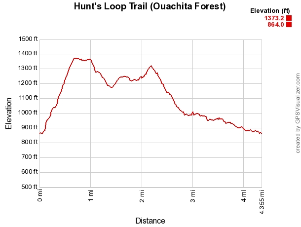
It is a moderate trail overall. The only difficult part is at the beginning (going clockwise) up Short Mountain. The elevation change is about 500 feet.
Getting to the Iron Springs Trailhead
Hunt’s Loop Trail is off of Highway 7, just north of Jessieville.
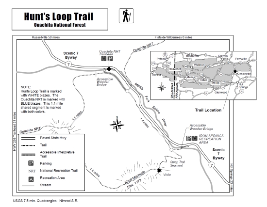
You can access the trail from two trailheads on Highway 7 that are located about 1.5 miles apart. There is a trailhead at Iron Springs Recreation Area, and there is a Ouachita Trail (OT) Highway 7 trailhead. (About a mile of the trail overlaps with Section 7 of the OT.)
I have hiked Hunt’s Loop numerous times and usually begin at the Iron Springs Recreation Area. It is a day-use area with picnic tables and vault toilets. It is a very nice area.
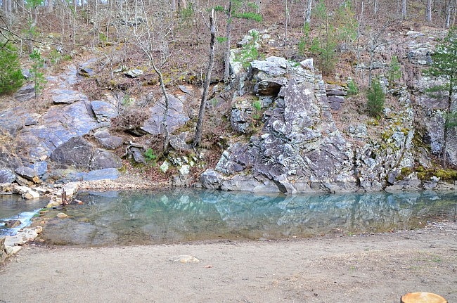
The Middle Fork of the Saline River is dammed which makes for a lovely swimming hole in the summer.
Iron Springs Recreation Area is on Highway 7, about 4 miles north of Jessieville.
Hiking Hunt’s Loop Trail
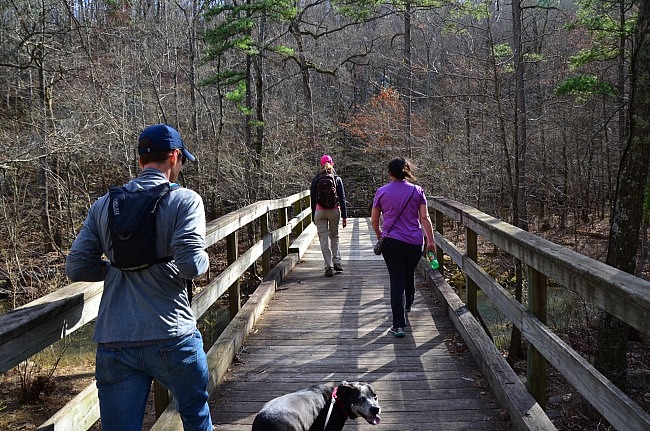
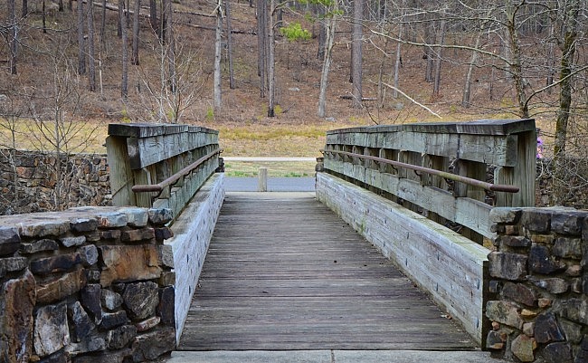
The trailhead is not hard to find. Simply follow the large and gorgeous bridge over the river. The Middle Fork of the Saline River does resemble a creek, but further south, out of the mountains and with all forks combined, it looks more like a river.
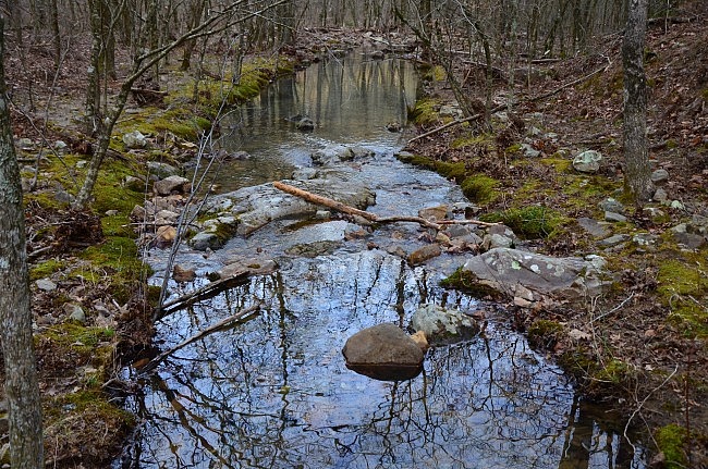
Once you cross the bridge, you are at the loop. Here you can turn right and follow the river toward the Ouachita Trail Highway 7 trailhead. I usually go left (clockwise) and head up Short Mountain, to knock the steep climb out of the way first. (For a more steady climb, go to the right.)
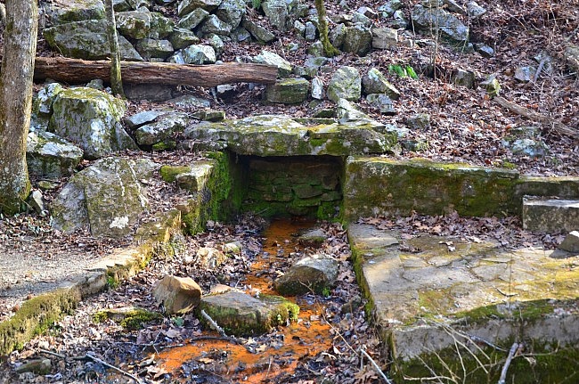
Going left, the trail may be hard to spot. You actually have to kind of walk around the rail of the bridge and over the Iron Spring. There is a sign that can point you in the right direction.
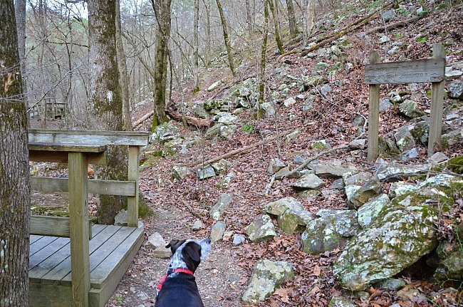
The first half-mile is steep but built well with switchbacks, but once you get to the Short Mountain Vista, it is nearly all downhill from there. There are a few places later on that are short climbs, but nothing terribly difficult.
If you pay close attention to the trees in the Ouachita Mountains, you notice that along ridge lines they tend to be shorter. So when making climbs like this one, when the trees began to shrink in size, you can tell when you are getting close to the top.
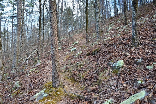
I love the hike to the top of Short Mountain, especially in the leaf-off season. Because of the narrow valley, the mountains on the other side are very close, and you can see how rugged the area is.
At the Short Mountain Vista (about .6 miles), there is a plaque with information about the area. The view, which faces south, is amazing, and it is better during leaf-off.
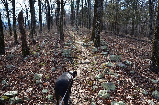
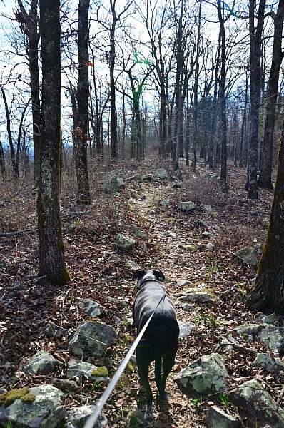
From the vista, the Hunt’s Loop Trail follows the ridge of Short Mountain, an elevation of 1,372 feet. I love this portion of the trail because you feel as if you are walking along the spine of a dinosaur from the rocky terrain.
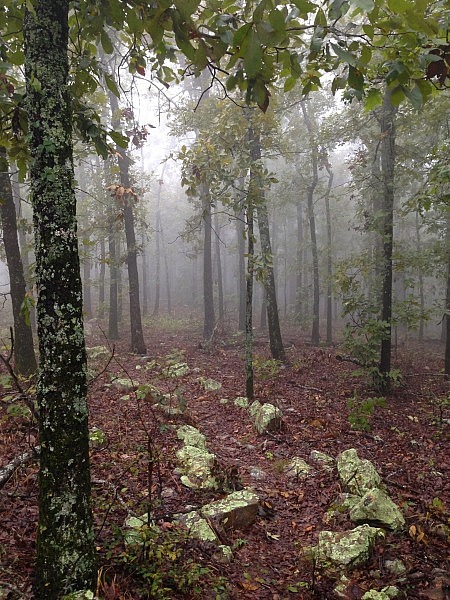
Once I went when the weather was gloomy and gray. The higher I hiked, the more foggy it got. The thick fog on this section of the trail was magical, and it was well worth the climb to see it.
At around 1 mile, the trail turns north and heads towards the OT junction. Before meeting up with the OT, Hunt’s Loop takes you through a stand of pines, and on a dry, windy day the evergreens sing to you as you hike.
Hunt’s Loop Trail is marked with white blazes, and the trail (except for the beginning) is easy to follow. The OT is marked with blue blazes. The 1.1-mile shared section of the trail is marked with both colors.
(This was the first part of the OT that I hiked. One day I will hike the whole thing.)
The intersection is clearly marked with a sign. Turn right to stay on Hunt’s Loop Trail (toward Highway 7).
In this section, there is an old pond. At one time, someone had stocked it with koi, large ornamental goldfish, I guess as a joke. The koi have died or been taken elsewhere, but if you are quiet, you might see frogs or turtles on the bank. I am not the most quiet and have not seen them, but I have heard them jump into the water as I approach.
At around 2.9, the trail goes by the Highway 7 trailhead of the OT. At about 3.1, the Ouachita Trail splits off to the left to cross the highway. Stay on the right to continue on the Hunt’s Loop Trail. It continues to follow Highway 7 back toward Iron Springs Recreation Area.
One thing that is not ideal in this last stretch is how close the trail is to the highway and the noise of the vehicles going by. But the scenery of the stream flowing nearby helps make up for the highway noise.
Final Notes
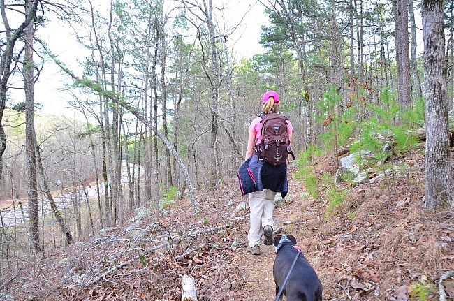
I love this trail for many reasons, but one thing that I find exceptional is how varied the trail is. You start off in the steep ascent to Short Mountain, then go through open woods, and then follow along the mountain stream. It would be tough to pick a favorite part.
These photos are all from my March 6, 2016 hike (except for the 2 foggy ones from a 2014 hike).
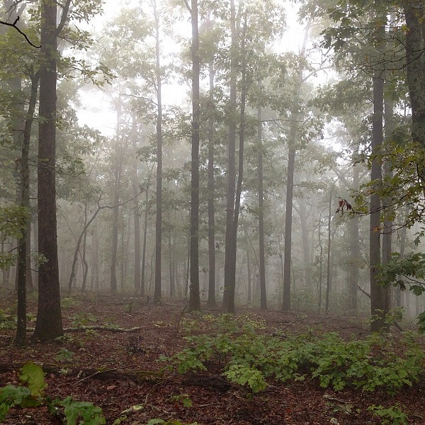
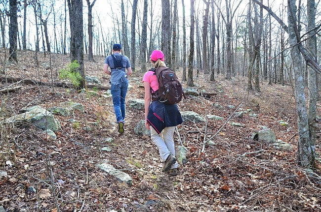
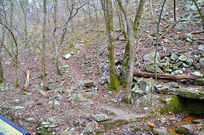
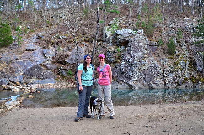
Photo Gallery
Click below for full-screen photo gallery.
Map
Hunt's Loop Trail, Ouachita National Forest |
|
|---|---|
| Location | Perry and Garland Counties, Arkansas |
| Hike Length/Type | 4.4 mile loop. White blazes. |
| Difficulty | Moderate (3 of 5) |
| Other Permitted Usage | Hiking only. |
| Gpx file by Mike | Link |
| Date Hiked | March 6, 2016 and earlier |
| Directions | Google Maps Directions to Iron Springs Rec Area |
| Official Info | (501) 984-5313 Website USFS Trail Map (pdf) |
[A version of this post was originally published on March 30, 2016 in the blog “Right Kind of Lost.”]
Last revised: 6-7-2021.


2 replies on “Hunt’s Loop Trail (Ouachita Forest) – 4 mi”
Enjoyed this trail report, Mara. This is a favorite early morning hike when we pamper ourselves at the Mountain Thyme B&B about two miles south of the trailhead. Saw one of my two Arkansas black bears on this loop one morning.
I’d never heard that goldfish were in the little wildlife pond. Thanks for sharing your hike and the photos.
Thank you! I’m glad you enjoyed it. I would love to see a bear there sometime … at a safe distance of course :P