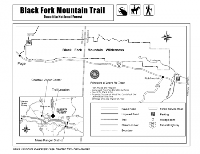
Black Fork Mountain Trail (Polk County, northwest of Mena) is a strenuous 11 mile out-and-back hike (5.6 miles each way) on Black Fork Mountain. It is in the Ouachita National Forest in southwest Arkansas, just north of Queen Wilhelmina State Park on Rich Mountain.
The trail offers spectacular views, unique forests, and historic places. Black Fork Mountain Trail is great for a long day hike or an overnight backpack.
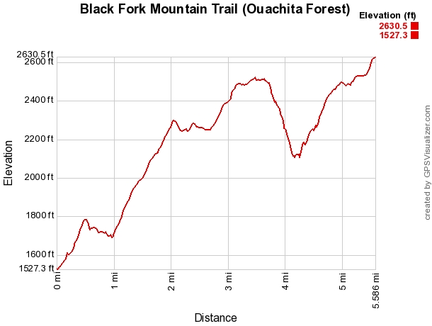
My GPS tracked me at 5.6 miles to the summit of Black Fork Mountain. The total elevation gain was 1,705 and elevations loss of 644 feet.
Directions to Black Fork Mountain Trailhead
The trailhead for Black Fork Mountain Trail is off of Highway 59/270 west of Mena, Ark. From Mena you will want to take Highway 71 north to the town of Acorn. At Acorn turn onto Highway 59/270 and drive for about 6 miles. The parking lot for the trailhead will be on your right.
If you come to the intersection of Highway 272 to your left, you have gone too far.
Trailhead to the Ouachita Trail
The Black Fork Mountain Trail follows the Ouachita Trail to the east for a little less than a mile before it splits off and heads to the west.
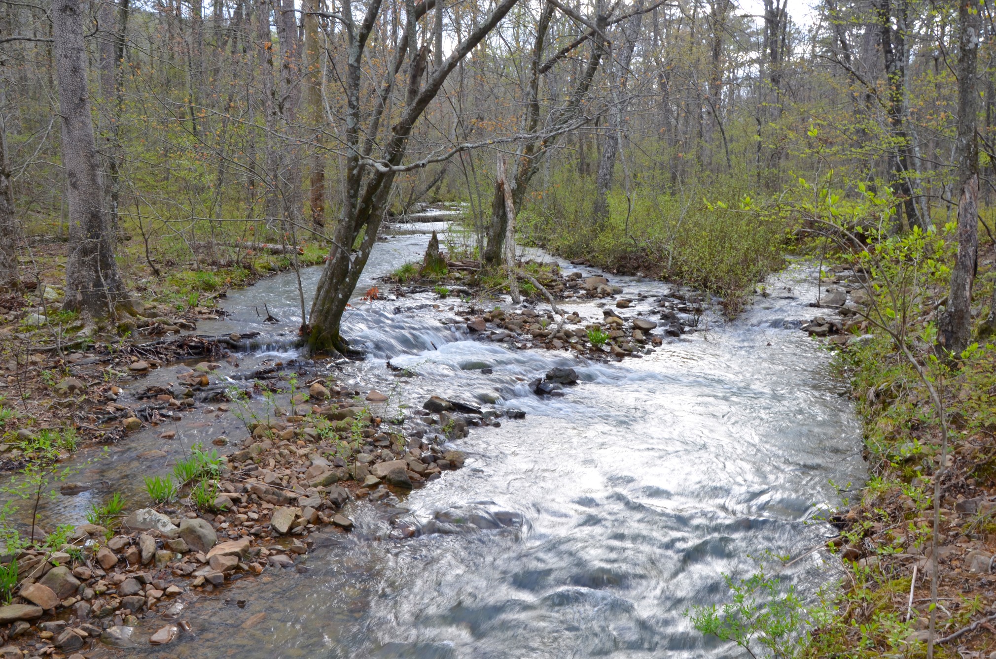
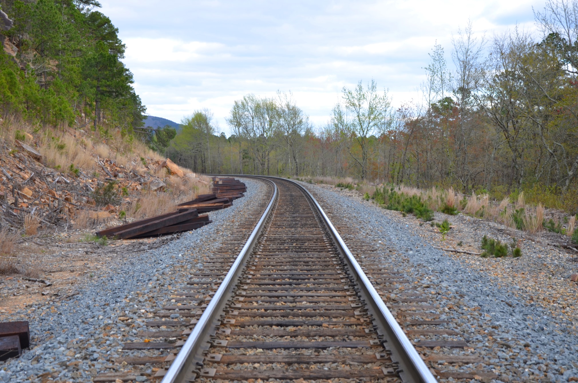
When you begin your hike, you immediately cross via a footbridge over the Ouachita River. For those of us who live down river, it’s hard for us to see this creek as the Ouachita River.
From the river, you will then cross the railroad tracks. This was a first for me, crossing railroad tracks, and I thought it was neat. Once you cross the railroad tracks, you will need to look for the blue blazes to show you where the trail enters the forest again.
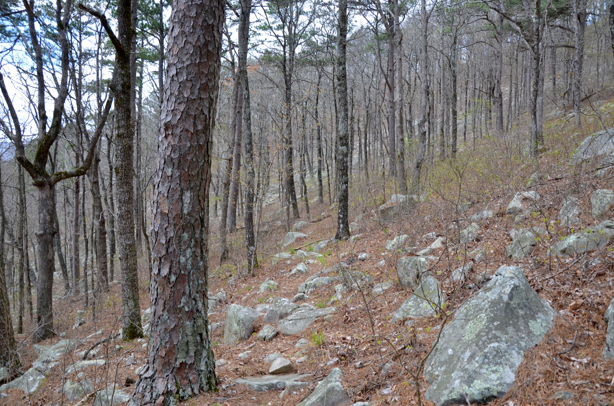
This part of the Ouachita Trail is a steady climb through open forest with lots of boulders. I thought this part was very pretty.
At about mile 0.9, the trail intersects with the Black Fork Mountain Trail. Here you will want to turn to the left, and follow the white blazes. There is also a sign directing hikers which way to go.
Ouachita Trail to False Summit
When the Black Fork Mountain Trail splits from the Ouachita Trail, it follows an old road bed. Shortly past the intersection, there is another intersection with a very short spur trail to a backcountry shelter.
From there the trial climbs semi-steeply through a beautiful pine forest until it gets to the ridge and levels out a little bit at mile 2.15.
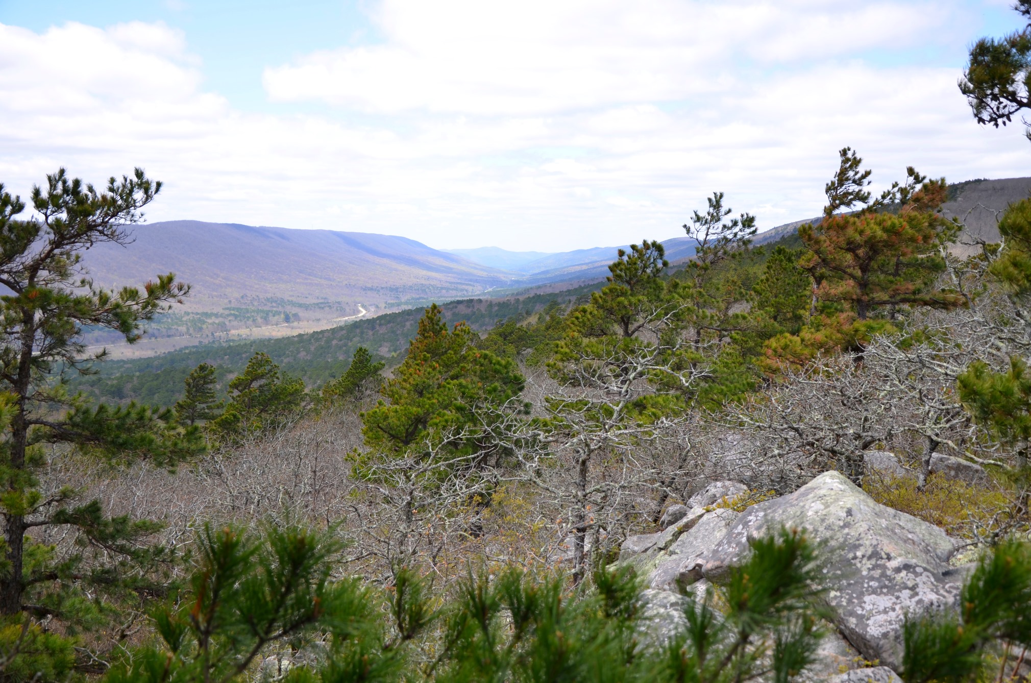
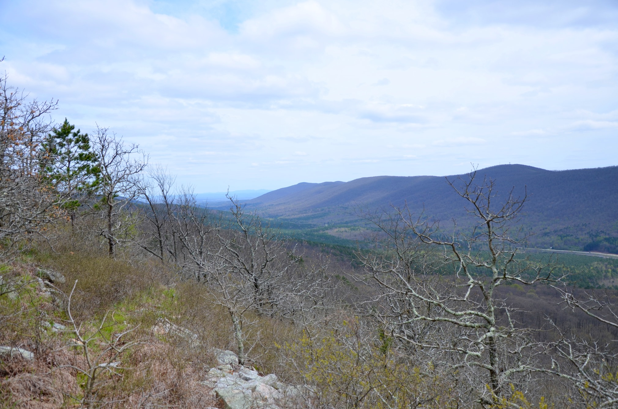
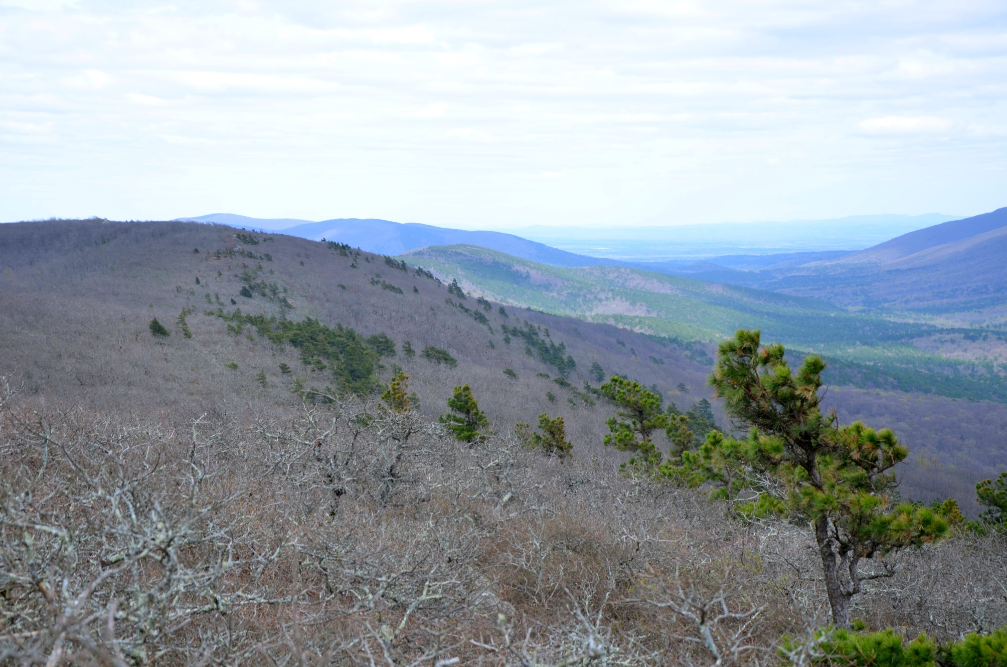
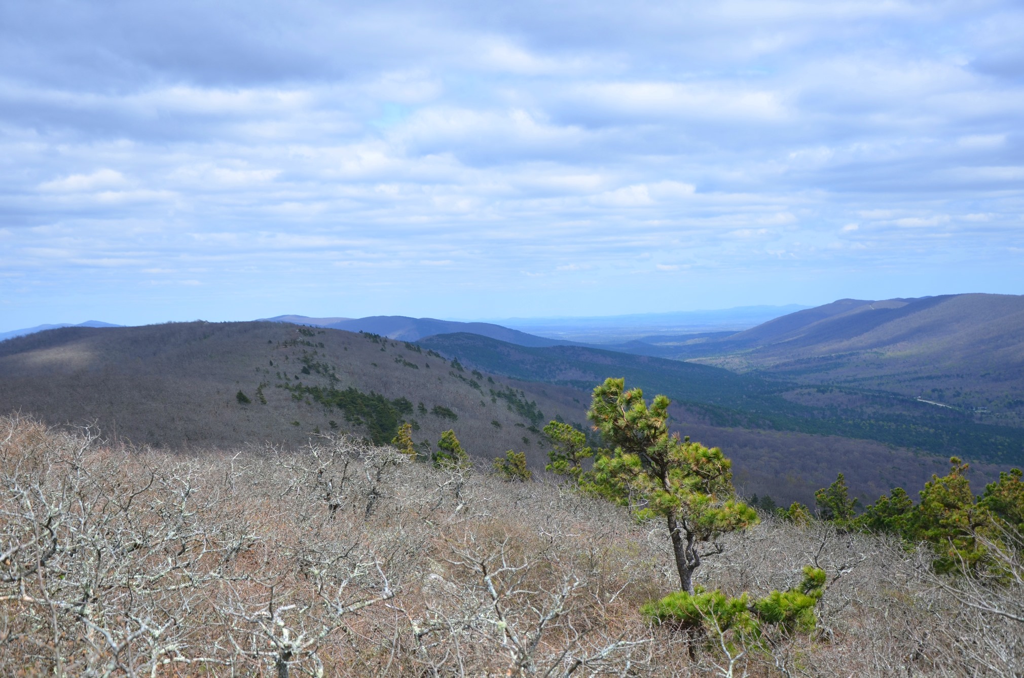
At mile 2.47 there is a quick spur to a wonderful vista. You can see Rich Mountain to the south and a long ways to the west. You can also see the highway and how far you have climbed at this point.
From there the trail continues to follow the ridge and at mile 2.77 it passes by a pond.
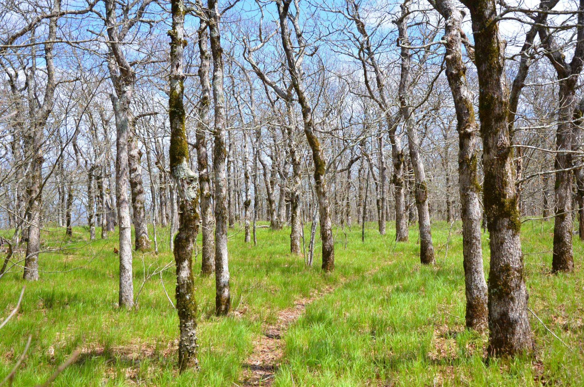
There is a really short steep part and then the trail levels out along the ridge line. This is where some of the good campsites are.
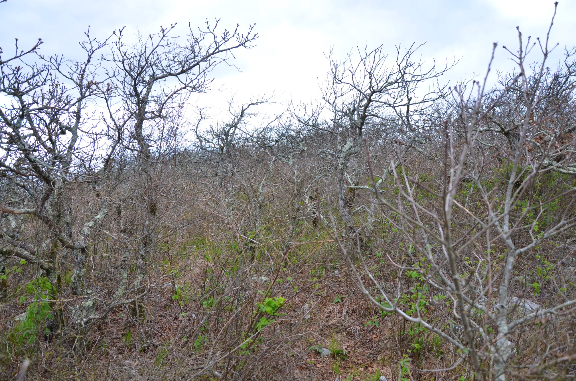
Along the ridge the oak trees are very short, but very old. This is a unique forest and something that I find amazing.
False Summit to Real Summit
At about mile 3.75 the trail turns and begins to head down hill. This part of the trail is steep. It also takes a little bit of route finding. You will need to watch for the cairns. I saw no white blazes on trees in this part, and because the trail takes you through a rocky part it can be hard to spot the beaten path.
At mile 4.2, another trail comes into the Black Fork Mountain Trail. I did not notice this trail until my return back to the trailhead, where I went the wrong way. On the return, you will want to be sure to stay to the left. In Tim Ernst’s “Arkansas Hiking Trails” book, he calls the other trail a “Mule Trail.”
It was confusing to me on the return because on the way back you are heading downhill until this point. The Mule Trail continues downhill, but the Black Fork Mountain Trail splits off and takes you back uphill. Also on the return this part is very steep.
Continuing toward the summit, about two tenths of a mile down the trial you can see a huge rock glacier above you to your right through the trees.
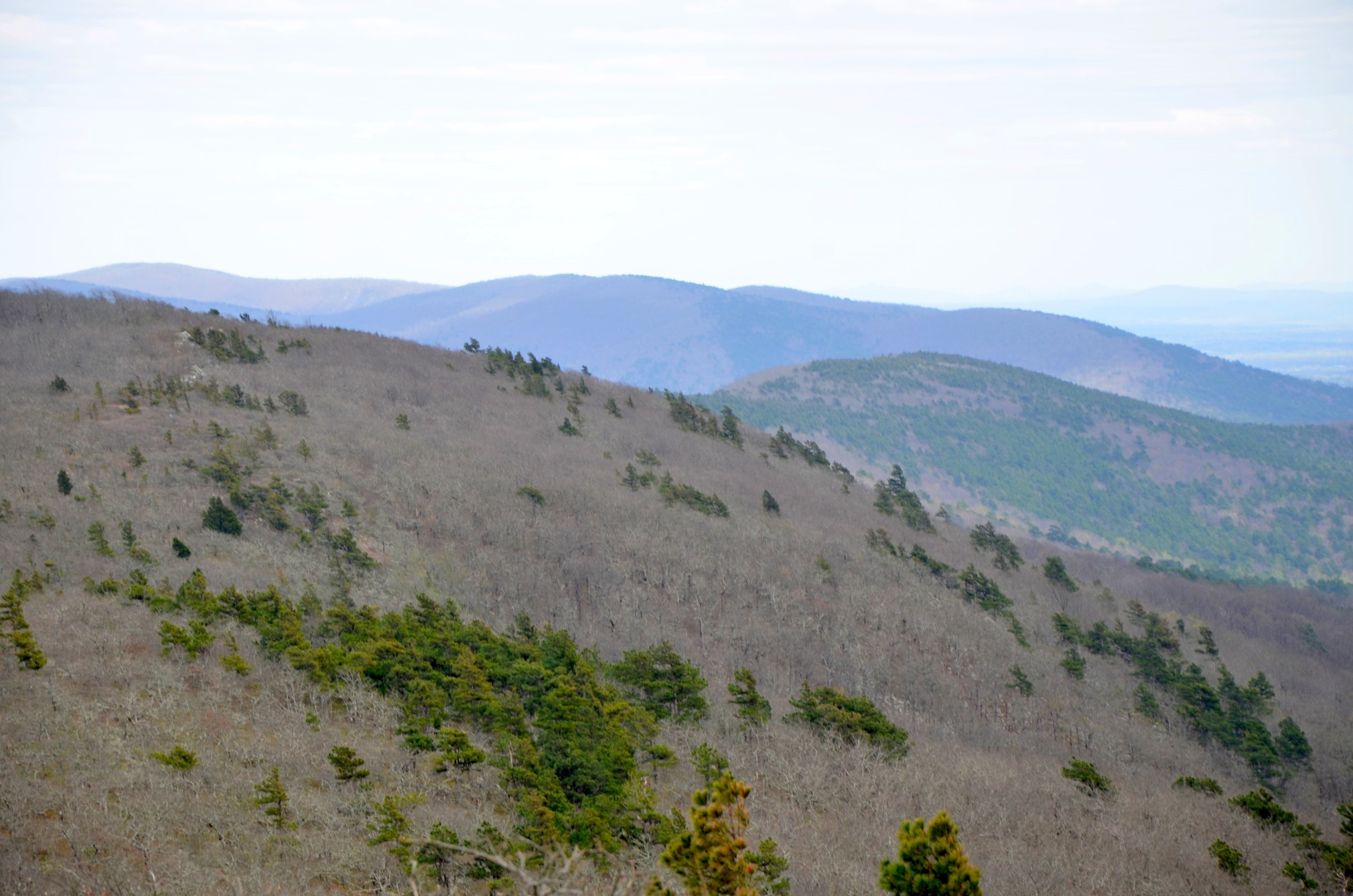
From there the trail climbs back to the ridge and along an open side of the mountain. There are excellent views here.
At about mile 5, the trail gets back on the ridge and levels out again.
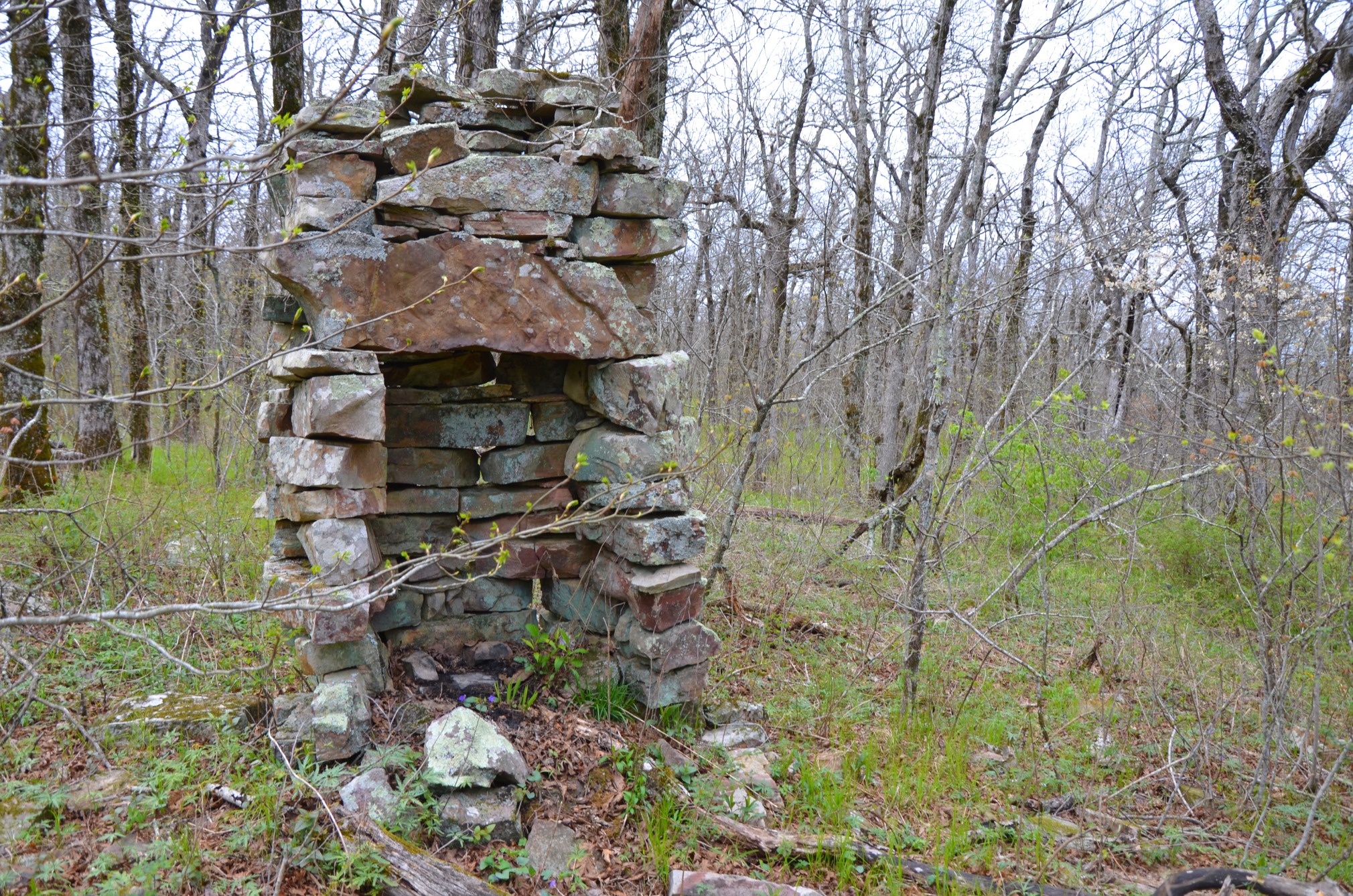
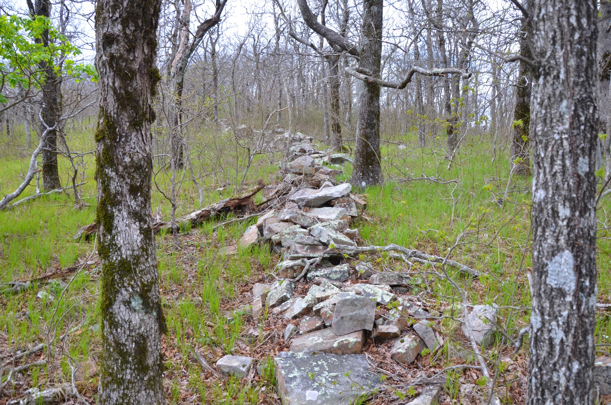
Around mile 5.2, the trail passes an old chimney left from long ago. It then follows an old stone fence. I loved seeing these old structures.
Summit to Trailhead
The trees get really thick and really short near the summit, and the trail sort of ends at a rock outcropping. From the summit, you can see the lodge at Queen Wilhelmina State Park and miles to the east and west.
There is not a sign or anything that marks the end of the trail. I attempted to go further from this point, but the small oaks choked out the trail and it petered out.
This is a great place to have a picnic too.
Final Notes
As far as backpacking, there are numerous amazing places to camp along the ridge of Black Fork Mountain. However, the Back Fork Mountain Trail mostly follows the ridge of the mountain, so water is scarce and almost non-existent.
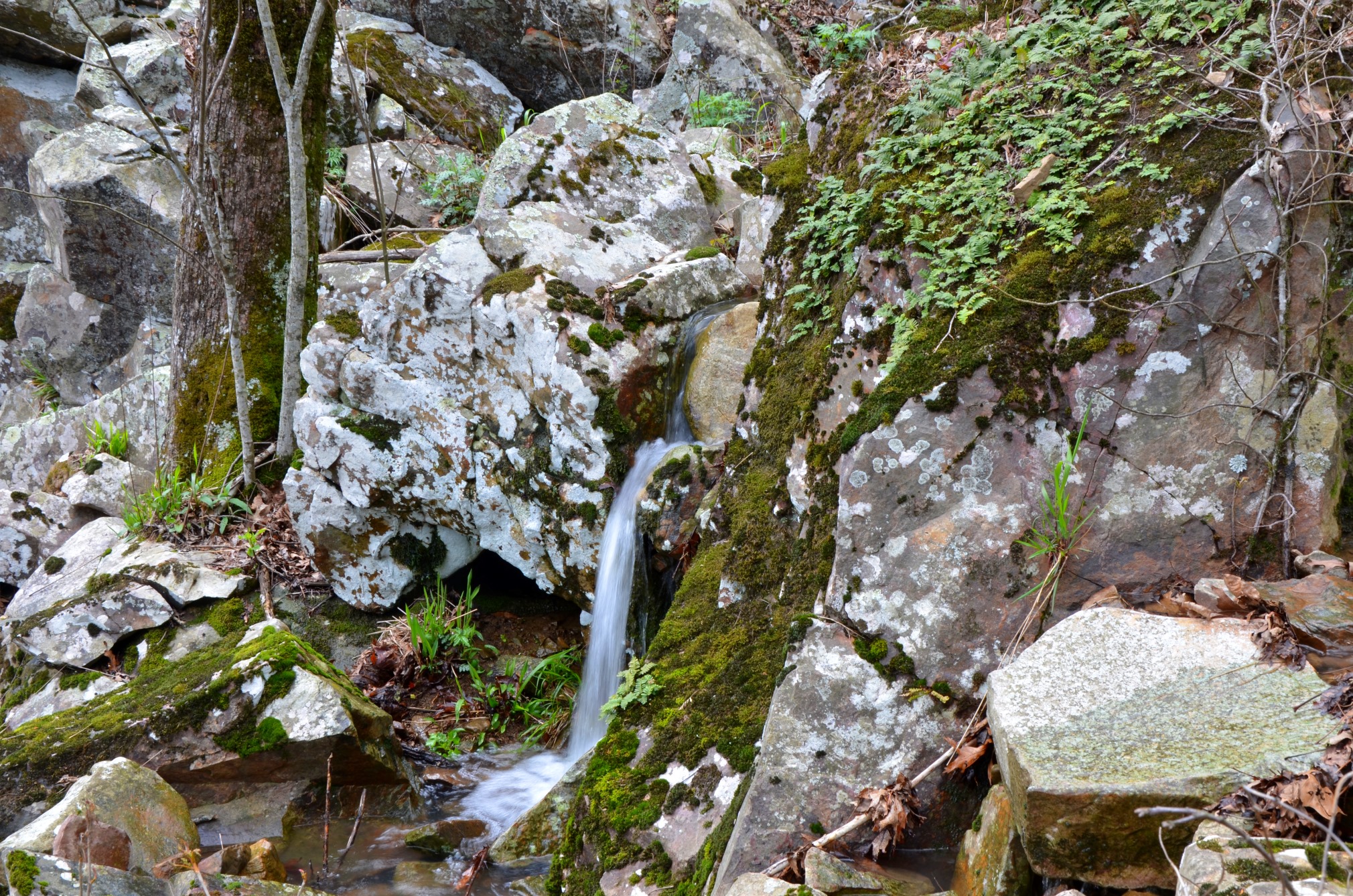
If you are going to backpack the trail, you will need to bring all your water with you. I say water is “almost non-existent” because when I hiked the trail in the spring of 2018, I did cross a beautiful cascade. But I wouldn’t count on it to be flowing if I were to backpack it.
It’s apparent that other people think this trail is a great backpacking trail by the number of fire rings I saw. Backcountry camping is permitted.
The majority of the trail is in the Black Fork Mountain Wilderness.
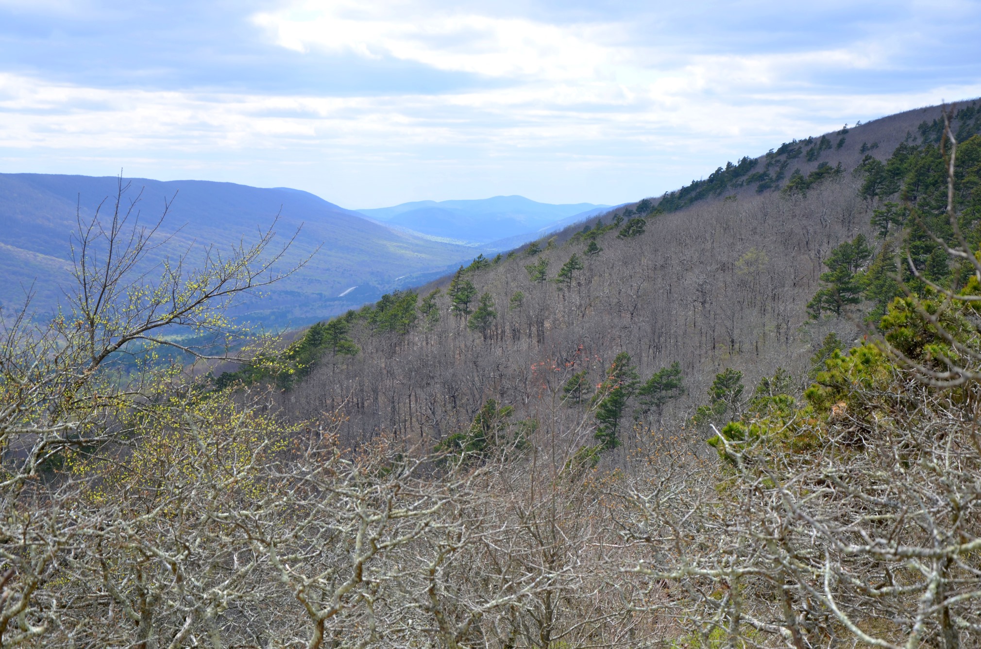
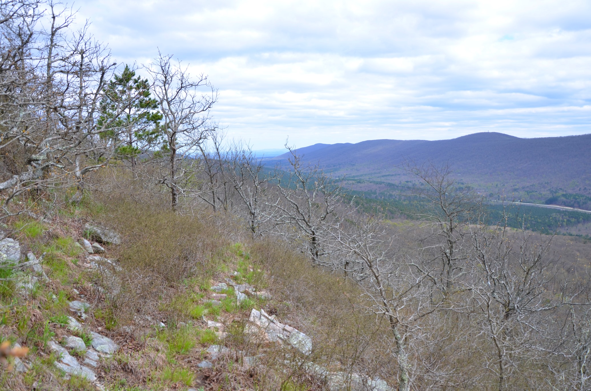
Photo Gallery
Click below for full-screen photo gallery.
Map
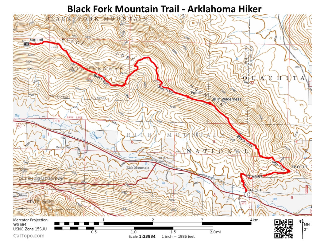
Black Fork Mountain Trail (Ouachita Forest) |
|
|---|---|
| Location | Polk County, Arkansas |
| Hike Length/Type | 5.6 mi each way out and back (11.2 total hike). White blazes (except for first mile which has Ouachita Trail blue blazes). |
| Difficulty | Very Strenuous (5 of 5) |
| Other Permitted Usage | -- |
| Gpx file by Mike | Link |
| Date Hiked | 03-17-2012 |
| Directions | Google Maps Directions to Black Fork Mountain Trailhead |
| Official Info | (479) 394-2382 (Mena/Oden Ranger Dist.)USFS Website USFS Trail Map (pdf) |
[A version of this post was originally published on September 13, 2018 in the blog “Right Kind of Lost.”]
3 replies on “Black Fork Mountain Trail (Ouachita Forest) – 11 mi (o&b)”
Nice. Bad thing about this wilderness is that there’s no escape from civilization, since the ridge runs down the middle. You can always see the surrounding area. Still beautiful…but…
Hello! I am going to be doing this hike soon and was wondering if you still have any notes. Was wanting to check mile check point for camping bed sites so I can plan accordingly.
Hi Kiley, sorry for the late response. Hope it was a good hike! Mike