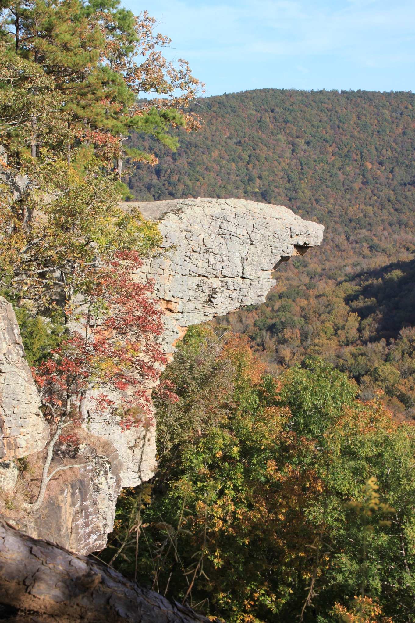
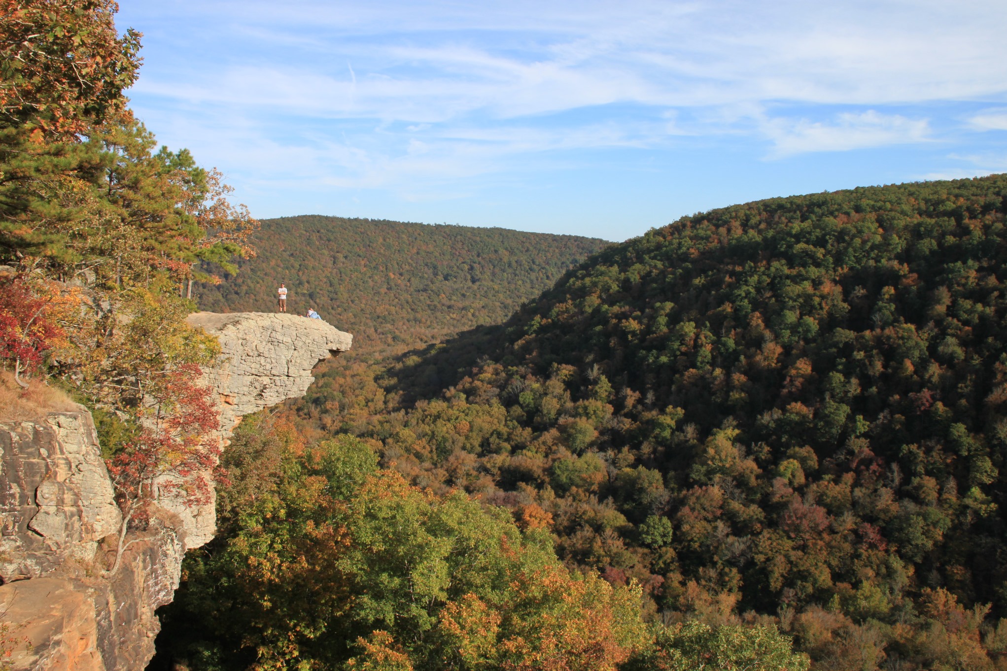
If you’ve spent much time in the Buffalo River area, you’ve seen pictures of Hawksbill Crag (aka Whitaker Point). It is one of the most photographed spots in the area, and with good reason.
The hike to Hawksbill Crag is a short one, and it is relatively easy. Getting to the trailhead is a bit trickier.
Directions to Hawksbill Crag (Whitaker Point) Trail
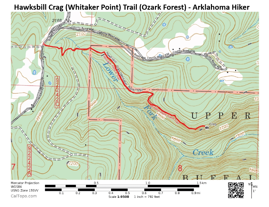
The trail is in the part of the Upper Buffalo Wilderness Area (Newton County) that is in the Ozark National Forest.
To get to the trailhead from Ponca, take Highway 43 south from Ponca toward Boxley. When it merges with Highway 21, take the southern route and continue on to Boxley. Right before you cross the Buffalo River, there is a gravel road on the right called Cave Mountain Road. (It may not be marked.)
Turn right onto Cave Mountain Road. You’ll know you’re at the right place when the gravel road heads up, seemingly straight up. This is a rough, rocky, steep road. I will note that we’ve made the trip many times in our 2-wheel drive car without problems, but never when the road was wet and potentially slippery.
The road will eventually level out. Continue on Cave Mountain Road for a total of 6 miles; it will feel like a lot more.
When you pass the Cave Mountain Church and cemetery, you’re just a bit more than a half-mile away.
At 6 miles, you’ll come to a small parking area marked “Wilderness Access.” Find a spot to park here, or on the side of the road if the lot is full. The trail starts out on the opposite side of the road from the parking lot.
Hiking Hawksbill Crag Trail
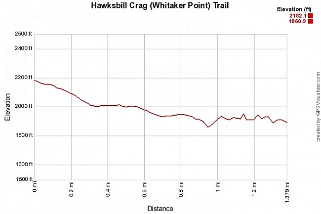
This is a heavily used trail, so following it should not be difficult. It starts off down the hill. (Getting back up this hill at the end of the hike is the toughest part of the hike.)
After going down a bit, the trail eventually levels out.
At about the 1-mile mark, the trail dips down a bit and crosses a small stream. If there is water flowing in this stream, there is a nice little waterfall down to your right over the bluff. This waterfall is called Haley Falls – named after a six-year-old girl who got lost from her group in this area for 3 days and 2 nights. She was eventually found near here.
If you go down to the bluff, there is a tree there that can help you get down to the upper version of this falls (and more importantly, back up).
There is a lower version of the falls that I’ve never been down to because we usually do this hike in October when the leaves are turning and the views here are so tremendous. But there is seldom much water here in October.
As you cross the stream, you have an option to turn left or right. Both trails lead to the Crag.
To the left, the trail heads up on a higher path, farther into the woods and away from the bluff line.
The trail to the right heads right along the edge of the bluff line.
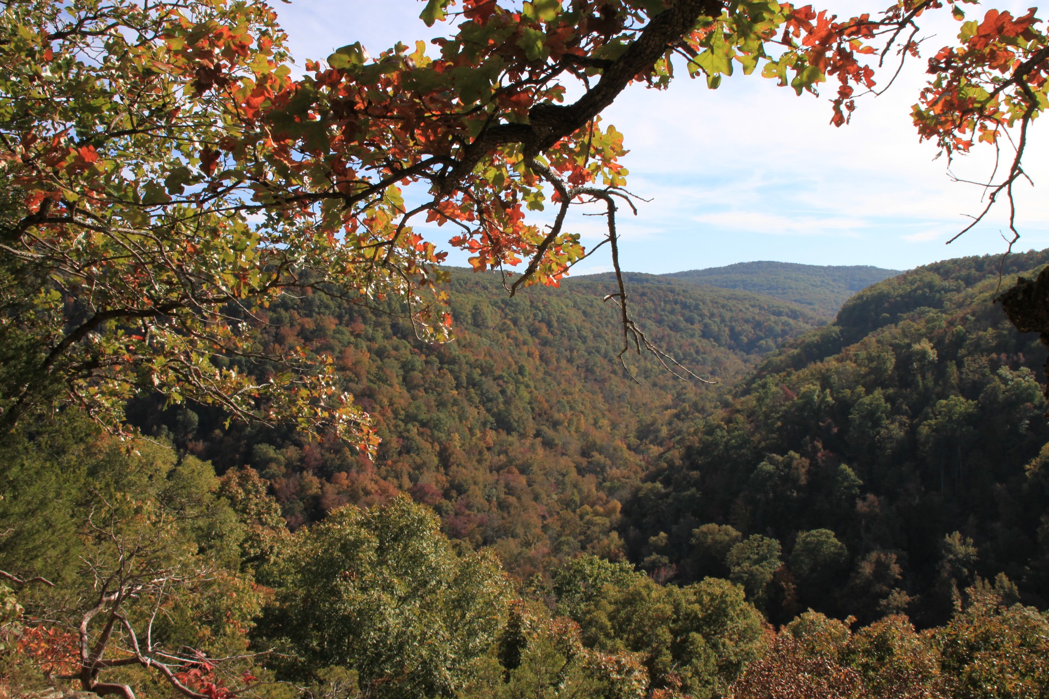
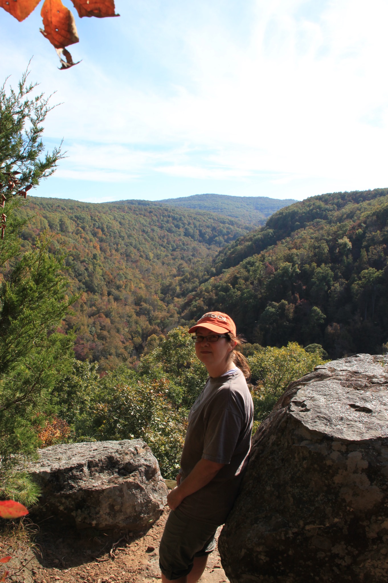
While the upper path is a very nice hike, we usually take the path to the right and come back on the other route. If you go to the right, the next half-mile is filled with interesting rock formations, great views of the Upper Buffalo Wilderness Area, and a lot of places to stop for a snack or just to soak it all in. (Hitting this area in late October when the trees are in full color is just breathtaking).
Note of caution: As always, be very careful around bluffs because of the risk of a dangerous or fatal fall. A drop from this bluff would be several hundred feet and would likely be fatal.
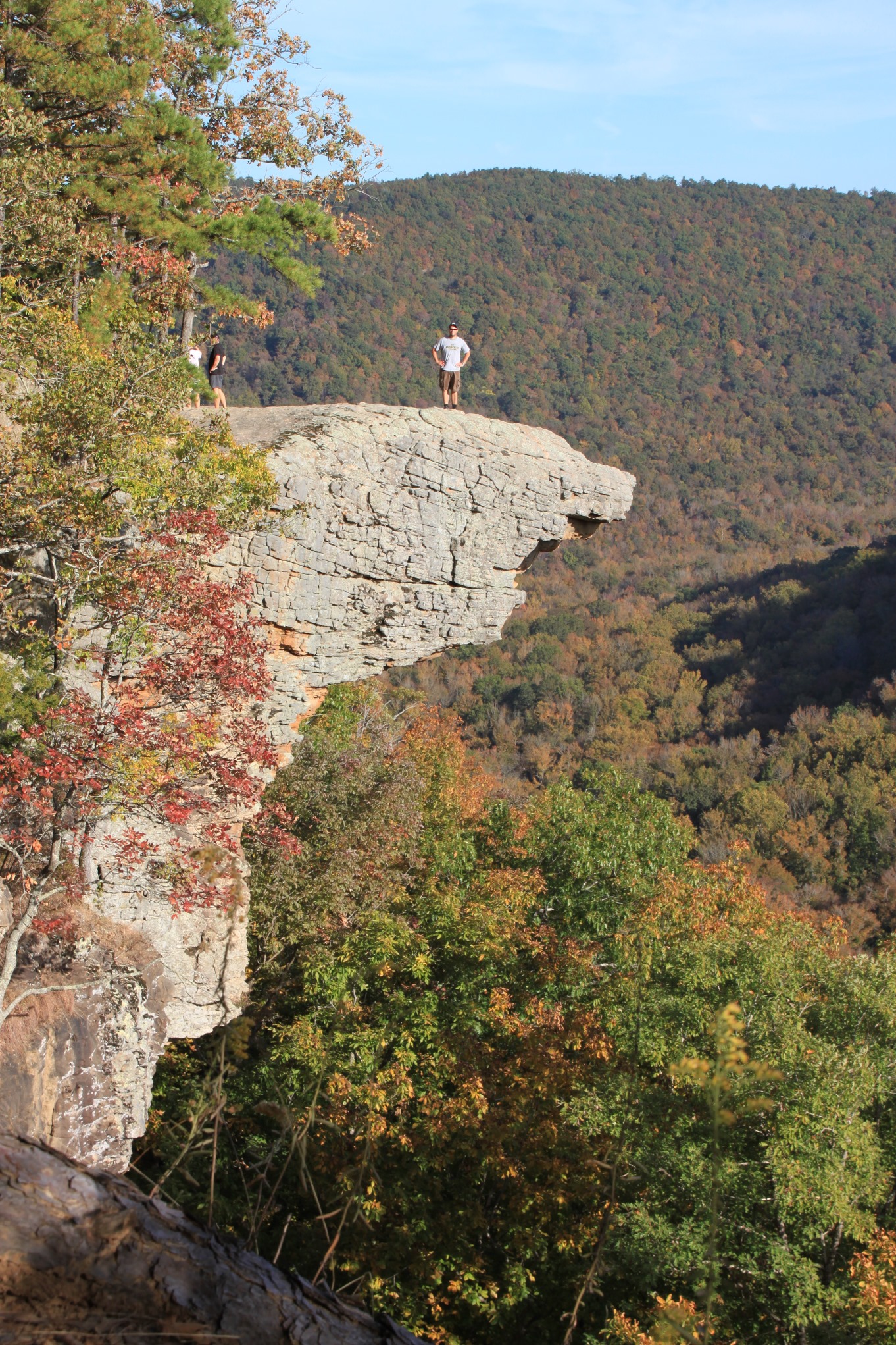
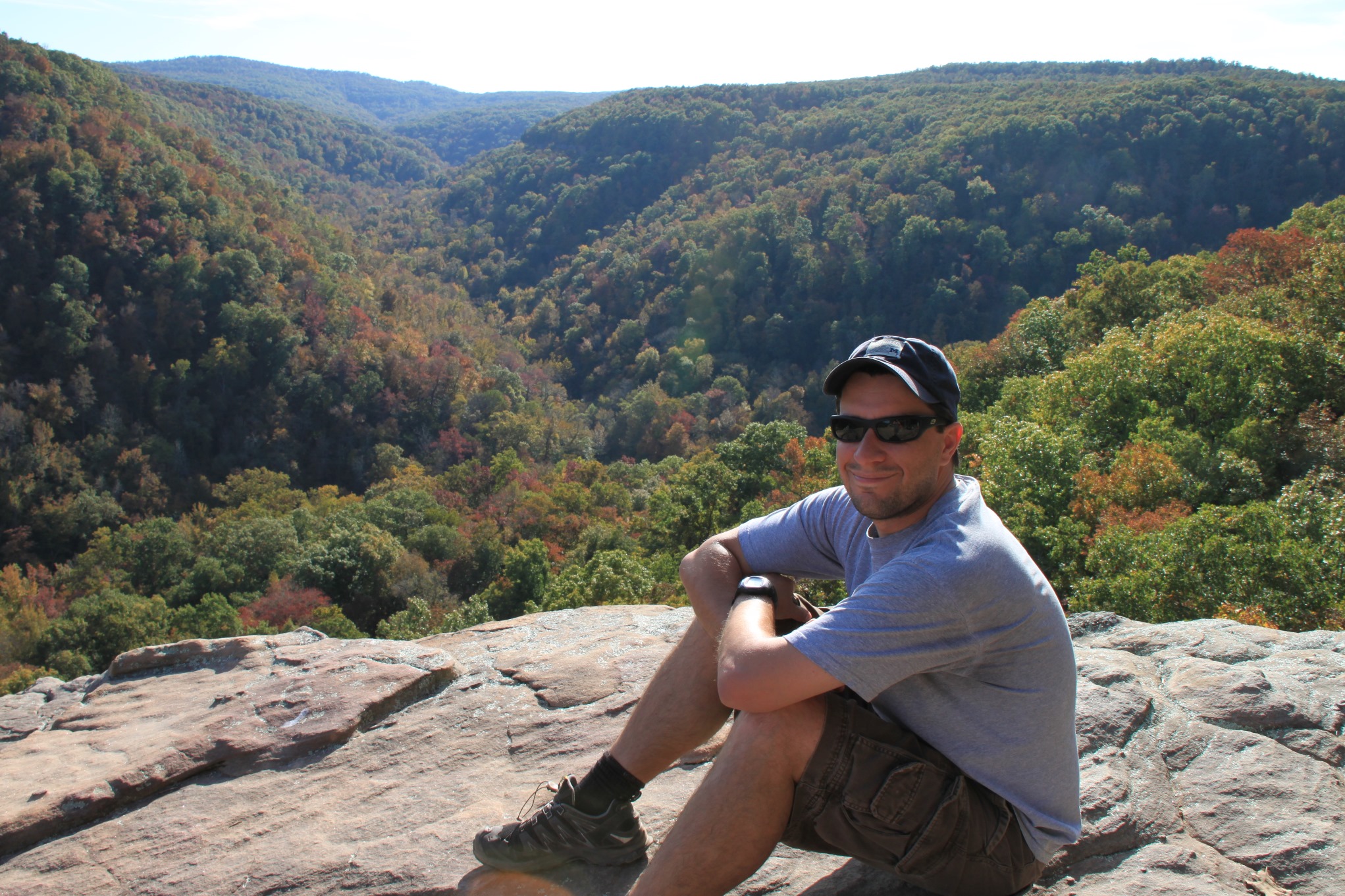
After a half-mile of bluff top views, you reach the Crag. The views from here are incredible. There are also a lot of little places to get pictures of the Crag itself.
Again, when you venture out on the Crag, be very careful. A fall would likely be fatal.
After taking time out here to enjoy the area, head back the way you came in. When it starts getting steep, you’re getting close to the trailhead.
Final Notes
As an out-and-back hike, the total length is about 2.8 miles.
I rate the difficulty of the hike as mildly challenging (2 of 5), only because of the hike out.
This trail, unlike most in the Buffalo River area, does allow dogs on leashes. If your dog is the type that will pull you trying to chase a critter, this may not be the best path to take them on.
For footwear, I recommend hiking boots or trail runners.
You can read more about the trail in Tim Ernst’s Buffalo River Hiking Trails.
These photos are all from our October 16, 2010 hike.
Photo Gallery
Click below for full-screen photo gallery.
Map
Hawksbill Crag (Whitaker Point) Trail (Ozark Forest) |
|
|---|---|
| Location | Upper Buffalo Wilderness, Ozark National Forest, Newton County, Arkansas |
| Hike Length/Type | 2.8 miles out-and-back (1.4 miles each way) |
| Difficulty | Mildly challenging (2 of 5) |
| Gpx file (by Mike) | Link |
| Date Hiked | October 16, 2010 |
| Directions | Google Maps Directions to Trailhead |
| Official Info | (870) 446-5122 (Big Piney Ranger District - Jasper) Website |
[A version of this post was originally published on December 26, 2011 in the blog “Exploring Northwest Arkansas.”]
[Last updated: 10-22-2019]
One reply on “Hawksbill Crag (Whitaker Point) Trail (Ozark Forest) – 3 mi (o&b)”
Thank you for the thorough description! It is nice to have some preview of the trail and hike before voyaging 4 hours there :)