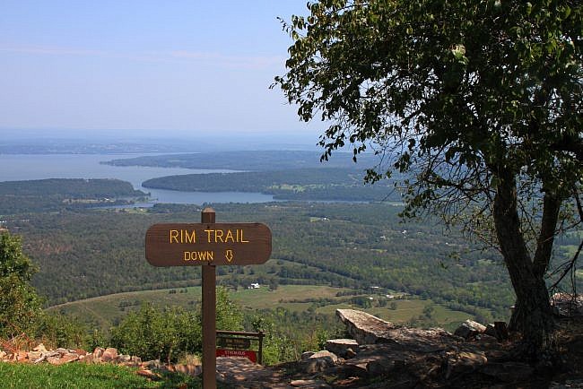
Arkansas has earned the reputation as “The Natural State” because of the beautiful natural sites around the state. And as a part of this reputation, Arkansas has established an outstanding state park system that is diverse in the natural beauty they provide.
One of the crown jewels of the state park system is Mount Nebo State Park. The park was established in 1935. Many of the trails and cabins date were built by the Civilian Conservation Corps (CCC), part of President Roosevelt’s “New Deal” during the Great Depression.
The park is located seven miles west of Dardanelle on Highway 155. You can get there by taking Highway 7 south, through Russellville and Dardanelle, making a brief right onto Highway 22, and then turning left on Highway 155. (Follow the signs to the park.)
Highway 155 up Mount Nebo is very steep and very curvy. (Don’t bring a long trailer.)
At the top of the mountain, there are campsites, cabins that can be rented, private residences, a pool, tennis courts, playground equipment, a basketball court, and a great little visitor center with several snakes on hand, so you can learn about the native species.
You may also catch the sight of hang gliders from the visitor center as it is a frequent launch point.
The park also offers 360-degree views of the countryside which also means fantastic views of the sunrise and sunset (at sites aptly named “Sunrise Point” and “Sunset Point”).
Mount Nebo Hiking Trails
The park boasts over 14 miles of hiking trails, all of which connect in ways that can make for a wide variety of routes, distances, and difficulty levels.
There are two main trails that go around the entire mountain. The Bench Trail is four miles long and is part-way down the mountain. It’s a smooth, soft and easy trail that’s great for taking the dogs, trail running or for mountain-biking. It is also where the majority of the springs on the mountain are located.
Further up the mountain is the 3.2-mile long Rim Trail. It is more rugged in places, but it has outstanding views all the way around the mountain – many of them views of Lake Dardanelle.
Most of the other trails are vertical trails that connect the Rim Trail and Bench Trail — often near natural spring areas or the park’s seasonal waterfall, Nebo Falls. These trails, Nebo Step Trail, Nebo Springs Trail, Varnall Springs Trail, and Gum Springs Trail, are each less than a mile long. However, they are very challenging as they go nearly straight up (or down).
The other trail in the park is the Summit Park Trail – a historical trail that has a great stone bridge, remains of an old hotel that once stood here, and a man-made lake.
Mount Nebo Rim Trail
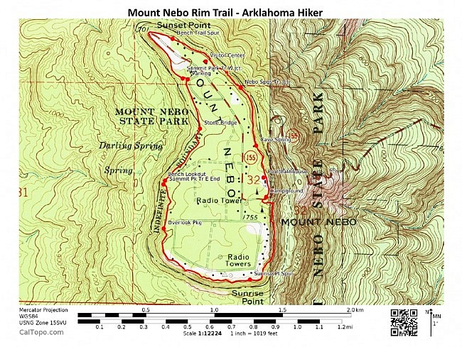
There are a number of access points for hiking the Rim Trail. One of these is at the visitor center. That is where we started.
To reach the trail from the visitor center, just walk down the flight of stone steps behind the building. (The steps go next to a hang-glider launching point.)
We turned right and started heading clockwise around the mountain so that we would be getting the most difficult portion of the trail out of the way first.
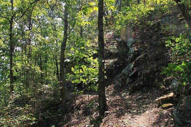
During this stretch on the east side of the mountain between the visitor center and the campground/pool area, there are some challenging up-and-downhill climbing switchbacks with stone stairs, many of which were probably first built by the CCC. This part of the trail is pretty rough, and it probably is not suitable for youngsters or dogs.
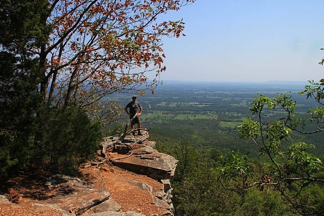
This section follows along some great bluff-lines to the right and has some scenic overlooks to the left. This portion of the trail was pretty rough for us. It was early September and hot, and we hiked it in the middle of a sunny day. While there often is a breeze at the top of the mountain, we could not feel one in this area. In addition, the rocks were radiating heat from the afternoon sun.
During this section of the trail, you also pass the Nebo Steps Trail and the Nebo Springs Trail. (Nebo Springs sounds like a great area, but we ran out of time to see it and are going to do this the next time back.)
Eventually, the trail passes the swimming pool and then the campground (with some great campsites) before crossing Highway 155 and darting back into the woods again. It is about here that the trail becomes somewhat less rugged and is easier hiking.
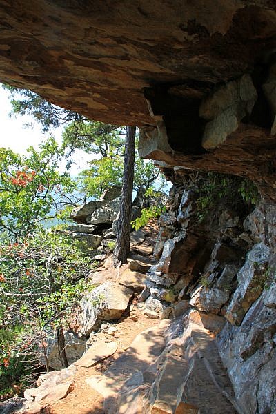
This section of the trail winds around the south end of the mountain. It took us along a great bluff line and had many great views. Had it not been so hot, this probably would have been my favorite stretch.
The trail passes by the Varnall Springs Trail, and as it rounds the bend at the southeast corner of the mountain, there is a trail that goes up to the right that will take you up to Sunrise Point. We walked up to Sunrise Point, checked it out, and had a quick lunch on one of the picnic tables up there. (This is also another trail head for the Rim Trail hike.)
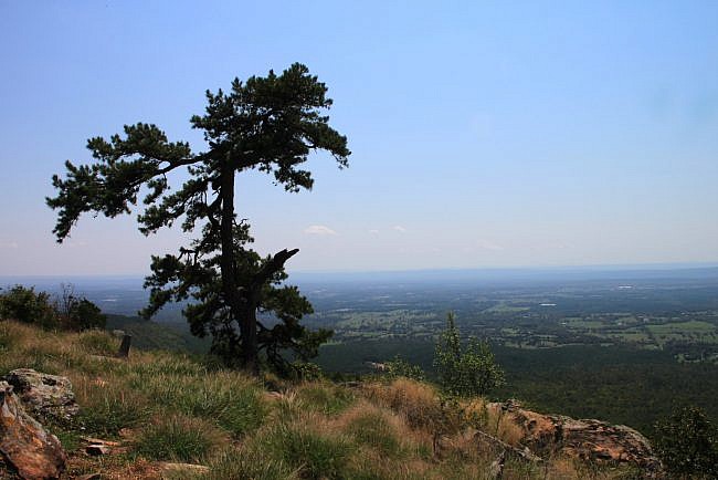
We continued back along the trail, past several private homes and a couple of the state park cabins. The trail then passes Gum Springs Trail. (There is a gazebo at the top of this trail, and there is another trail head here.) Then there is a really nice, flat, soft stretch of trail that goes past a few more cabins.
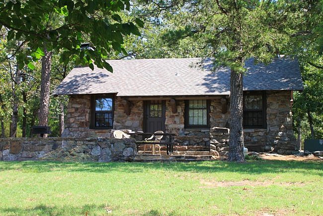
At a point here on the west side of the mountain, the trail overlaps with part of the Summit Park Trail (marked with red blazes). Keep following yellow blazes to stay on the Rim Trail.
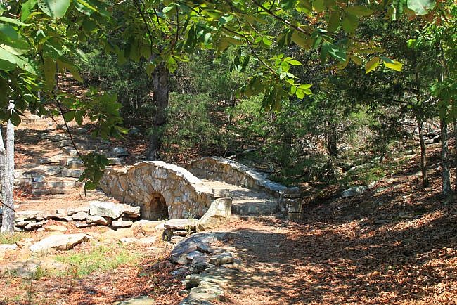
During the Summit Park Trail overlap stretch, we passed Lover’s Leap, a couple of rocks that overhang the valley with great views of the surrounding countryside, and the old stone remains of an old hotel that used to be here that burned down in the 1920’s. We also crossed a stone bridge, expertly built by the CCC.
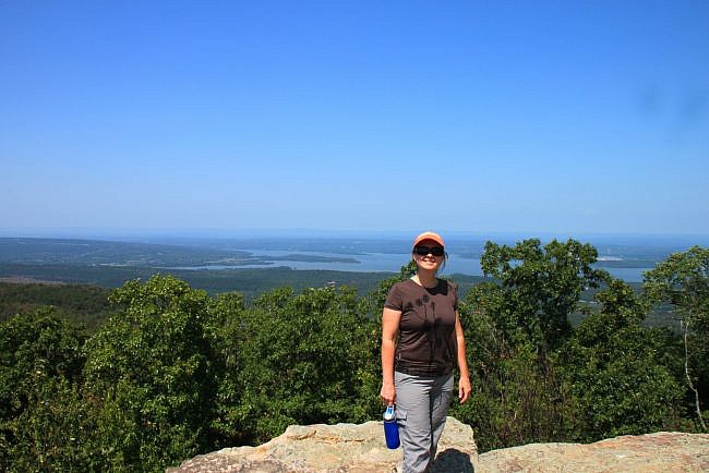
The remaining part of the Rim Trail, after the Summit Park overlap stretch, goes around the narrow north end of the mountain. It is very smooth and scenic and goes out to Sunset Point (another Rim Trail access point), and has fantastic views of Lake Dardanelle. It is then just a short trek back to the visitor center.
Caution: there are bluffs and drop offs on the trail. Use caution in these areas. A fall could result in serious injury or death.
Final Notes
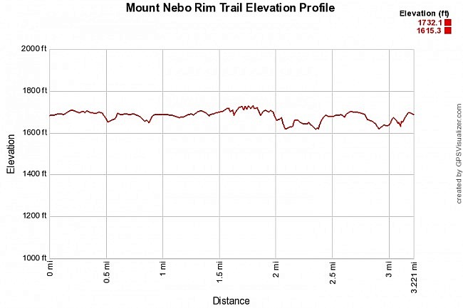
The full loop around the mountain top is 3.2 miles. I rate the trail difficulty as moderate, but it varies from very easy to pretty strenuous in places
This is an excellent trail year round, but I would avoid the heat of the day in the heart of the summer.
For footwear, trail runners are fine, but you may prefer hiking shoes on rougher stretches.
These photos are all from our December 2, 2012 hike.
Photo Gallery
Click below for full-screen photo gallery.
Map
Mount Nebo: Rim Trail |
|
|---|---|
| Location | Yell County, Arkansas (near Dardanelle and Russellville) |
| Hike Length/Type | 3.2 mile loop. Yellow blazes. |
| Difficulty | Moderate (3 of 5) |
| Other Permitted Usage | Pets on a leash. |
| Gpx file by Mike | Link |
| Date Hiked | September 2, 2012 |
| Directions | Google Maps Directions to Visitor Center |
| Official Info | (479) 229-3655 Website Park Trail Map (pdf) |
[A version of this post was originally published on October 2, 2012 on the blog “Exploring Northwest Arkansas.”]
[Last revised: 5-25-2021.]


2 replies on “Mount Nebo: Rim Trail – 3 mi”
The Rim Trail may be one of the best half-day hikes anywhere, and for a wide range of physical abilities.. With abundant vistas, interesting natural and man-made features, it’ll keep you coming back again and again.
I believe the foundation you saw was that of a hotel/lodge that was never finished by the CCC due to the onset of WWII, if its the same as this photo; http://bit.ly/1o5f92L .
The Summit Park Hotel, which indeed did burn down in the early 1900’s, was located between the visitor’s Center and Sunset Point. There is a very large, old two story house still there, which if I recall correctly was a part of the hotel.
Its a great hike – make sure your camera/phone battery is charged up because there are pictures around every bend…
Keep the enjoyable reviews coming!
Thanks Dave. It really is a great hike with a mixture of just about everything — great views, bluff lines, and good history. I’m looking forward to a return visit!