Hole in the Ground Mountain Trail is one of those trails that seemed much more difficult when I first hiked it a few years ago than it does to me now. Some weight loss and lots of day hikes have probably helped.
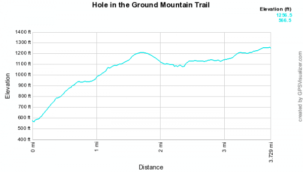
Even though it doesn’t seem all that difficult to me now, I’m still giving it a “5” (out of 5) difficulty rating. I figure when a trail has a 600+ foot elevation increase, that’s enough to put it in the “most strenuous” category.
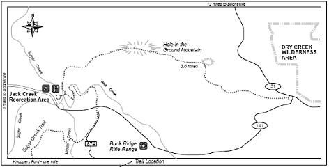
Hole in the Ground Mountain Trail Map
Click here for full-screen trail map.
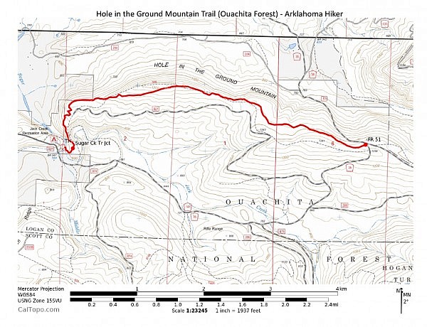
The trail starts at Jack Creek Recreation Area in the Ouachita National Forest, about 10 miles south of Booneville, Arkansas. This is a beautiful area to go for a picnic, a swim, or just to hang out.
Sometimes the main gate at the park is closed during the off-season. If it is, you can still park outside the gate and walk to the trailhead. Or you can enter the park through the secondary entrance a little further up the road.
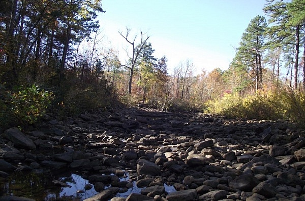
The trailhead is toward the lower end of the park. The trail starts by first crossing Sugar Creek. It then proceeds straight (east) heading up Hole in the Ground Mountain. The uphill climbing starts pretty quickly.
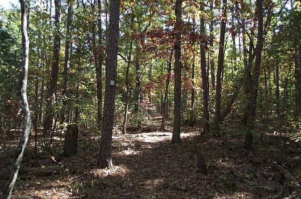
The trail is well-marked with rectangular white blazes.
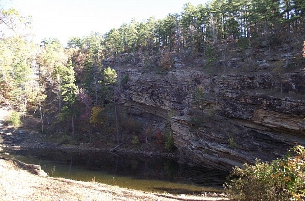
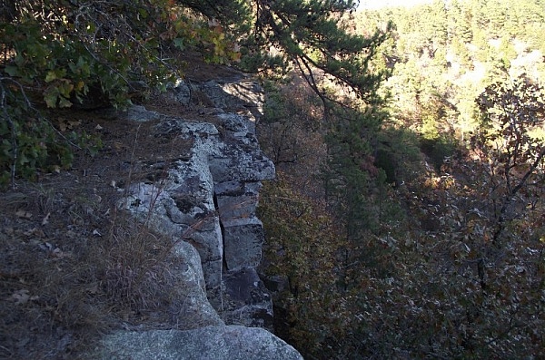
After about 1,000 feet, you should notice a giant horseshoe-shaped bend to your right. It is beautiful, but you should be very careful if you walk off the trail over to this area as it has dangerous bluffs.
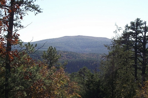
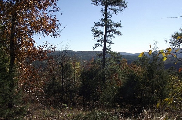
There are some very nice views of the surrounding mountains and countryside once you get near and at the summit area.
After the summit area, the rest of the hike is a long walk along a forested ridge.
There are some real advantages to wearing long pants rather than shorts on this trail due to some of the thorn vines you are likely to encounter.
The trail ends at the area where FR 51 and FR 141 intersect. Unless you have a second vehicle waiting for you, this is the point where you turn around and head back. It is about 7.4 miles to the end and back.
It is not unusual in the springtime for the water in Sugar Creek by Jack Creek Recreation Area to be too high to make a dry crossing. If that happens, you can park at the east end on FR 51 and then hike back towards Sugar Creek. That is not the preferred way to do the trail because then you will have the most difficult part of the hike (the climb up from Sugar Creek) right in the middle of your journey.
As usual, I have posted some of my photos and a gpx map made from my gps data.
Click here for gpx file download.
Hole in the Ground Mountain Trail (Ouachita Forest)
Location Jack Creek Recreation Area, Poteau/Cold Springs Dist., Ouachita National Forest, Logan County, Arkansas Hike Length/Type 7.4 miles/out and back (3.7 mi each way) Difficulty Very Strenuous (5 of 5) Other Permitted Usage None ATT Cell Coverage? Mostly Official Info - Phone/Links (501) 321-5202; Website. Official Trail Map (pdf). Date Hiked 11-06-2010

4 replies on “Hole in the Ground Mtn Trail (Ouachita Forest) – 7 mi (o&b)”
First off thank you for this website. Makes it a lot easier to find trailheads when all I have to do is type in my address and then drive to it based on your maps.
I was out here this morning and made it up to almost the 1 mile mark and turned around. The trail starts getting really overgrown around 1/2 mile or so and then it REALLY gets tall just under a mile. Some of the trees with blazes on them are on the ground and I got off trail slightly several times. I could see the next blaze but not the trail. I am waiting on a phone call from other trail volunteers to see if anyone wants to get with me and spend a day with some trimmers and chainsaws clearing it out. I really want to make it up that mountain. Definitely a challenge but not a bad as I thought it would be. I ended up taking the Sugar Creek Trail almost all the way to Knoppers Campground. Now THAT is an awesome trail with some really great views of the creek. I spent more time just sitting in the creekbed than walking the trails. Anyway, just thought I’d leave my 2 cents here and share some trail knowledge and thank you for your website.
Scott,
–I would check with the Forest Service and get their okay before doing any trail maintenance.
–Actually, I just did the HITGM trail again a few weeks ago. Yes, it’s unfortunate how rough the condition of much of the trail is right now. There is a stretch that is a mile or so long that I think you were getting into that was very overgrown when I did it requiring quite a bit of bushwhacking and wading to get through. Then the last 1.5 miles or so has lots and lots of large dead trees lying across the trail. (My guess is that much is the result of recent ice storms.) Fortunately, it is pretty well blazed though.
–As long as the Forest Service approves, it would be great if someone was able to do some maintenance. There are some very nice views on the trail, particularly at the horseshoe bend and up at the higher areas. It would be great for it to be more accessible.
–I did the Sugar Creek Trail a few years ago. It’s one I need to get on the website soon.
Thanks for your comment! Mike
Yes I called the USFS in that area and got all the correct paperwork signed and sent back and on Sunday Oct. 19th spent 4 hours clearing the trail up to about .7 miles. I underestimated how long it would take to clear that thing. lol It seems completely gone in sections. I plan on going back up there weekly until I make it all the way to the end and the entire trail is visible again. Some of the blazes are on the ground as well and will need replacing as I go along but at least they are still there. The Sugar Creek trail may be next once the HITGMT is done.
Scott, I think that is awesome that you are doing that (with USFS permission). I think it is a pretty cool trail when it’s accessible. Thanks and good luck with that project.