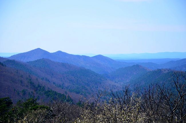
The mountains in southwest Arkansas between Glenwood and Mena are my favorite on the entire planet. They are so rugged, remote, and beautiful, you simply cannot look at them without awe.
The Caney Creek/Buckeye Trail loop (Ouachita National Forest in Polk County, near Shady Lake) is my new favorite hike in Arkansas. It has it all—a gorgeous valley, mountain vistas, and a unique waterfall.
This challenging hike is a 9.4-mile loop in the Caney Creek Wilderness that connects the Buckeye Trail, the eastern part of the Caney Creek Trail, and Forest Road 64.
I took the loop clockwise starting at the Caney Creek Trail east trailhead. (The alternative is to start at the Buckeye Trailhead and make the loop counterclockwise.) I chose this route so that at the end of the trail when I was tired, I would be heading downhill on the dirt road.
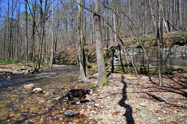
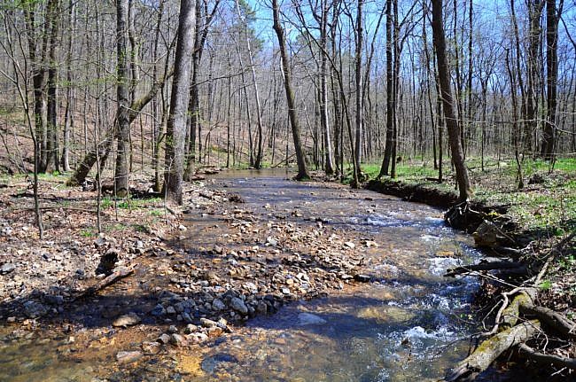
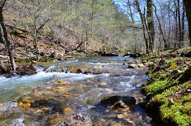
I am glad I hiked it this way so that I could do the creek crossings in the beginning. The Caney Creek Trail crosses the creek several times. I had to stop and take off my boots several times for the crossings.
Getting to the Trailhead
Because there are 2 trails, there are 2 trailheads. I began at the Caney Creek Trail east trailhead. It is on Forest Road 38, about 3.5 mile from the Shady Lake Recreation Area.
If want to go counterclockwise, the Buckeye Trailhead is about a mile further up Forest Road 38.
East Caney Creek Trail to Buckeye Trail
The Caney Creek Trail is a 9-mile east-west trail that follows the Caney Creek Valley. But for this loop, you will only hike on it for 3.8 miles when it intersects with the Buckeye Trail.
This section of the trail is fairly easy, as there is only one uphill portion. And I say “fairly” loosely depending on your tolerance for stream crossings.
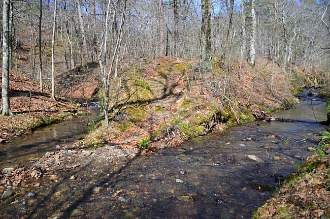
I hiked it in the spring and after a rain. I had to take off my boots to cross Caney Creek two times as well as two tributaries of the creek. I have trekking poles to help keep myself stable on the slick river rocks, and river shoes – both I failed to bring. So by the fourth creek crossing, I was irritable. It didn’t help that on that last creek crossing, I fell in soaking my boots and socks.
Despite my failures in the creek crossings, I love this section of trail. If you are a backpacker, there are so many great spots for a campsite.
Caney Creek is beautiful, and in warm weather it would be a great hike because there are many opportunities to cool off in the water.
Caution: Fording a stream or river can be dangerous. Don’t cross a river or stream where it is more than waist deep. See this post at Section Hiker for more water crossing safety tips.
One really neat thing about this loop is that it runs parallel to Tall Peak. (I hiked the Tall Peak Trail about a month before this hike.) As I was in the Caney Creek Valley, I could look up and see the towers on Tall Peak and see how high up it is.
And then on the ridge line of Buckeye Mountain, I could gauge how far I had come and how high I was by the beacon of the towers on Tall Peak.
Katy Falls
The intersection with Buckeye Trail is at about 3.8 miles. There are no blazes or signs since this is a designated wilderness area. There is a rather large cairn at the junction. It is right after the trail crosses Katy Creek. (This was the fourth crossing where I had to take off my boots.)
Take a right to proceed onto the Buckeye Trail.
Shortly afterward, there is another intersection. You should take a right for the short spur to the Katy Falls.
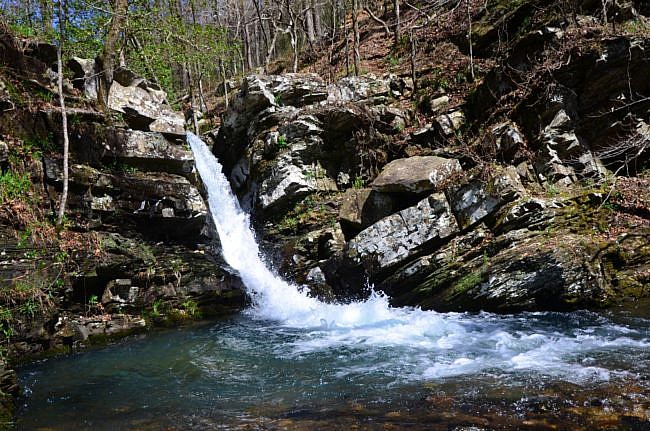
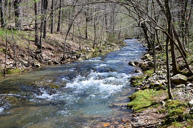
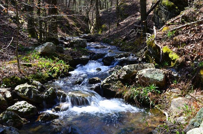
Katy Falls is amazing. The water cascades about 12 feet through a very narrow shoot, for a pretty unique waterfall. (For backpackers, there is an amazing unofficial campsite right above the falls.)
Katy Falls to the First Vista on Buckeye Mountain
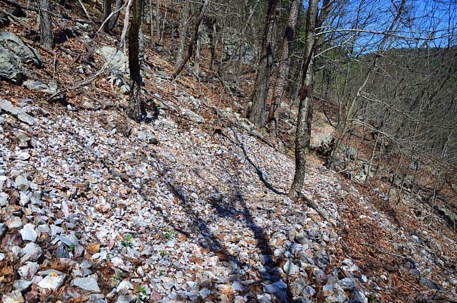
After the spur to Katy Falls, the Buckeye Trail climbs steeply to a saddle below East Hanna Mountain. I loved this part of the trail as it takes you up a narrow valley between East Hanna Mountain and Katy Mountain. There you hike over massive novaculite rock glades and see broken bluffs on the opposite side.
During leaf-off, you have amazing views. And once you get to the top, you can see down the funnel of the valley looking toward the Caney Creek Valley.
Buckeye Mountain Ridge Line
At around mile 5.2, the trail turns toward the east as you hike along the ridge line. You are still climbing in this part, but not as steeply.
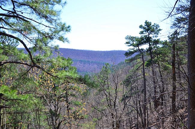
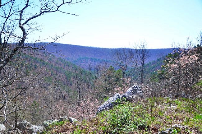
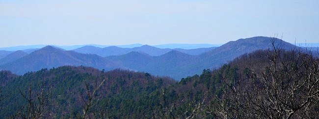
Along this ridge line are some of the best mountain views in Arkansas. Toward the west, you have an endless panorama of blue mountain ridges piled on top of each other.
As you hike, to the south and your right, you look down on the Caney Creek Valley—the valley you just hiked. And to the east, you look through another valley toward endless mountains of the Little Missouri River area.
The hillside to the north has balding peaks with mountain glade, one of my favorite features of this area.
There are several vistas along this section of trail. You’ll want to stop and look behind you as you hike because they are all around you.
Buckeye Mountain Back to the Trailhead
At about 7.6 miles, you get to the Buckeye Mountain summit. The rest of the trail is downhill.
After the summit, you hike steeply down for about a mile before coming to the Buckeye Trailhead.
From there you will hang a right on the road (Forest Road 38) to get back to the Caney Creek Trailhead.
Final Notes
This trail really has it all—beautiful Ouachita Mountain valleys, a unique waterfall, and epic vistas. It’s no surprise to me that my new favorite trail is in this area of the state though. This is truly a unique and beautiful area.
Be prepared for some climbing though. The net elevation change is about 1,100 feet. The cumulative elevation gain on the hike is about 1,970 feet. I rate the difficulty as “very strenuous” (5 of 5).
Check out these links for trail profiles of the west Caney Creek Trail and Tall Peak Trail.
I took these photos on my March 30, 2018 hike.
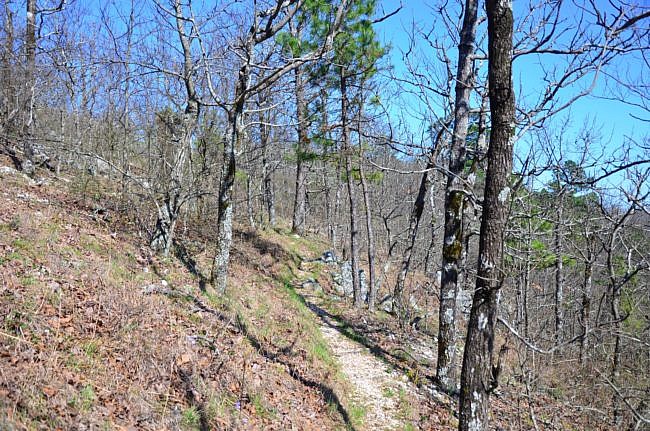
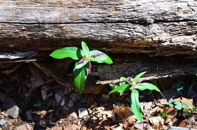
Photo Gallery
Click below for full-screen photo gallery.
Map
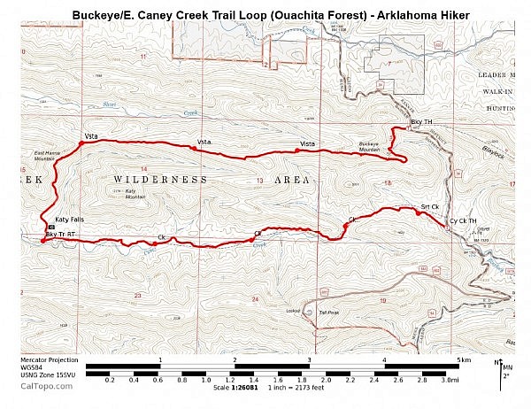
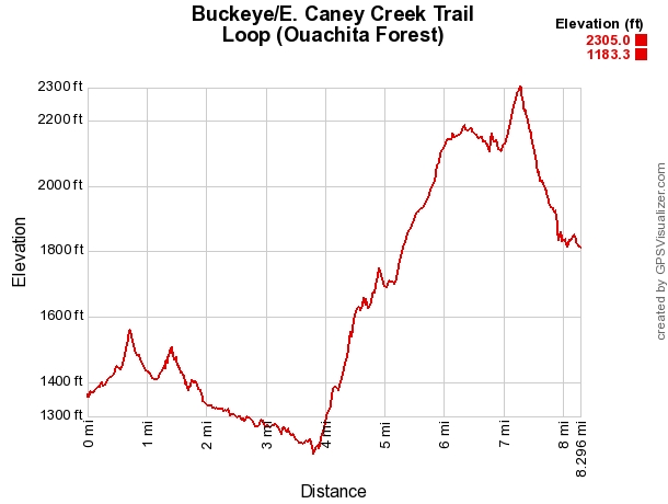
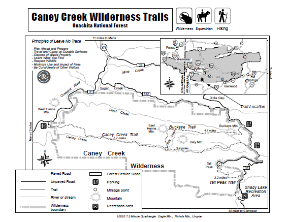
Buckeye Trail/East Caney Creek Trail Loop (Ouachita Forest)
Location Caney Creek Wilderness, Ouachita National Forest, Polk County, Arkansas
Hike Length/Type 9.4 mile loop, including the 1.1 mile walk on the forest road from one trailhead to the other. No blazes (wilderness).
Difficulty Very Strenuous (5 of 5).
Other Permitted Usage --
Gpx file by Mike Link
Date Hiked March 30, 2018
Directions Google Maps Directions to East Caney Creek Trailhead
Google Maps Directions to Buckeye Trailhead
Official Info (479) 394-2382 (Mena/Oden Ranger Dist.) Website USFS trail map (pdf)
[A version of this post was originally published on May 3, 2018 in the blog “Right Kind of Lost.”]
Last revised: 9-17-2019.


