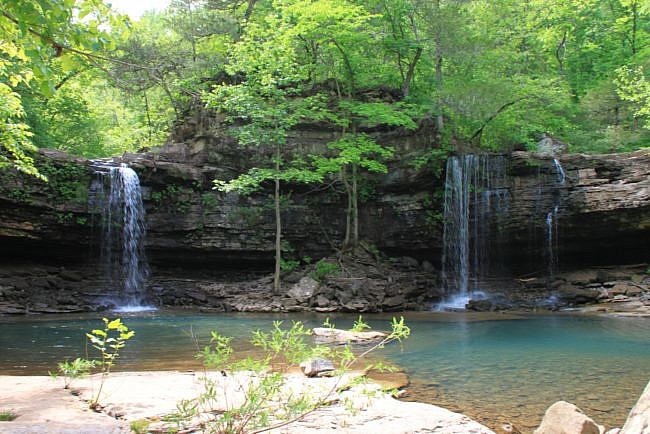
Last weekend, we hiked the Richland Creek Wilderness area of the Ozark National Forest back to Richland Falls and Twin Falls of Richland.
It had been probably eight years since last hiked to this area. It was among the first hikes we did in Arkansas. We loved it then, and it was great to go back.
This area is highly regarded by national publications and by locals alike. But since it is not easy to reach, it is not as well-traveled as many areas.
The waterfalls are the highlight of the hike, but really, the hike itself is spectacular.
Getting to the Trail
Let’s talk a bit about how to get to the trail. First, let me note something about trail guides to the area. Tim Ernst, who writes all the major trail guides to the area, recommends people come into the falls from the Hill Cemetery from the north. The basis for his recommendation is: (a) it sounds like easier hiking since it mostly follows an old road, and (b) it allows the hiker to avoid wading across Richland Creek (a large creek with a lot of water).
However, Ernst notes in some of his updated guides that the road to Hill Cemetery has been unmaintained lately, and a four-wheel drive vehicle may be needed to get there.
As someone who was using an older trail book (that noted none of this), I can tell you the road to Hill Creek cemetery definitely requires the use of a four-wheel drive vehicle, and I would recommend a skilled driver. That road is narrow, steep, and in poor condition.
So instead, let’s start our hike from Richland Creek Campground.
The campground is a bit hard to get to, but the road is generally in good shape. (There is a horse campground not far away that requires the road to be in good enough shape for horse trailers to pass.) The drive is a very pretty one, as it mostly follows Falling Water Creek down to the campsites.
If coming from the north, take Highway 7 south from Jasper. At Pelsor, take Highway 16 west past the Pedestal Rocks Scenic Area and take a left (north) on Forest Road 1205. This road goes for quite a while, along Falling Water Creek and past Falling Water Creek Falls. It then crosses Falling Water Creek and eventually comes to the Richland Creek Campground. (If you cross Richland Creek you’ve gone too far.)
There are a lot of great little campsites along this road that are nestled right up against the creek.
Turn into Richland Creek Campground. Take the road to the right to the lower campground. Go to the back of the campsite and park.
There is a sign-in sheet here. Sign in please.
Getting to the Waterfalls
Now, on to the trail. First off, let me note that this isn’t an official or maintained trail. For some reason, there are no established trails in this wilderness. However, the trail to the waterfalls is fairly well traveled. It is not too difficult to follow for the most part — although, the closer to the falls you get, the rougher the trail gets.
The trail heads out into the woods, and then it fairly quickly leads to Falling Water Creek, the creek you followed on your way to the trailhead. You will need to cross this creek (and in relatively high water, you will probably need to get wet to do so).
Once across the creek, you will have to find the trail. It is sometimes marked with orange tape (thanks to “Orange Man,” our name for whoever posted the orange tape), and sometimes you just have to find it. Look for a path, or a series of rocks leading upward, or some orange tape.
Once you get to the top of the hill, the trail is easier to find.
Once you hit the trail, you will be following along a second creek. This is Richland Creek.
The trail remains up high on the bluff for quite a while and is pretty easy to follow. Really, it is one of the best hiking trails you could ever hike.
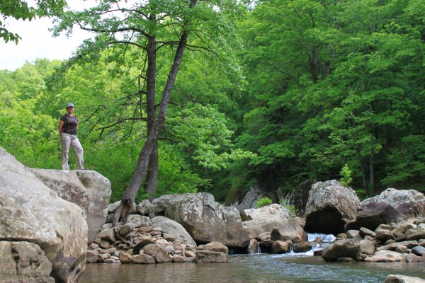
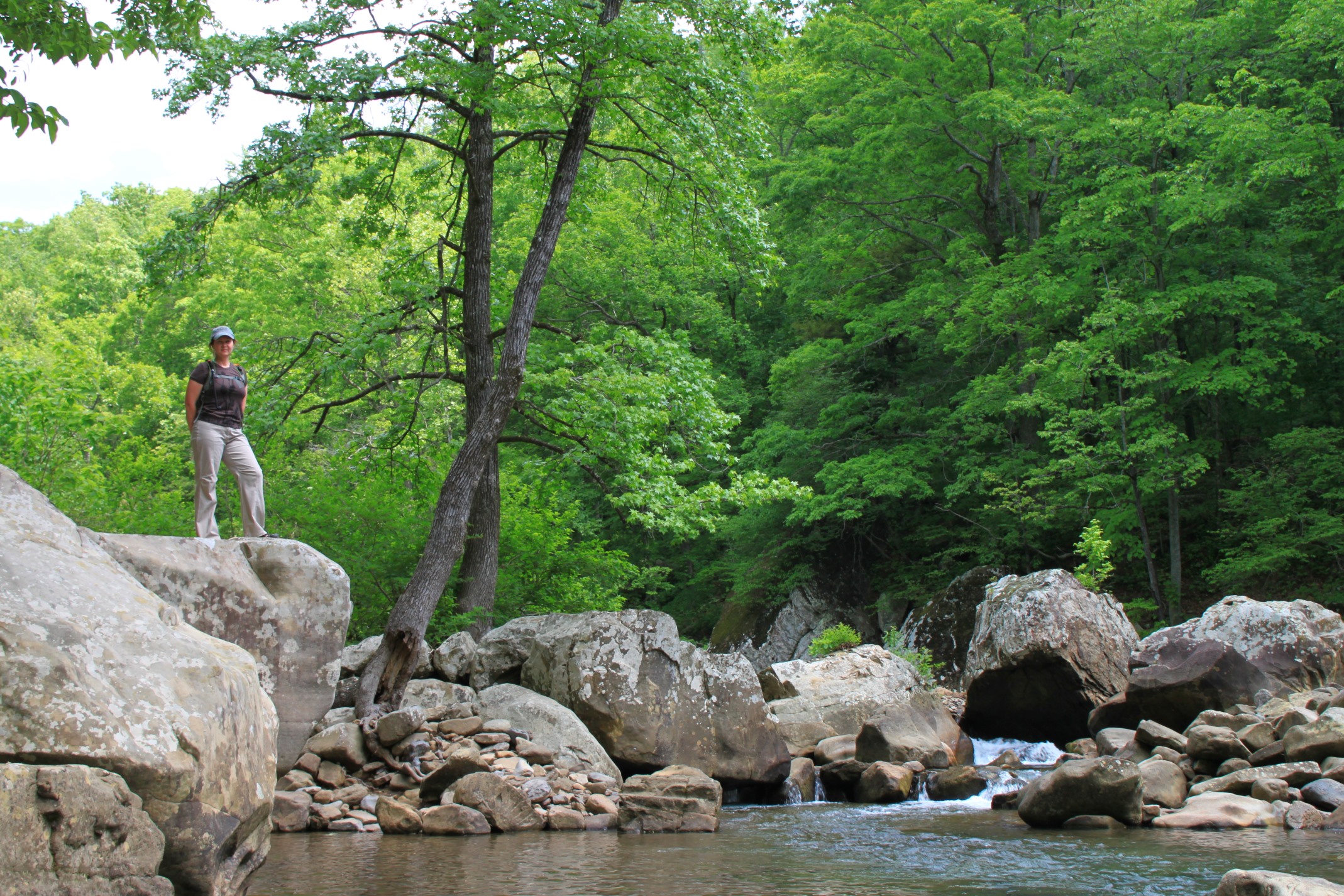
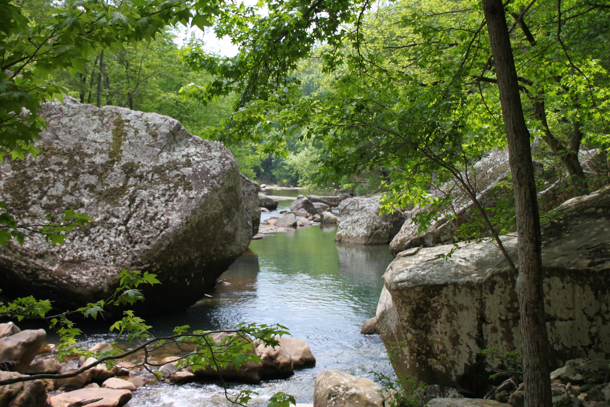
The trail eventually heads back down to Richland Creek, where there is a fantastic little overlook area with a lot of big boulders in the creek and small rapids. (Pictured from each direction in the photos.)
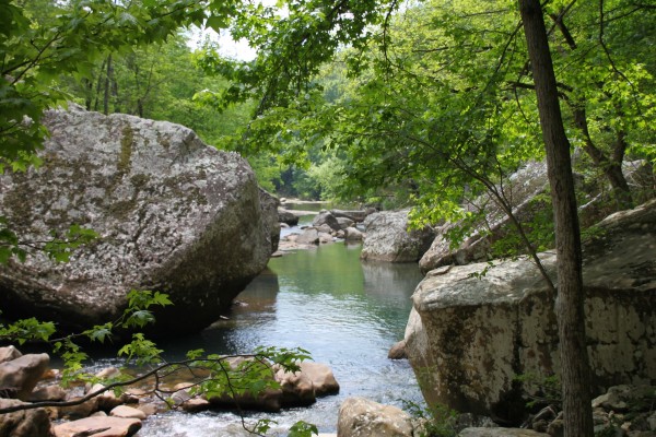
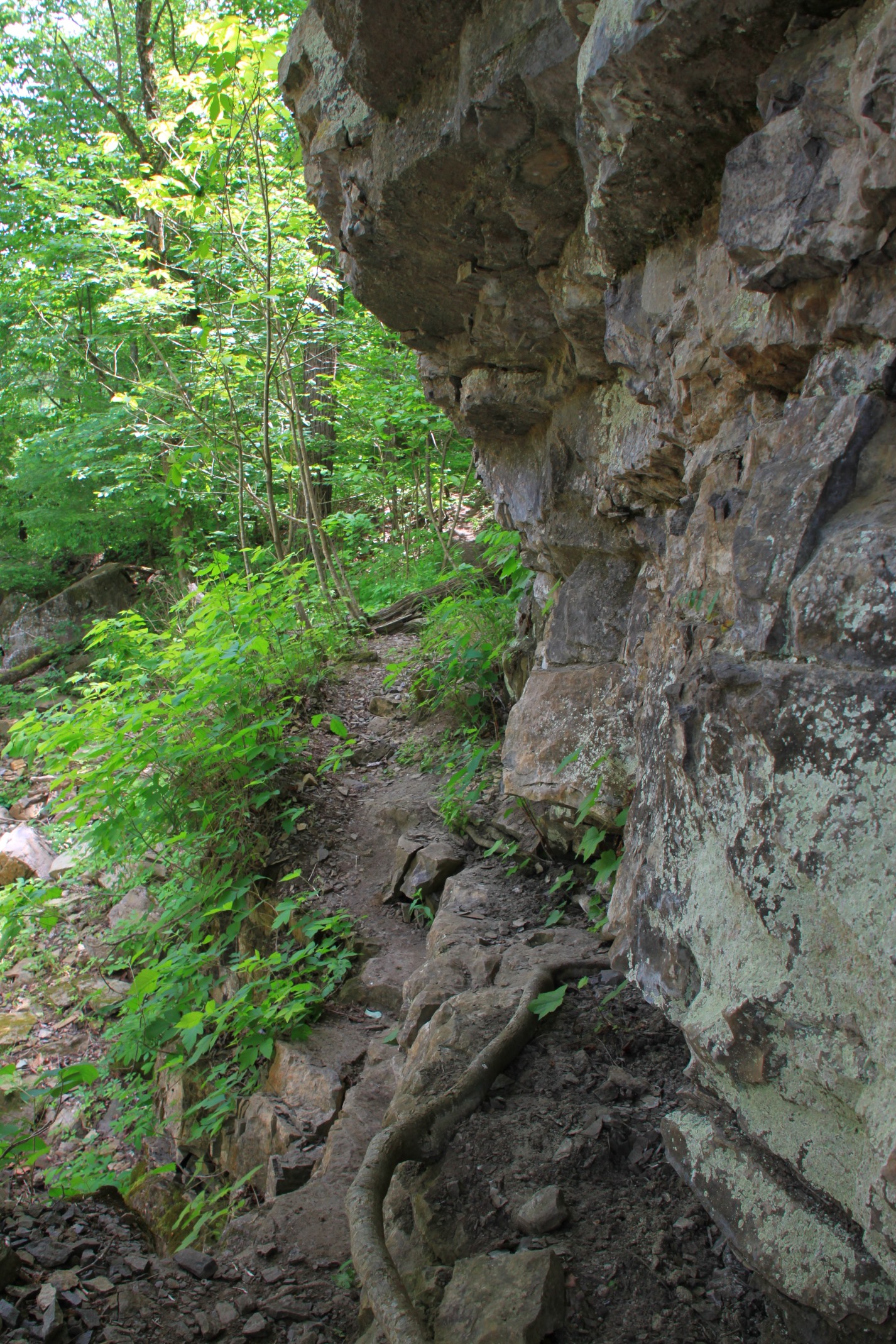
The trail follows the creek for a while and then heads back up the hill. It then heads back down another hill and follows the creek and along a little bluff line. It then heads steeply back up.
The trail then comes back down and heads out over a small, smooth stream bed that the trail follows for a bit. This is probably the hardest part of the trail to follow because it is difficulty to see where the trail heads back into the woods. But if you stick with it and remember to follow the creek, you will eventually get there.
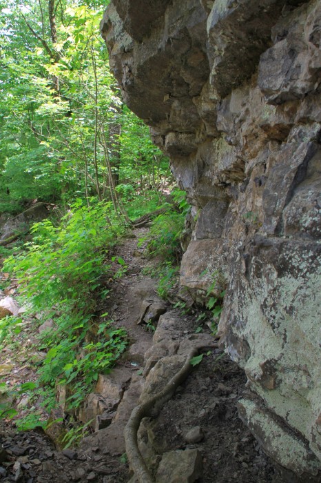
Finally, the creek makes a 90-degree turn to the left. The trail meets a campsite here.
At this point, the two waterfalls are close. To the left (upstream) is Richland Falls. Directly across from the 90-degree turn is Big Devil’s Fork which is where Twin Falls is. (Both times I have been here, Big Devil’s Fork has looked dry, but there was plenty of water back at the waterfall.)
Richland Falls
We’ll head first to Richland Falls. Continue on the trail past the campsite a bit, and then eventually cross Richland Creek. There are some stones to jump across, but it really is easier to just wade the creek.
There is a trail on the other side that you will have to find (marked with pink tape). It will lead you along the creek. If you can’t find the trail, just find the easiest way along the creek, and you will eventually find your spot.
At one point, the trail splits. Take the path to the left. It will lead down to Richland Falls.
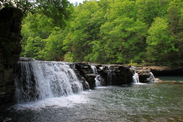
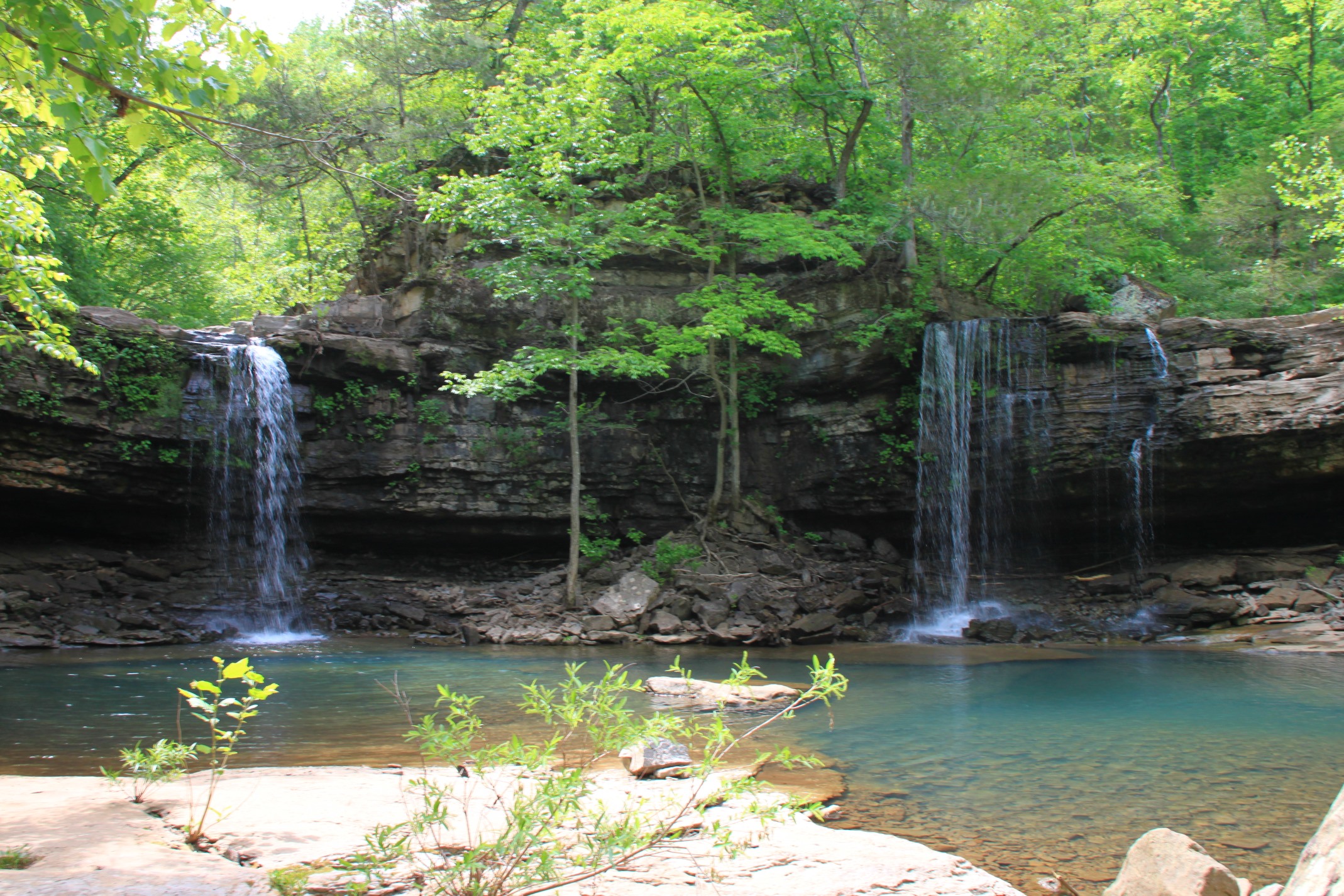
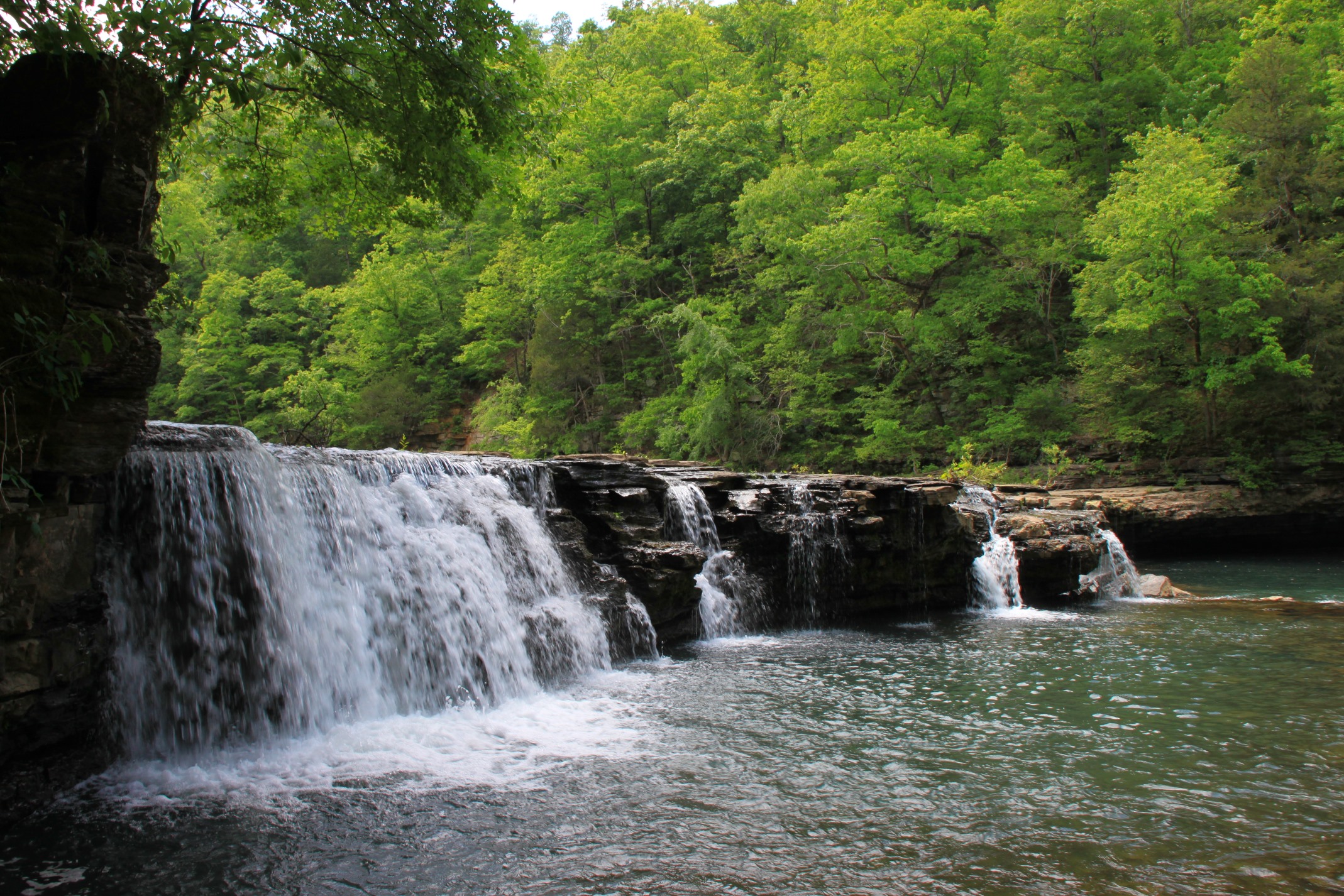
Richland Falls is a short waterfall, only about 8-feet tall, but it is magnificent because it spans the entire width of the creek, nearly 100 feet. Even when the water is low, it is a great sight as it splits into several smaller waterfall areas.
Below Richland Falls is one of the most enjoyable swimming holes I have ever encountered.
So spend some time here. Have some lunch. Go for a light swim, and just enjoy this special area.
Twin Falls of Richland
When you’re done, head back up to the trail on the north side of the creek and follow it. It will split and go up the hill and then back down. This will take you up Big Devil’s Fork to Twin Falls of Richland. (Tim Ernst uses the “Twin Falls of Richland” name since there are multiple Arkansas waterfalls with the name “Twin Falls.”)
Twin Falls is just a short jaunt from the 90-degree bend in Richland Creek and from Richland Falls.
Twin Falls also is one of those special places in the Ozarks. It is formed where two creeks — Big Devils Fork and Long Devil’s Fork — merge into one creek. Each of the falls is from a different creek falling into the same watering hole.
This too is a great place for a picnic and a swim. In fact, there are dozens of great swimming holes all along this area, so plan to spend some quality time here.
When you are done, head back down to Richland Creek, wade across the creek again, and head back the way you came.
Please plan to spend some time in this great little place. There is far more to see and explore if you have the time to do so.
Date Hiked: April 28, 2012
Distance: About 3 miles to the falls area — about 6.5 miles round trip, including going up to each waterfall.
Difficulty Level: Strenuous. The elevation changes aren’t particularly high, and the path isn’t particularly rough to follow, but the combination of both, along with multiple creek crossings, makes it challenging. (I would not recommend youngsters take this hike.)
Footwear: Wear hiking books, or possibly trail runners, and bring some water shoes or Keens for the water crossings. The trail is really tough on the knees and ankles if wearing low-cut shoes, but water shoes of some type are a must for the crossings.
Pants: If you are sensitive to poison ivy or oak, you have to wear long pants or only take the trail in winter. The trail is lined with oak and ivy plants. If you are very sensitive to them, don’t take the trail during the spring or summer. Zip-offs are preferred so you can zip off the legs for water crossings. Have quick-drying pants or a swim suit with you so you can enjoy a good swim along the way.
Guidebook: Tim Ernst’s Buffalo River Hiking Trails, Arkansas Waterfalls, and Arkansas Nature Lover’s Guide.
Time of year: Wet season or spring and early summer.
[See this link for US Forest Service pdf map of the Richland Creek Wilderness.]
Photo Gallery
Click here or below for full-screen photo gallery.
[This post was originally published on May 6, 2012 on the blog “Exploring Northwest Arkansas.”]

3 replies on “Richland Creek Wilderness Waterfalls Hike (Ozark Forest) – 6 mi”
. Who do you contact to plan your vacation……. I think it is beautiful and would love to visit it is on my bucket list now
Janet, It might depend on what your question is. Before an extended hike in the national forest, it’s probably a good idea to check out one Tim Ernst’s books, such as his Arkansas Hiking Trails book. Also the “Backpacking and Hiking Day in Arkansas” Facebook group (https://www.facebook.com/groups/585290894962587/) is a good place to post questions. Mike
You keep referring to the Hill Cemetery. Where exactly is the Hill Cemetery?