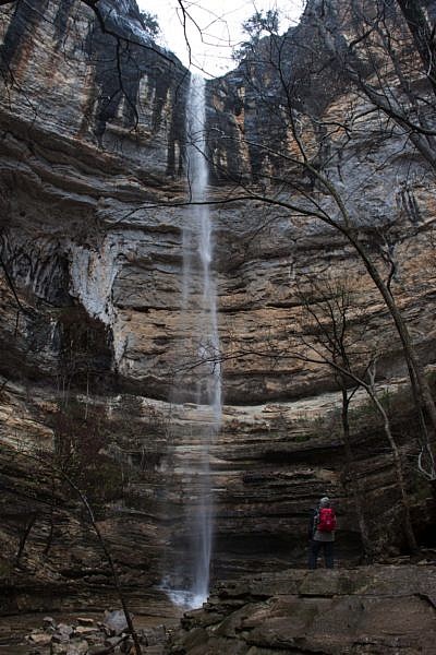
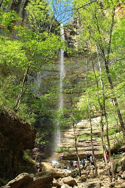
At 209 feet tall, Hemmed-in Hollow Falls (Buffalo River Upper District, Newton County near Compton) is the tallest waterfall between the Appalachian Mountains and the Rocky Mountains. While the hike isn’t easy, it is very popular as hikers are eager to see this towering beauty of the falls, and the Compton trailhead is easy to get to.
While the trail to the falls is usually in good condition, at 1,300 feet of elevation change, the hike is not for the faint of heart. But a breathtaking waterfall and secluded canyon await those who make the challenging 5-mile out-and-back hike (2.4 mi each way).
Getting to Compton Trailhead
To get to the Compton Trailhead, go to the community of Compton (8.3 miles north of Ponca on Highway 43) about 15 miles southwest of Harrison. Turn east on the gravel road immediately across from JB Trading Co. (Watch for the sign.)
After about 1/10 of a mile, turn right onto the gravel road and follow it .8 miles and then turn right onto another gravel road. (There is a sign here.)
The parking area and trailhead are just up the hill.
By the way, the nearby JB Trading Co is a fantastic establishment in Compton. They make a great sandwich, and also have maps, trail guides, outerwear, socks, camping supplies and virtually anything you need to make your hike and camp a success.
The Hike
There are two trails at the trailhead — the one to the right is a horse trail that heads down through Sneeds Creek. The one on the left is the main hiking trail. That is our trail.
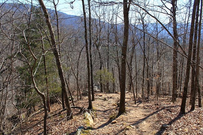
The trail heads down the hill gradually at first. Off to the left, you will begin to notice a small creek. This is the creek that feeds Hemmed-in Hollow Falls.
At about .7 miles, there is an intersection. Stay straight at this intersection. The trail to the left takes you to Wild Vic’s Cabin, and to the right connects with the horse trail.
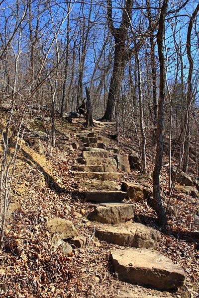
The trail continues going down the hill. In some steep parts, there are stone stairs built to make it easier. There are other places that the steep slope has caused the trail to wash out a little and makes for some less-than-sure-footed hiking.
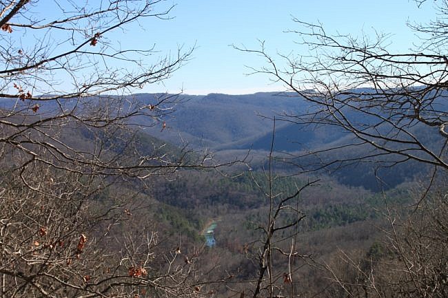
There are great views all around (particularly during leaf-off), so be sure to enjoy them.
While the excitement of getting to the falls is usually prominent, at some point as you may realize that hiking back out of here is going to be hard.
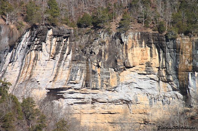
At about 1.5, after a few switchbacks, the trail turns right at a rock slab right along the top of an overlook. It’s a beautiful overlook, and if you look closely you will see a notched out “U” in the bluff on the other side of the valley and you can see the top of Hemmed-in Hollow Falls flowing over the ridge.
This is a great spot to enjoy, and even a better spot to stop and rest to catch your breath on the way back up! Keep going though, the best views are only a mile away.
Caution: Be very careful at bluffs. A fall could be fatal or result in serious injury.
At 1.8 miles there is an intersection. Turn left here. The trail coming from the right is the trail that comes in past Big Bluff and the Goat Trail from Centerpoint Trailhead.
When you turn left, the trail goes downhill and back below ridge of the the trail you have just hiked down.
At 2.3 you reach a creek that is downstream from Hemmed in Hollow and another trail intersection. Stay straight (left) on the trail. The trail to the right goes .5 miles to the Buffalo River (and this is the trail that comes in from the river if you choose to float and then hike back to the falls).
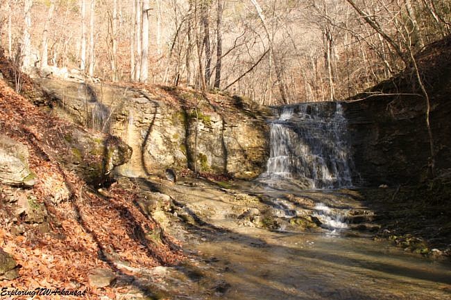
Follow the trail as it now goes back uphill to the big falls. After a bit, you will cross a small creek that comes in from your left. Below here is a very nice twin waterfall that is approximately 14 feet tall (note on the pic above that the falls coming in from the left has pretty low flow on this day).
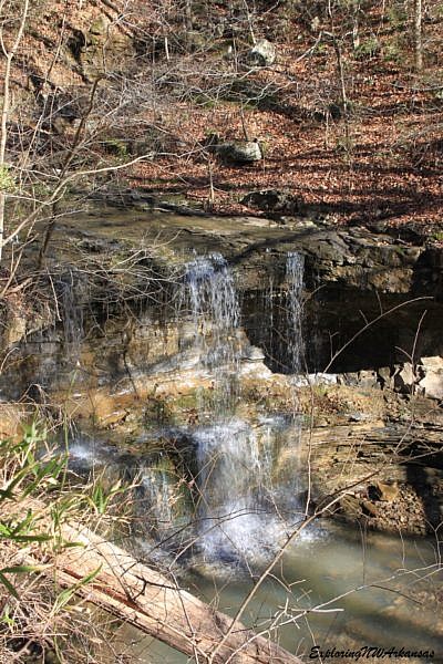
Continue on the trail and you will come across yet another nice, 18-foot(ish) tall waterfall on the main creek.
The Waterfall
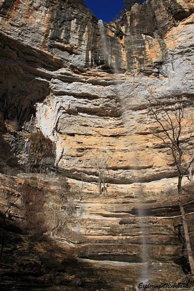
At about 2.5 miles, you reach Hemmed in Hollow Falls. It’s a beautiful 209 foot tall falls that pours off into an amazing canyon.
It really worth spending the time here to enjoy the area and have a sandwich or some snacks. You’ve earned it. And you’re going to need to refuel before the trip back up.
You can easily climb back up behind the falls (but be careful, the rocks are very slick here). And notice that when the wind blows, it often makes the falls move from side to side and around almost like it’s dancing in the wind.
After enjoying one of the finest places in the Ozarks, you turn around and head back the way you came.
The hike back up is quite challenging. With 1,300 feet of elevation gain in just 2 miles you’ll feel the burn. Take your time, and drink plenty of water.
Final Notes
I rate the trail difficulty as very strenuous (5 of 5).
This is a wet-weather falls, so it is usually best enjoyed in the winter and spring and when there has been a fair amount of moisture.
As for footwear, I recommend sturdy hiking boots.
You can read more about this trail in Tim Ernst’s “Buffalo River Hiking Trails” and “Arkansas Hiking Trails” books.
The pics are from my January 1, 2016 hike (except for the indicated Mike Newman pics).
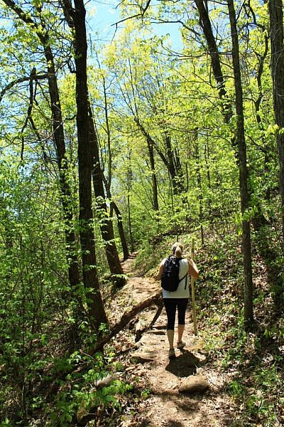
Photo Gallery
Map
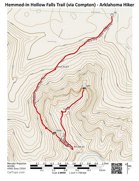
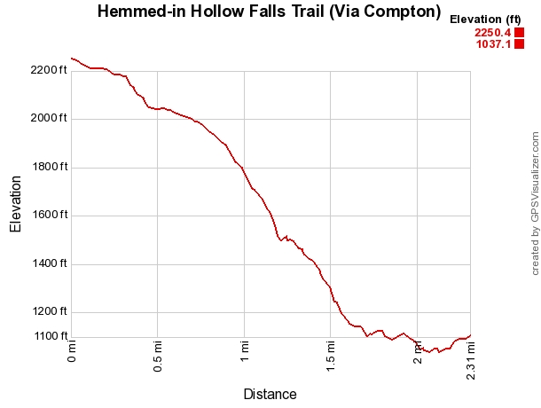
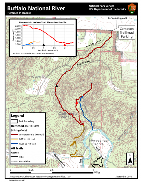
Hemmed-in Hollow Falls Trail (Via Compton) (Buffalo River)
Location Buffalo National River - Compton, Newton County, Arkansas Length/Type 4.8 miles out and back (2.4 miles each way). Difficulty Very strenuous (5 of 5). Gpx file (by Mike) Link Date Hiked January 1, 2016 Directions Google Maps Directions to Compton Trailhead Official Info (870) 439-2502 (Tyler Bend Visitor Center Information) Website NPS Trail Map (pdf)
[A version of this post was originally published on January 31, 2016 on the blog “Exploring Northwest Arkansas.”]


