The Koen Interpretive Trail (Newton County) is short trail that is easy to get to and easy to hike.
The trail is in the Henry R. Koen Experimental Forest, an 800-acre research forest in the Buffalo National River area that is managed by the U.S. Forest Service. It was created in 1950 with the goal of studying plant life in the south Ozarks and understanding sustainability of the forests in the area.
Directions to Koen Interpretive Trail
The trail is easy to get to, as well as to hike. From Jasper, take Highway 7 north for 4 miles to County Road 79 (gravel) (aka Erbie Campground Road). (There is a sign pointing you to Erbie Campground.) This is about 2.5 miles south of Pruitt.
Go west on County Road 79, heading toward the Erbie Campground.
At .4 miles, turn right where the sign indicates to head to the Koen Interpretive Trail. The parking area and picnic spot are about 200 yards down this road.
The Trail
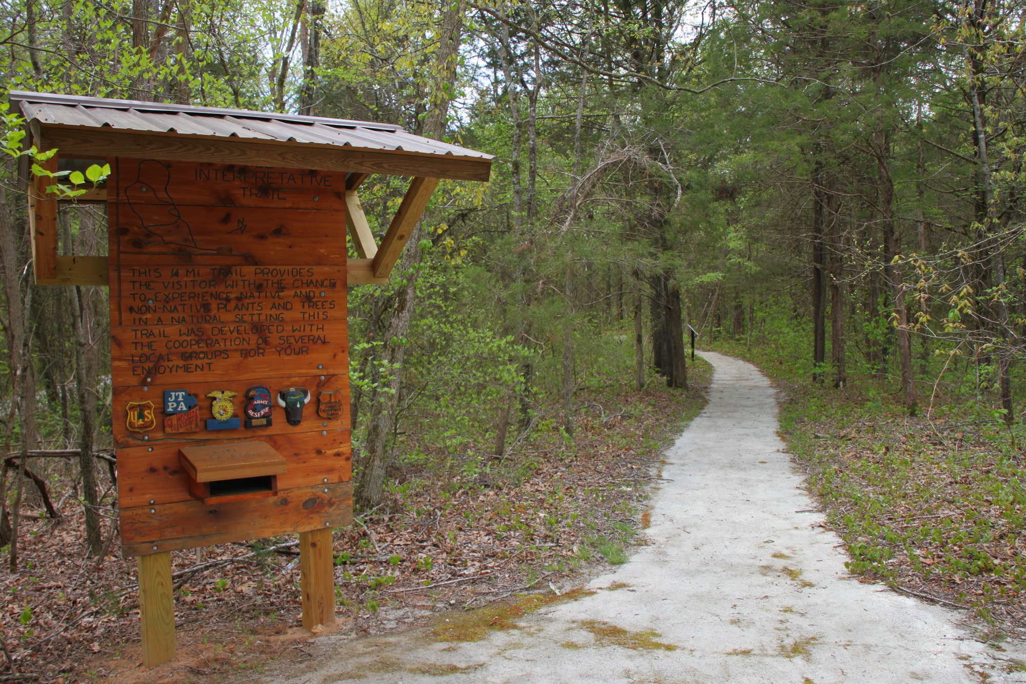
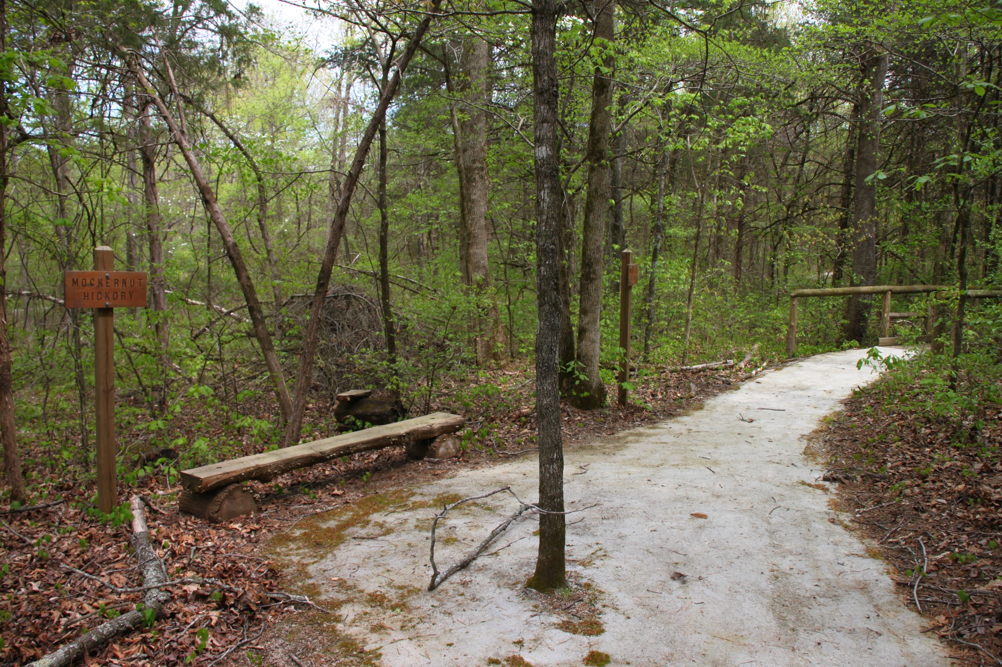
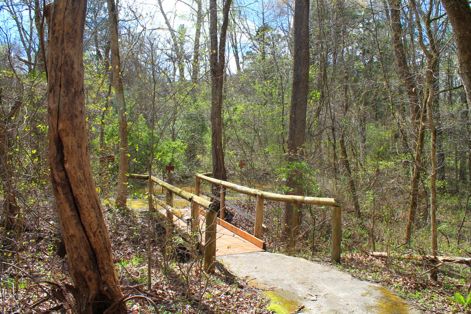
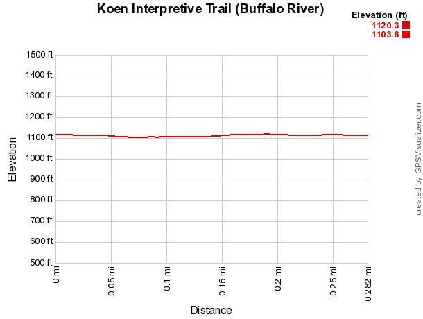
The Koen Interpretive Trail is a short, .25-mile loop through the Koen Interpretive Forest. There are also a couple of short spur trails here that connect the different sides of the loop. If you take them all, it will be about .4 miles total.
The trail is a nice, flat, packed trail, that is handicapped accessible. This is a good trail for folks of all ages.
Along the trail, there are 34 different types of trees and plants that are well-marked to help you recognize both native and non-native species. There are also many different types of wild flowers and bird species in the forest.
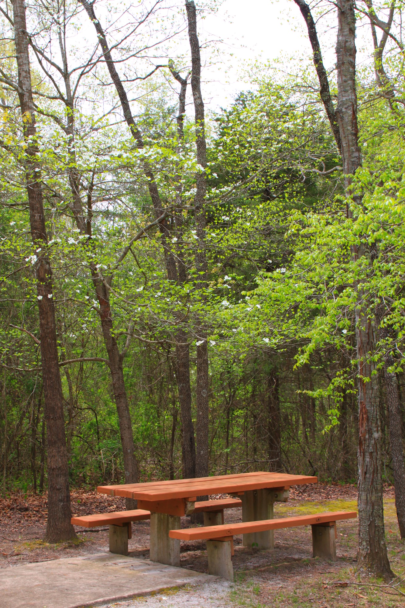
There are plenty of sitting areas, as well as a nice little picnic area at the trailhead that help make this a great way to spend some time outdoors with the family.
With the same outing, you can might also want to check out the Ponds Trail, another family friendly trail just down the road.
Final Notes
Any kind of footwear should work fine on this trail.
As for difficulty, I rate it as easy (1 of 5).
You can read more about this trail in Tim Ernst’s “Buffalo River Hiking Trails.”
These photos are from my April 20, 2013 visit to the trail. The bottom 3 were taken by Mike Newman on April 3, 2017.
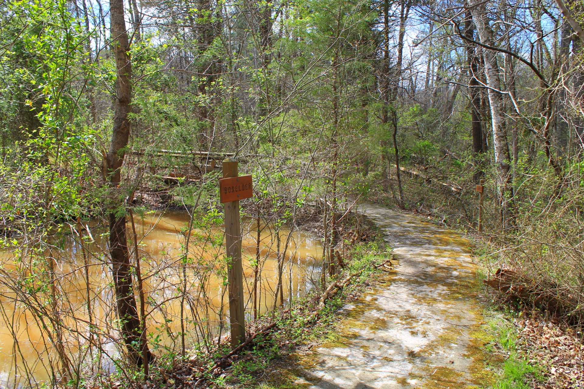
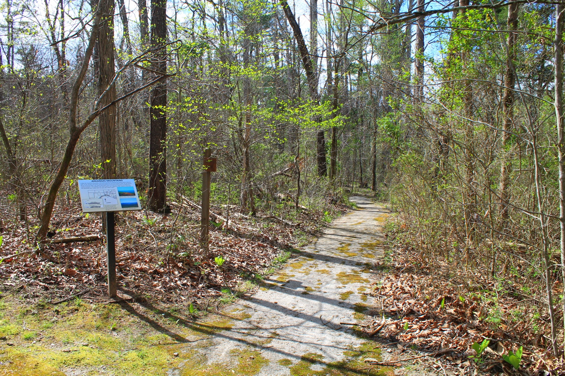
Photo Gallery
Click below for full-screen photo gallery.
Map
Koen Interpretive Trail (Buffalo River) |
|
|---|---|
| Location | Buffalo National River near Erbie, Newton County, Arkansas |
| Hike Length/Type | .3 mile loop. |
| Difficulty | Easy (1 of 5) |
| Other Permitted Usage | -- |
| Gpx file by Mike | Link |
| Date Hiked | April 20, 2013 |
| Directions | Google Maps Directions to Trailhead |
| Official Info | (870) 439-2502 (Tyler Bend Visitor Center Information) Website |
[A version of this post was originally published on April 29, 2013 in the blog “Exploring Northwest Arkansas.”]