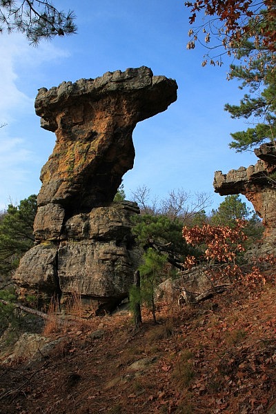
The Pedestal Rocks Scenic Area in the Ozark National Forest (north Pope County) is a spectacular recreation area with two unique loop hikes. These hikes can be done separately for short afternoon trips, or together for a longer day hike.
One of these is the Pedestal Rocks Loop Trail, a 2.4 mile semi-loop hike, which features some great pedestal-shaped rock formations and some spectacular overlooks — and a lot of extra exploring opportunities for the adventurous.
Getting to Pedestal Rocks Scenic Area
To get there, take Highway 7 to the community of Pelsor (28 miles north of Dover, and 28 miles south of Jasper). Turn east (left if coming from the north) onto Highway 16.
Travel 6 miles on Hwy 16 and look for the Pedestal Rocks Scenic Area sign on your right. There is parking there and a pit toilet.
Pedestal Rocks Loop Trail
The trail starts off behind the pit toilet and across a small bridge.
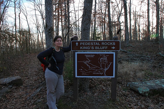
You will immediately come to fork in the road. Go left for the Pedestal Rocks Trail. (To the right is the King’s Bluff Loop Trail.)
The trail will head down a bit and go down nine stone stairs.
At about .1, the trail will fork again. Stay straight. (To the right is the return of the King’s Bluff Loop. To the left is the return of the Pedestal Rocks Loop.)
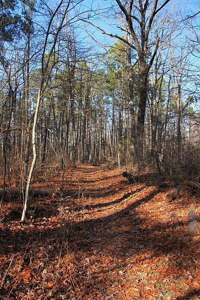
The trail will head out on the level and go through a nice little forest of pines. After a bit, the trail will begin to descend, and then turn right, and then sharply back left again. (There is a wooden post at this sharp left.)
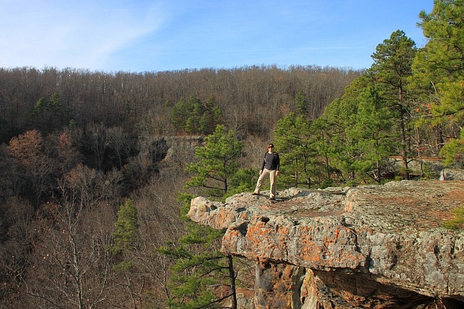
From here, the trail is level for a while. To your right is a big view and the spectacular bluff line you are here to see (and it gets better from here).
Note of caution: Bluffs can be very dangerous. There are no rails on the bluffs so be very careful near bluff lines.
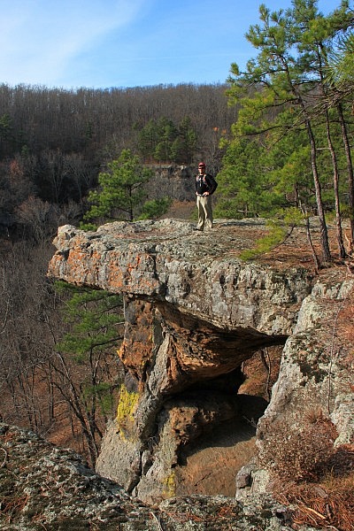
Shortly after the trail levels out, there is a small volunteer trail that heads to the bluff. Take it. This view from the bluff off this volunteer trail includes one of the “pedestal rocks” that the trail is named for.
Back on the main trail, you’ll follow along the bluff for a bit, with great rock formations and views all around.
At about 1.1, there is a road trace that comes down and joins the trail from the left. At the point where the road meets, just to the right is one of he easiest places to go down below the rock bluff and see some of the cool stuff that is below. If you’re up for some exploring, go down below and look around a bit.
Below the Bluffs
There are no maintained trails below the bluff, but it’s easy to follow and explore. To the right is a walk-through cave that is regularly used for camping, and there is another smaller cave.
There are two “needle eyes” that you can also scramble through, and eventually you’ll get back to the bottom of the first “pedestal” we saw.
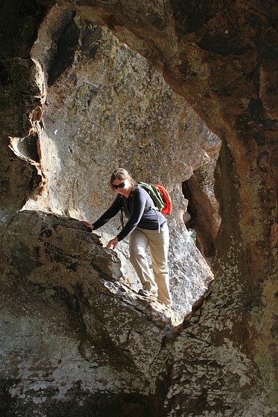
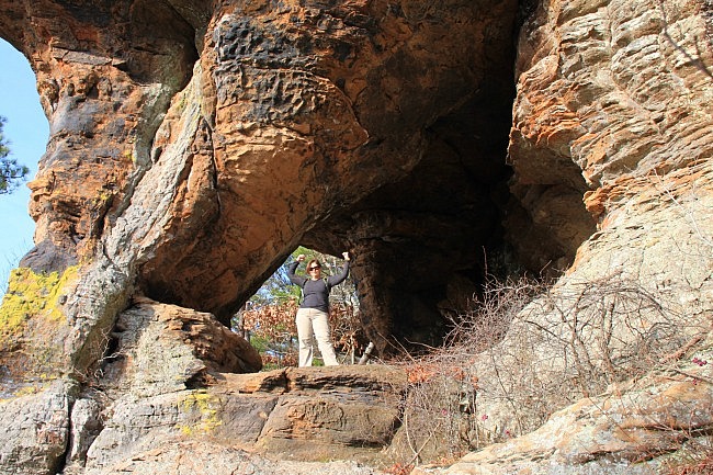
As you can see, we had an awful lot of fun climbing and exploring.
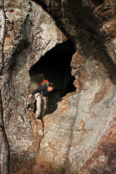
To the left are more caves and rock formations.
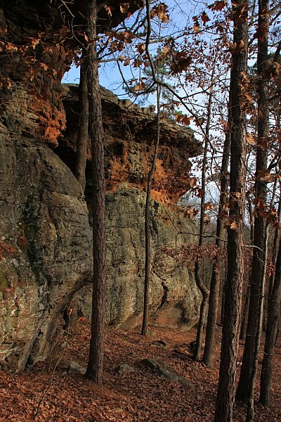
One especially large cave has several spectacular views from it.
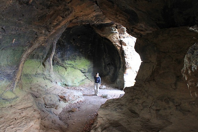
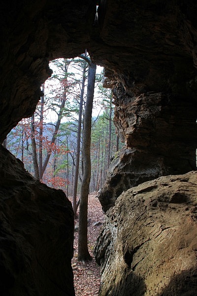
If you keep going in this direction you get to yet another “pedestal.”
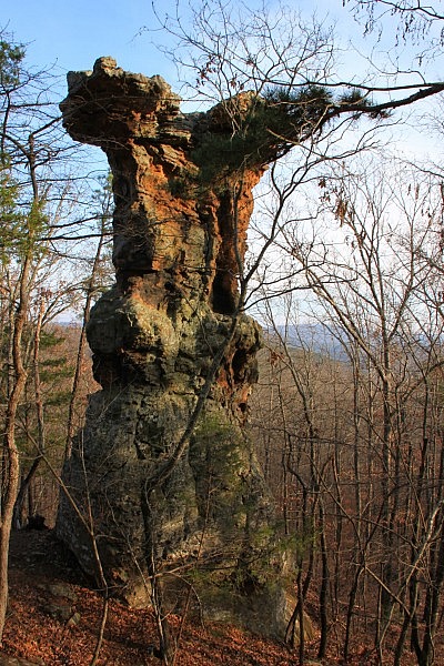
Once you are done exploring below the bluffs, you can climb back up the way you came down and continue on the trail.
Back on the Trail
The trail continues out along the bluffs for a while with more great rock formations and more great views.
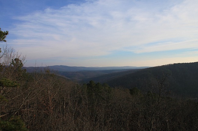
The trail begins to turn to the left as you follow the bluff line back toward the parking area.
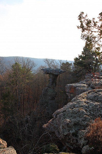
After following the bluff line for a bit, the bluffs begin to disappear and you’re back in the woods.
A little further, you’ll see a large natural bridge (or arch rock) on your right that is big enough to drive a car through. It is worth checking out.
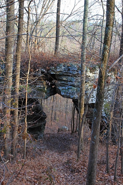
Finally, you’re back on the trail and heading back up the hill.
At about 2.2, the trail finally intersects with the trail you started on. Turn right to finish back at the trailhead. (Or you can go straight ahead to do the Kings Bluff Loop Trail.)
Final Notes
I rate the difficulty of the hike as moderate (3 out of 5). The net elevation change is about 250 feet.
I recommend wearing trail shoes or hiking boots.
For more info about the trail, check out Tim Ernst’s Arkansas Hiking Trails.
Check out Mike’s photos from his November 2014 hike here.
Map
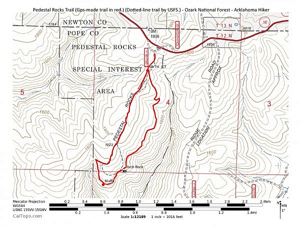
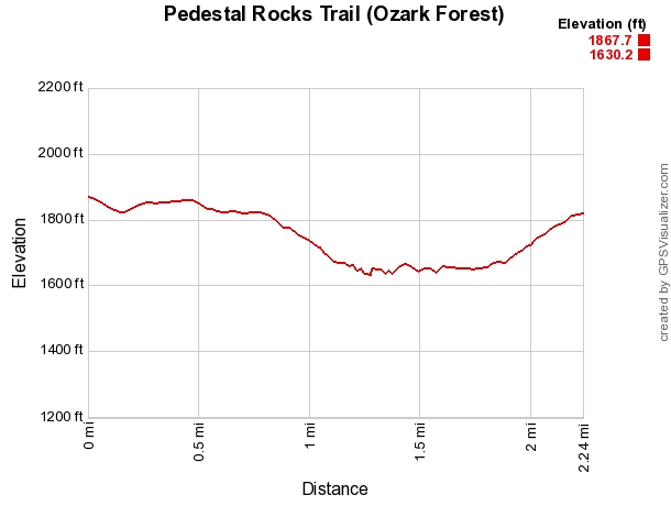
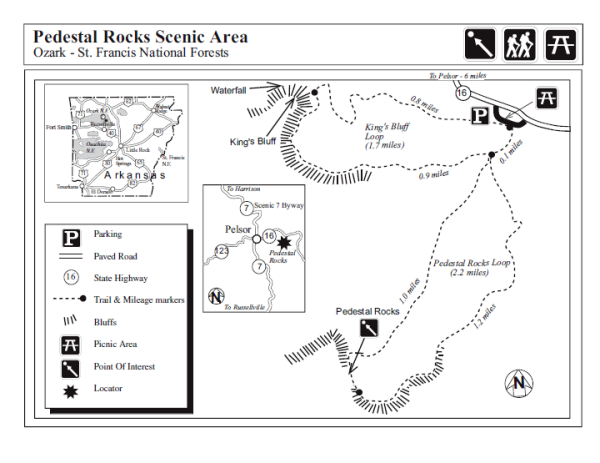
Photo Gallery
Click below for full-screen photo gallery.
Pedestal Rocks Trail (Ozark Forest) | |
|---|---|
| Location | Pope County (near Newton County), Ozark National Forest, Arkansas |
| Hike Length/Type | 2.4 miles, semi-loop |
| Difficulty | Mildly Challenging (2 of 5) |
| Other Permitted Usage | None |
| Gpx file by Mike | Gpx file link |
| Date Hiked | 12-2-2013 |
| Directions | Google Maps Directions to Pedestal Rocks Scenic Area |
| Official Info - Phone/Links | (870) 446-5122 (USFS Big Piney Ranger Dist., Jasper) USFS Website Trail Map Flyer (pdf) |
[A version of this post was first published on December 23, 2013 on the blog “Exploring Northwest Arkansas.”]
[Last revised: 4-21-2020.]


2 replies on “Pedestal Rocks Loop Trail (Ozark Forest) – 2 mi”
love how your site is set up. lots of pictures and good hiking info. this was very helpful
Thanks for the kind comments, Jonathan.