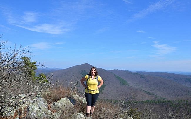
The Caney Creek Wilderness in the Ouachita National Forest in southwest Arkansas (Polk County, southeast of Mena, near Shady Lake) is one of the most beautiful and rugged areas in the state. It is 14,460 acres and is a backpacker’s paradise.
Because it is a designated wilderness area, it is a great place for solitude and primitive recreation.
Tall Peak Trail is a great day hike in this area. It is 3.1 miles each way (6.2 miles out and back). Although it is steep and rugged with an elevation change of nearly 1,200 feet, it is a very rewarding hike.
Getting to Tall Peak Trail
To get to Shady Lake from Highway 71 (south of Mena), turn and go east on Highway 246 near Vandervoort. After about 20 miles, there will be a sign on your left for Shady Lake Recreation Area. Follow the signs.
The trailhead is at Area C of the Shady Lake Campground, near the badminton net and restroom.
If the campground is closed, you can park outside the gate and walk to the trailhead. (The trails are still open when the campground in the off-season.)
Hiking Along a Creek
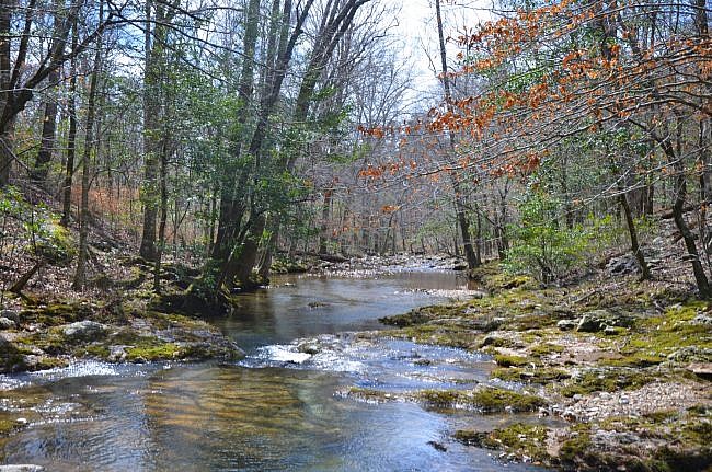
You begin the trail by crossing a low water bridge. The trail follows a beautiful river for about a mile before it turns to the left and heads uphill. (It’s called the Saline River, but is quite small for a river)
During this first mile as you follow the Saline River you also follow the road. The trail crosses the river four times. When I hiked it in March, I was able to hop from rock to rock or tippy toe to keep the water from flowing over my boots. But if the water level had been any higher, I would have had to take off my boots.
One good thing about the road being right there is that if the water is too high, you can walk the road.
If you decide to cross the river during a wet time of year, be very careful.
Caution: Fording a stream or river can be dangerous. Don’t cross a river or stream where it is more than waist deep. See this post at Section Hiker for more water crossing safety tips.
This area of the trail is gorgeous as there are a number of high steep embankments along the river which create beautiful chutes and deep pools. At one point, the trail climbs the steep embankment and can be a little treacherous. So you’ll want to watch your footing and be extra careful.
Caution: There are a number of drop-offs and bluffs on the Tall Peak Trail. Be very careful in these areas. A fall could result in serious injury or death.
Making the Climb
Right at 1 mile, the trail begins to climb the mountain, and the trail splits. Here you’ll want to stay to the left. (The path to the right appears to be a spur over to the road.)
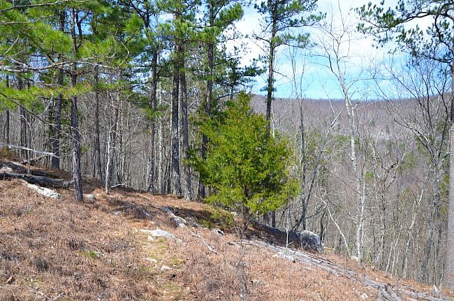
The trail steeply climbs for about two tenths of a mile and then levels off just a little. You are still climbing up, just not as steeply.
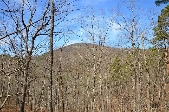
Then at right about 1.5 miles, the trail makes a turn to the left, and during leaf-off you begin to see Tall Peak with the old fire lookout building and towers through the trees to your right.
I love seeing where I’m going and how far and high I’m going. You get that on this trail. At this point, Tall Peak looks far away and way high up. But don’t worry—it’s not as bad as it seems. It also looks like you have to drop back down into the valley, but you don’t.
The trail is fairly level as it swings to the west and follows the contour line to a saddle at mile 2 before starting the steep climb to the top of Tall Peak. The saddle is pretty neat. It is very narrow, and I love how it showcases the ruggedness of the area.
After you cross the saddle, the trail starts to climb on a very steep slope to your sides. If you use trekking poles, they will come in handy here.
Amazing Vistas
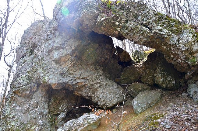
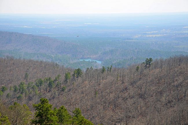
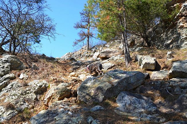
Around mile 2.3, the trail comes to a rocky glade with amazing views to the west. You then turn and head up the mountain to the east. It’s steep and rocky, but the vistas along the way are worth it.
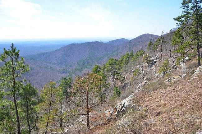
At mile 2.6, there is a short spur trail to the right to an amazing vista. I actually like this view better than the view from the top. The vista shows the mountains to the east, and you can really get a feel for how rugged this place is.
From the vista, you continue climbing, heading west. The trail then turns and heads northeast toward the forest service road that takes you to the top of Tall Peak. The road has been closed for a while now. But if you are looking for a less steep and shorter alternative, you can walk up the road. It’s about a two-mile hike.
If you are looking for a trail with even more vista in this area, check out the Athens-Big Fork. But be prepared, it’s a long and hard one.
The trail intersects with the road at about 2.9 miles and from there you can follow the road around to the old fire lookout at the top.
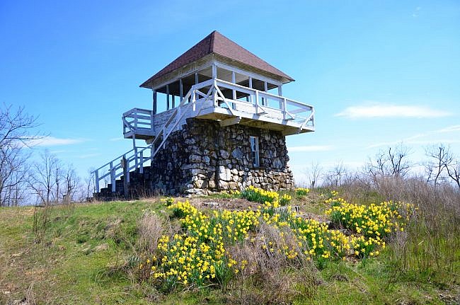
Historic Fire Lookout
The lookout at the top of Tall Peak is pretty neat and a great campsite if you are stuck in a storm. It is listed on the National Historic Lookout Register which recognizes “fire lookout sites, structures and towers with historic and cultural significance to forest fire detection in order to promote their protection.”
For more information on these structures, visit the National Historic Lookout Register.
From the peak, you can either hike back down the way you came or take the road back to Shady Lake Campground. If you decided to hike the road, it will add about two miles to your hike. I chose to hike back down the trail because I loved the vistas I saw on the way up. I also didn’t want to add two more miles.
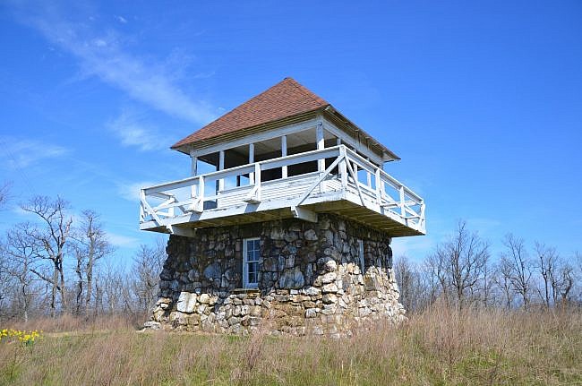

Final Notes
Tall Peak Trail is a great hike, but it is rough and rugged. You should bring plenty of water because on the rocky outcroppings it can get much warmer than in the valley.
I rate the difficulty as “very strenuous” (5 of 5).
Tall Peak Trail is better hiked in the leaf-off season because you get more views. But even without all the vistas, it is an amazing fall hike. Another advantage of hiking it during leaf-off is the thick briers that are usually at the top part of the trail.
Nearly all of the trail lies in the Caney Creek Wilderness.
You might also want to check out the nearby Caney Creek Trail (West) and the Buckeye Trail-Caney Creek Trail Loop.
These photos are from my hike on March 11, 2018.
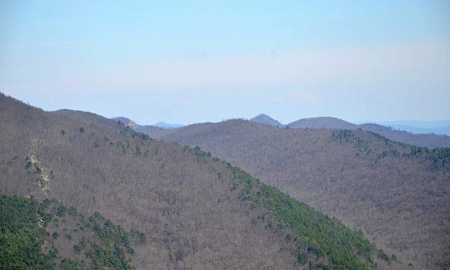
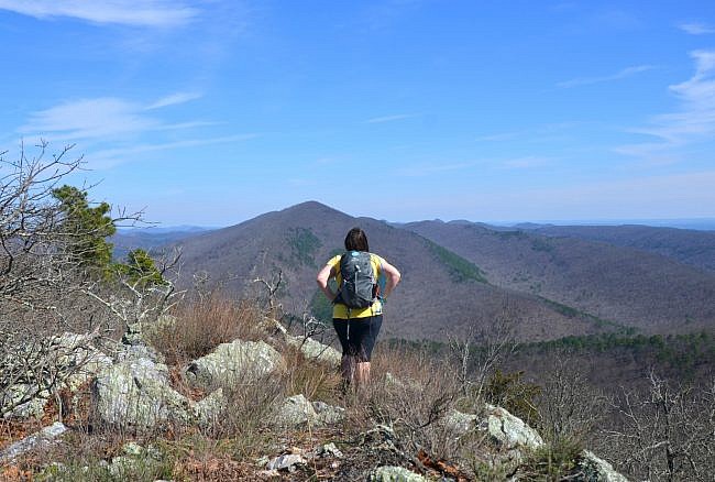
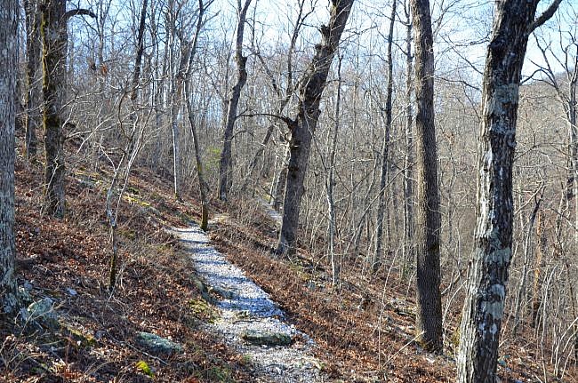
Photo Gallery
Map
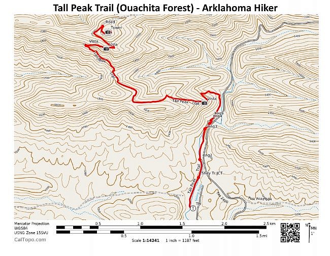
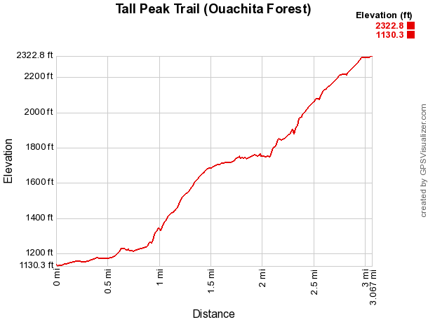
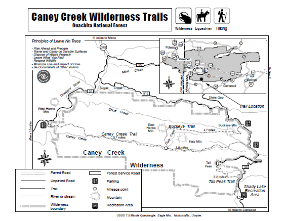
Tall Peak Trail (Ouachita Forest)
Location Caney Creek Wilderness, Ouachita National Forest, Polk County, Arkansas Hike Length/Type 6.2 miles (3.1 miles each way)/out-and-back. White blazes. Difficulty Very Strenuous (5 of 5). Other Permitted Usage Equestrian. Gpx file by Mike Link Date Hiked 2-24-2013 Directions Google Maps Directions to Tall Peak Trailhead Area
Official Info (479) 394-2382 (Mena/Oden Ranger Dist.) Website USFS trail map (pdf)
[A version of this post was originally published on April 5, 2018 in the blog “Right Kind of Lost.”]
Last revised: 9-18-2019.


3 replies on “Tall Peak Trail (Ouachita Forest) – 6 mi (o&b)”
Thank you Ms Kuhn beautifully written and composition of picture. Exce..ent.
Stubbled across this page and wow wow wow! I love the details of every hike and all the graphs! It makes me , who’s coming from a different state, more confident in knowing what I’m getting into !! Thank you so much!
Thanks Jennifer! We are glad it is helpful. Enjoy your hikes!