About the Ouachita Trail
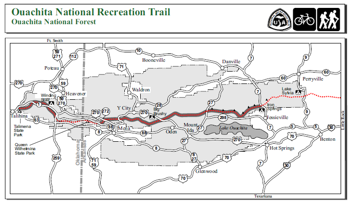
The Ouachita Trail is a 223-mile trail that runs from Talimena State Park in Oklahoma to Pinnacle Mountain State Park in Arkansas. The vast majority of it is in the Ouachita National Forest.
You can download a detailed USFS trail map (3.6 MB) here. (Note: the USFS map does not include the eastern end. Also it divides the trail into segments that don’t correspond with the Tim Ernst Sections.)
You can learn more about the OT at the Friends of the Ouachita Trail (FoOT) website – http://friendsoftheouachita.org/. (The old website http://friendsot.org is still on the web but no longer updated.)
Also a great place to ask Ouachita Trail questions to knowledgeable hikers is at this Facebook Ouachita Trail group.
Some great OT resources to purchase: Tim Ernst’s Ouachita Trail Guide; and the 3 Ouachita Trail backcountry maps by Underwood Geographics.
About This Page
The lists below are of segments of the Ouachita Trail, grouped by designated Section. The Sections follow the 10 Section divisions in Tim Ernst’s Ouachita Trail Guide. He divides the trail into 10 Sections.
I have subdivided each Section into segments, largely based on those from the FoOT trail conditions page. I added a post link for each segment I have hiked and posted.
The stated lengths are based on my gps calculations. Obviously, if you are hiking a segment out and back (as I usually do), you must double the length.
As of 2022, I have day hiked about 30% of the trail. I hope to eventually hike it all.
| Section 1 |
|---|
| 0.0 - 2.4 | Talimena SP to Potato Hill Vista Spur - 2.5 miles - LeFlore Co., OK - [A] - (recently updated) |
| 2.4 - 5.8 | Potato Hill Vista spur to FR 6010 - 3.5 mi - LeFlore County, OK - [B] (recently updated) |
| 5.8 - 8.0 | FR 6010 to Deadman's Gap TH - 3.5 mi - LeFlore County, OK - [C] (recently updated) |
| 8.0 - 13.4 | Deadman's Gap TH to Cedar Branch to Wildhorse Creek - 5.5 mi - LeFlore County, OK - [D-E] (recently updated) |
| 13.4 - 19.9 | Wildhorse Creek to Holson Valley Vista to Horsethief Springs - 5.6 mi - LeFlore County, OK - [E2-H] (recently updated) |
| 19.9 - 23.7 | Horsethief Springs to Winding Stair TH. - 3.4mi - LeFlore County, OK - [I-J] (recently updated) |
| Section 2 |
|---|
| 23.7 - 25.8 | Winding Stair TH to East Summit to Highpoint to Saddle (LeFlore Co. (OK))- 2.5 mi - [A1] (recently updated) |
| 25.8 - 28.3 | Hiker Campsite (Saddle) to FR 6023 (LeFlore Co. (OK)) - [A2] |
| 28.3 - 30.5 | FR 6023 to Hwy 259 (LeFlore Co. (OK)) - [B] |
| 30.5 - 34.3 | Hwy 259 to Pashubbe TH (LeFlore Co. (OK)) - 3.8 mi - [C] (recently updated) |
| 34.3 - 39.2 | Pashubbe TH to Wilton Mountain to Kiamichi River TH (FR 6031) (LeFlore Co. (OK)) - 4.8 mi - [DE] (recently updated) |
| 39.2 - 42 | Kiamichi River TH to Mile 42 (LeFlore Co. (OK)) - [F] |
| 42 - 44 | Mile 42 to Mile 44 (LeFlore Co. (OK)) - [G] |
| 44 - 46.3 | Mile 44 to AR State Line (LeFlore Co. (OK)) - [H] |
| 46.3 - 47.8 | AR State Line to FR 514 (Polk Co.) - [I] |
| 47.8 - 51.6 | FR 514 to Pioneer Cemetery to Queen Wilhelmina SP (Polk Co.) (Updated 2021) - 3.7 mi - [J] |
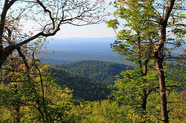
| Section 3 |
|---|
| 51.6 - 54.1 | Queen Wilhelmina to Talimena Scenic Drive - (Polk Co.) - 2.5 mi - [AB] (recently updated). |
| 54.1 - 56.7 | Talimena Scenic Drive to 270 TH - (Polk Co.) - 2.6 mi - [CD](recently updated) |
| 56.7 - 58.5 | 270 TH to Eagle Gap/Clear Fork - (Polk Co.) - [E] |
| 58.5 - 63 | Eagle Gap to MM 63 - (Polk Co.) - 4.3 mi. - [FG} (recently updated) |
| 63 - 68.1 | MM 63 to MM 66 to Foran Gap/Hwy 71 - (Polk Co.) - 4.9 mi - [HI](recently updated) |
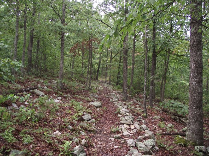
| Section 4 |
|---|
| 68.1 - 69.7 | Foran Gap/Hwy 71 to 278E (Polk Co.) - [A] |
| 69.7 - 74.2 | 278E to Tan-a-Hill Gap (Polk Co.) - [B] |
| 74.2 - 77 | Tan-a-Hill Gap to Mile 77 (Polk Co.) - [C] |
| 77 - 79.9 | Mile 77 to Turner Creek Gap (Polk Co.) - [D] |
| 79.9 - 81 | Turner Creek Gap to Mile 81 (Polk Co.) - [E] |
| 81 - 85.5 | Mile 81 to FR 76A (Polk Co.) - 4.7 mi- [F] |
| 85.5 - 88.2 | FR 76A to FR 48 (Polk, Scott, Montgomery Co.) [G1] |
| 88.2 - 90.3 | FR 48 to FR 813 (Scott, Montgomery Co.) (recently updated) - 2.1 mi - [G2] |
| 90.3 - 93 | FR 813 to Mile 93 (Montgomery Co.) - [H] |
| 93 - 94.5 | Mile 93 to Big Brushy Campground (Montgomery Co.) - [I] |
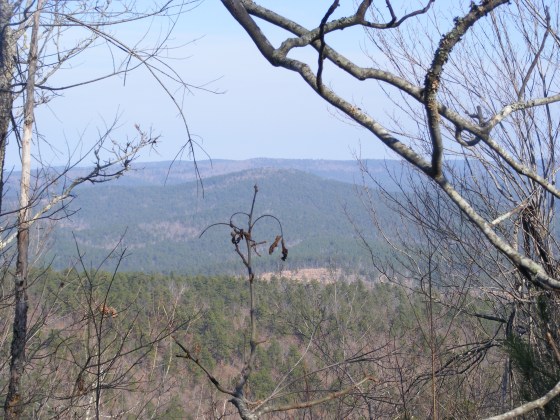
| Section 5 |
|---|
| 94.5 to 96 | Big Brushy Cmpgd to FR 33 (Montgomery Co.) - [A] |
| 96 to 101 | FR 33 to FR 274 West (Montgomery Co.) - [B] |
| 101 to 103 | FR 274 West to Mile 103 (Montgomery Co.) - [C] |
| 103 - 106.1 | Mile 103 to Mile 106.1 (Montgomery Co.) - [D] |
| 106.1- 108.7 | 106.1 to Suck Mtn (old road bed) (Montgomery Co.) - [E] |
| 108.7 - 112 | Suck Mtn (old road bed) to Mile 112 (Montgomery Co.) - [F] |
| 112 - 114.1 | Mile 112 to Round Top Trail (Montgomery Co.) - [G] |
| 114.1- 116.7 | Round Top Trail to Womble Trail (Montgomery Co.) - [H] |
| 116.7 - 118.7 | Womble Trail to FR 149 (Montgomery Co.) - [I] |
| 118.7 - 121.7 | FR 149 to Hwy 47 Trailhead (Montgomery, Yell Co.) - [J] |
Last updated: 5-15-2022.
