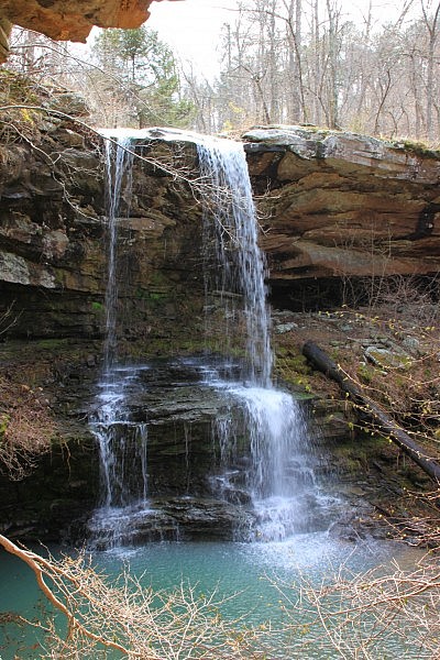
Fern Falls is a quick hike just off of Highway 7 south of Jasper. There is not an official trail here, but the trail to it generally follows some old road traces and thus tends to be fairly easy to follow.
The hike is a bit of a mess after a lot of trees and branches fell during the 2009 ice storm, but we found our way without any problem and got to view a nice waterfall as our reward when we made this hike in April.
Getting to the Trailhead
The trailhead begins 11.4 miles south of the Jasper square on Highway 7. At 11.4 miles, there is a “Historic Highway 7” sign on the west side of the highway.
There is no official parking area here, but if you can pull off the side of the highway here and find a place to park, that’s the spot.
The trail begins just behind the sign.

Hiking to the Falls
The trail starts off along an old road and heads down the hill a bit. It’s a fairly well-defined road, so it’s easy enough to follow.
At approximately .25 miles, the trail turns sharply to the right and leaves this road trace to follow another one. (There is pink tape tied to trees here to note the spot.)
Turn onto this old road trace (definitely less defined than the one that continues straight) and continue down the hill.
After a few hundred feet, this trace becomes impassable due to about a dozen trees that have fallen over the trail, but the trail turns left and heads steeply down the hill.
Eventually, you hit the old road trace again and continue down the hill.
When you get to the bottom of the hill (roughly .5), you’ll see a small stream in front of you. Turn right here and follow the road trace along the side of the creek.
After about another .25, you’ll get to the top of the waterfall.
To make your way to the bottom of the falls, cross the creek upstream from the falls and follow the ridge around until there is a gap in the rock line and head down to the falls.
To get the best photos, follow the ridge around behind the falls to the other side for a great view of the falls and the water hole down below.
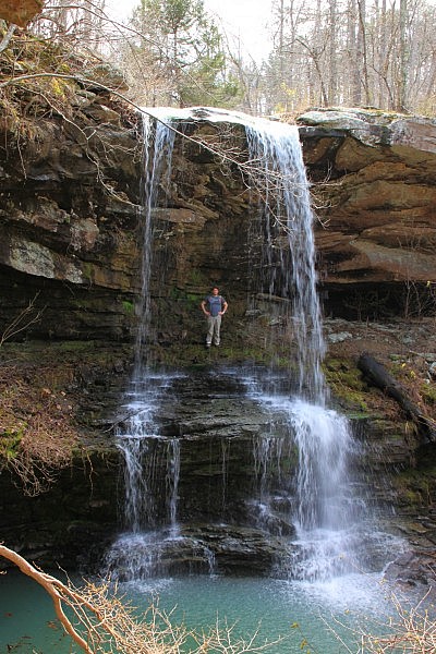
Fern Falls (named for the ferns that grow up around it in late April and May) is a 42-foot waterfall with two streams that fall and hit a rock bed below to spread into a nice secondary falls.
Caution: as always, be very careful around bluff lines.
When you are done exploring, you can head back the way you came — this time back up the hill you came down.

Final Notes
The total length of the hike to the falls and back is about 1.5 miles. I recommend wearing hiking boots for this hike.
I rate the difficulty of the hike as moderate (3 out of 5).
Photo Gallery
Click below for full-screen photo gallery.
Last revised: 6-28-2020.


