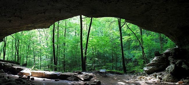
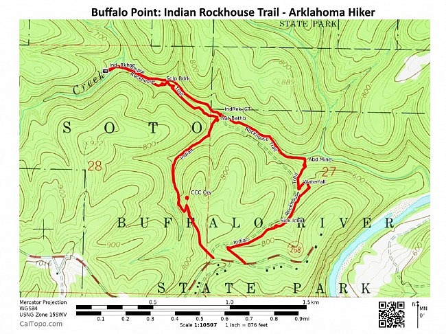
This beautiful 3-mile loop at Buffalo Point Campground in the Buffalo National River near Yellville (Marion County, Ark.) is a must-see trail.
The Indian Rockhouse Trail is wonderfully scenic with many great points of interest including sculpted bedrock, a waterfall, a former zinc mine, and the Indian Rockhouse Cave.
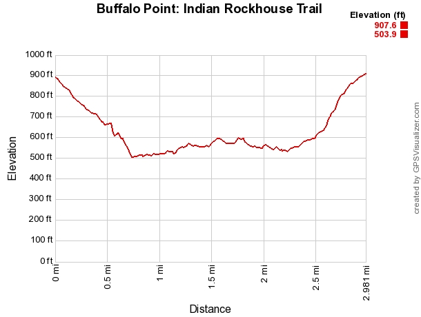
It is a vigorous hike with about 400 feet of elevation change, but it is well worth it.
Getting to the Indian Rockhouse Trail at Buffalo Point
Buffalo Point Campground is the most developed campground in the Buffalo National River. Built during the Depression, it was Buffalo River State Park From 1938 to 1972,
To get there from the north, take Highway 412 to Yellville, and then take Highway 14 heading east (really south). After 14 miles, take a left onto Highway 268. (Watch for the park signs on Highway 14. Wild Bill’s Outfitter is right there.)
If heading from central Arkansas, take I-40 to Conway, then get on Highway 65 heading north. Stay on 65 for 64 miles to Marshall. Then take Highway 27 north to Harriet where you turn left (west) onto Highway 14.
9 miles later, take a right on Highway 268 at Wild Bill’s Outfitter. (Watch for the park signs.)
Highway 268 takes you into Buffalo Point Campground.
At about 1.5 miles, the Ranger Station is on the right.
The trailhead parking is on the right about 1 mile further up the road. This is the same parking area (with picnic tables) for the Overlook Trail.
The Hike: Trailhead to Indian Rockhouse
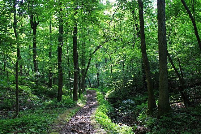
The trail starts directly across the road from the parking/picnic area.
This is the elevation high point for the trail. You will be descending 400 feet by the time you reach Panther Creek.
Elevation-wise, there are 3 sections of the trail: (1) the downhill stretch from the trailhead (the high point) until Panther Creek (400 feet lower) at about .8 miles; (2) the area along Panther Creek including the spur out to Indian Rockhouse Cave; and (3) the return uphill climb (350 feet) from Panther Creek on the last .8 miles.
The trail starts out heading downhill to the northwest and then makes a right turn (turning northeast) at around .1 miles and continues the descent.
Sinkhole Icebox – .3 miles. There is a cool sinkhole here on the left (estimated 50 yards wide).
Most of the Ozarks has karst typography which results in a large number of caves, sinkholes, and underground springs.
Here there is a large and fairly deep sinkhole right next to the trail. Be careful not to fall in. You may notice cool air arising from the hole.
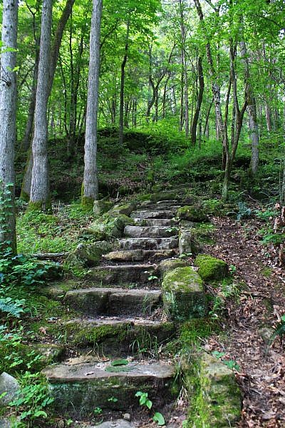
This is a beautiful and nicely maintained trail. A lot of the downhill/uphill stretches (like in this area) feature nice stone staircases.
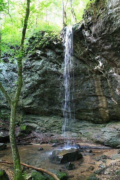
Waterfall – .6 miles. At this point (about 300 feet lower in elevation), there is a beautiful waterfall area. The falls is an estimated 25 feet high.
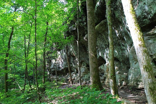
In this scenic area, the trail curves and goes by the bottom of the waterfall. After making a sharp turn by the waterfall, the trail follows along the bottom of a beautiful bluff-line.
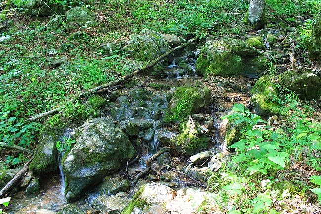
Then, during wet season, there is a very pretty stream that flows downhill along quite a bit of this part of the trail.
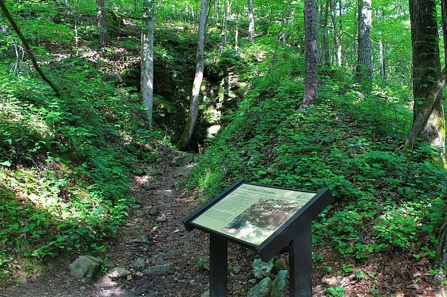
Zinc Mine – .7 miles. Here, to your left is what was the entrance to an abandoned zinc mine.
As the information sign explains, this was an exploratory mine dug into a hillside in an attempt to find zinc. In the late 1800’s, a lot of people came to this area, especially in the nearby community (now ghost town) of Rush, for zinc mining.
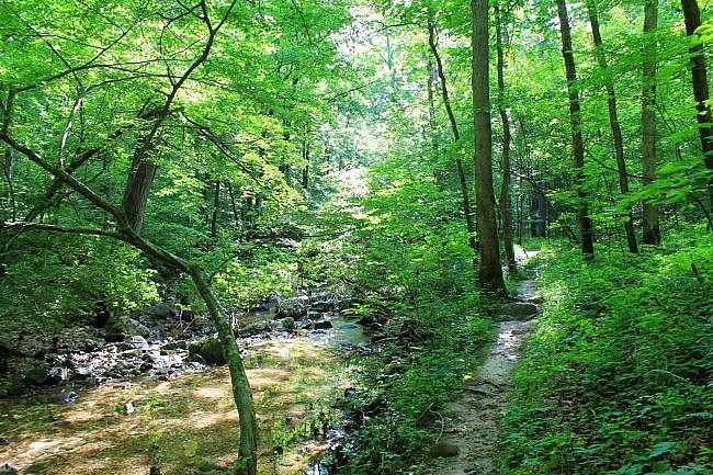
Panther Creek – .8 miles. Here, the trail finally reaches the end of the big descent to Panther Creek.
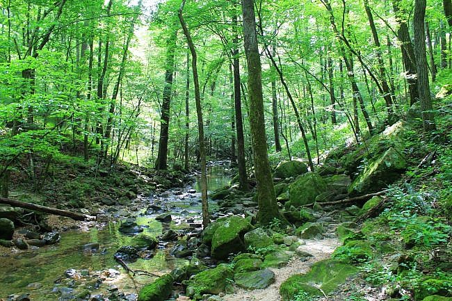
The trail makes a left turn to the northwest. The next .3 miles or so is one of the prettiest stretches of the trail as it follows right next to Panther Creek (on its south side).
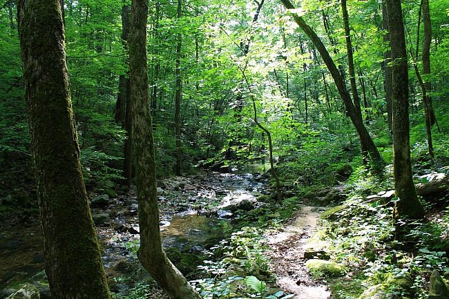
Of course, this stretch is at its prettiest during wet times as you get the sights and sounds of the creek next to the trail.
Indian Rockhouse Junction – 1.1 miles. Here, the trail continues on ahead onto the spur that heads to the Indian Rockhouse Cave.
As the sign indicates, you can make a left turn here to bypass the cave. Don’t take the bypass. You would miss the best part of the trail.
It is about a half-mile further to the cave.
Indian Rockhouse Cave and More
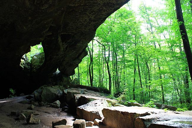
Indian Rockhouse Cave -1.7 miles. This is a huge beautiful bluff cave. Photos definitely do not do it justice.
One of the cool things of this amazing natural structure is the stream flowing at the back of the cave. I have done this trail multiple times, and regardless of how dry it has been outside, I have always been able to hear the stream flowing in the back of this overhang cave.
According to archeologists who have excavated the cave, it was in use by Native Americans hundreds of years before European explorers came into the area. (Check this Arkansas Archeological Survey site for more info.)
After you have enjoyed Indian Rockhouse Cave, turn around and head back (now heading southeast) on the spur trail you took to the cave.
About .2 miles ahead, the spur forks. Take the right branch to continue back toward the main loop. (There should be a sign here that says “Return Trail.” Head that way.)
For the next .3 miles, the trail follows close to some very pretty parts of Panther Creek.
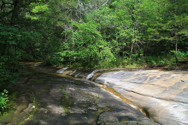
Sculptured Bedrock – 1.9 miles. This is a very scenic area both for the naturally sculpted rock formation (from many years of gradual erosion) and the beauty of the water flowing over it.
Don’t be confused and think that the trail crosses the creek here. It does not. Continue on the trail along the south side of the creek.
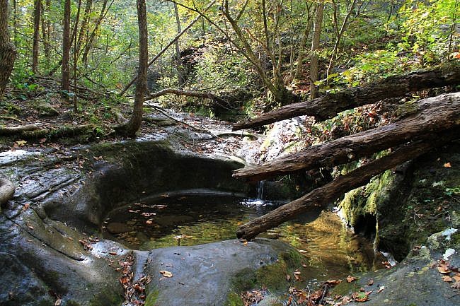
Natural Bathtub – 2.2 miles. At around 2.2 miles, the trail is back to the main loop. Make a right turn here.
Shortly, you will be at a really cool sculpted rock area in the shape of a round bathtub.
The trial then continues on a gradual uphill climb.
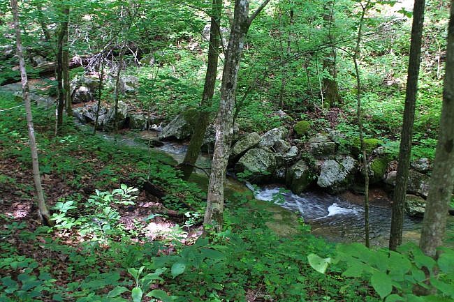
Up ahead, the trail crosses a small stream and then follows parallel to that stream for a quarter-mile (for another very nice stretch during wet times) as it heads uphill.
From the Natural Bathtub to the trail end (mostly heading south), there is about a 350-foot elevation climb.
I love going up and down hills as it makes for a more interesting hike, both visually and physically. But this is definitely the most demanding part of the hike.
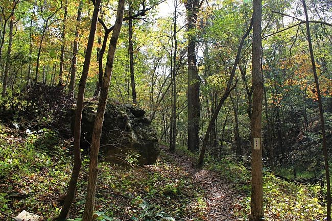
One of the things I like about hillside trails is that you frequently get cool rock formations. There are a number of interesting rocks and boulders on the climb back to the trailhead.
Quarry Spur -2.8 miles. At this spot (where it looks like the trail is joining a road trace), there is a short spur to the left to the quarry area where rocks were dug when the park was built during the 1930’s by the Civilian Conservation Corps.
At about 3 miles, you will walk through a wooden fence and be back at Highway 268.
Take a left, and then it is just a short walk back to the trailhead.
Final Notes
Like most trails that go along seasonal streams, it is a prettier hike during wetter times with the water is flowing. But it is still a very pretty trail any time of year.
Although there are not a lot of blazes, by and large, it is pretty easy to follow the this trail.
Indian Rockhouse Trail is a very frequently walked trail, and it is nicely maintained.
Don’t expect any cell signal on the hike. I probably had 10% or less AT&T cell signal on the hike. The only signal I had was in the highest points near the trailhead.
These photos are mostly from my hike on June 3, 2017. A few are from my October 16, 2016 hike.
Photo Gallery
Click below for full-screen photo gallery.
Map
Indian Rockhouse Trail (Buffalo River) | |
|---|---|
| Location | Buffalo Point Campground, Marion County, Arkansas |
| Hike Length/Type | 3 mile loop |
| Difficulty | Moderate (3 of 5) |
| Other Permitted Usage | None. (No pets.) |
| Gpx file by Mike | Link |
| Date Hiked | 9-22-2012 |
| Directions | Google Maps Directions to Indian Rockhouse Trailhead at Buffalo Point |
| Official Info | (870) 449-4311 Buffalo Point Ranger Station Information Website Official Indian Rockhouse Trail Brochure (pdf) Official Campground Map (pdf) |
Last revised: 9-21-2019.


2 replies on “Buffalo Point: Indian Rockhouse Trail – 3 mi”
I want to take our dog but I saw somewhere where it says no dogs but someone posted they took their dog. Can you help with this?
Dogs are not permitted. I would call the park office for questions on that.